


<< Our Photo Pages >> Table Maen - Natural Stone / Erratic / Other Natural Feature in England in Cornwall
Submitted by AngieLake on Thursday, 03 September 2009 Page Views: 7416
Natural PlacesSite Name: Table Maen Alternative Name: King Arthur's TableCountry: England
NOTE: This site is 0.158 km away from the location you searched for.
County: Cornwall Type: Natural Stone / Erratic / Other Natural Feature
Nearest Town: Penzance Nearest Village: Sennen
Map Ref: SW359258
Latitude: 50.073516N Longitude: 5.69241W
Condition:
| 5 | Perfect |
| 4 | Almost Perfect |
| 3 | Reasonable but with some damage |
| 2 | Ruined but still recognisable as an ancient site |
| 1 | Pretty much destroyed, possibly visible as crop marks |
| 0 | No data. |
| -1 | Completely destroyed |
| 5 | Superb |
| 4 | Good |
| 3 | Ordinary |
| 2 | Not Good |
| 1 | Awful |
| 0 | No data. |
| 5 | Can be driven to, probably with disabled access |
| 4 | Short walk on a footpath |
| 3 | Requiring a bit more of a walk |
| 2 | A long walk |
| 1 | In the middle of nowhere, a nightmare to find |
| 0 | No data. |
| 5 | co-ordinates taken by GPS or official recorded co-ordinates |
| 4 | co-ordinates scaled from a detailed map |
| 3 | co-ordinates scaled from a bad map |
| 2 | co-ordinates of the nearest village |
| 1 | co-ordinates of the nearest town |
| 0 | no data |
Internal Links:
External Links:
I have visited· I would like to visit
AngieLake has visited here
")
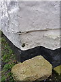
This large granite slab, which now sits in a private garden in the village of Mayon just NE of Sennen village, has an intriguing legend attached to it.
In 'Mermaid to Merrymaid - Journey to the Stones', Ian McNeil Cooke tells us that Mayon's name probably came from this stone. It is known as 'Table Maen' or 'King Arthur's Stone', the latter title deriving from the story of how the king held a feast around it with nine kings to celebrate victory over the Danes who had landed at the nearby beach of Gwenver.
All around this area are churchpaths running through the fields, linking Sennen area with St Buryan, which Sennen was ecclesiastically dependent on.
There are several ancient wheel-headed crosses in the area, and standing stones and cairns.
You may be viewing yesterday's version of this page. To see the most up to date information please register for a free account.
")
")
")
Do not use the above information on other web sites or publications without permission of the contributor.
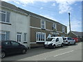
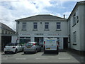
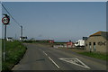
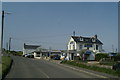
Nearby Images from Geograph Britain and Ireland:
©2017(licence)
©2017(licence)
©2006(licence)
©2006(licence)
©2014(licence)
The above images may not be of the site on this page, they are loaded from Geograph.
Please Submit an Image of this site or go out and take one for us!
Click here to see more info for this site
Nearby sites
Key: Red: member's photo, Blue: 3rd party photo, Yellow: other image, Green: no photo - please go there and take one, Grey: site destroyed
Download sites to:
KML (Google Earth)
GPX (GPS waypoints)
CSV (Garmin/Navman)
CSV (Excel)
To unlock full downloads you need to sign up as a Contributory Member. Otherwise downloads are limited to 50 sites.
Turn off the page maps and other distractions
Nearby sites listing. In the following links * = Image available
186m NW 320° Mayon menhir* Standing Stone (Menhir) (SW3578625948)
229m SE 127° Mayon Farm Cross* Early Christian Sculptured Stone (SW3607625653)
360m SSW 211° Sennen Church* Ancient Cross (SW357255)
446m WSW 241° Sennen Hedge* Standing Stone (Menhir) (SW355256)
607m ESE 110° Brew Cross Ancient Cross (SW36462556)
676m SSW 200° Trevescan Cross* Early Christian Sculptured Stone (SW3563425178)
896m NNE 12° Carn Towan Cross* Ancient Cross (SW3612626668)
919m W 280° Whitesand Bay Stone Circle (SW350260)
1.0km ENE 76° Trevear Sennen* Standing Stone (Menhir) (SW369260)
1.1km W 279° Mayon Cliff cairn* Cairn (SW34812602)
1.1km W 265° Maen Castle* Promontory Fort / Cliff Castle (SW34762576)
1.2km S 187° Trevilley Cross* Early Christian Sculptured Stone (SW3569524648)
1.4km N 9° Escalls Cliff Cairn* Cairn (SW362272)
1.7km WSW 247° Land’s End Iron Age Settlement* Hillfort (SW343252)
1.9km SSW 207° Mushroom Rock* Rock Outcrop (SW34952415)
1.9km SW 216° Pordenack Point* Promontory Fort / Cliff Castle (SW347243)
2.0km SW 214° Trevilley Cliff Tumuli* Barrow Cemetery (SW34682417)
2.1km S 183° Lower Bosistow Cliff Cave Cave or Rock Shelter (SW357237)
2.2km NE 36° Trevedra Common Tumuli Barrow Cemetery (SW37292752)
2.3km SE 128° Trebehor Cross* Early Christian Sculptured Stone (SW3763824319)
2.4km NNE 32° Tregiffian Vean* Chambered Tomb (SW37252773)
2.5km SSE 163° Higher Bosistow Menhir* Standing Stone (Menhir) (SW36532338)
2.5km S 180° Higher Bosistow Cliff Tumulus* Round Barrow(s) (SW35792330)
2.6km S 183° Carn Lês Boel* Promontory Fort / Cliff Castle (SW35642323)
3.0km NNE 14° Nanquidno Downs Tumulus and Hut Circles* Round Barrow(s) (SW368287)
View more nearby sites and additional images


 We would like to know more about this location. Please feel free to add a brief description and any relevant information in your own language.
 Wir möchten mehr über diese Stätte erfahren. Bitte zögern Sie nicht, eine kurze Beschreibung und relevante Informationen in Deutsch hinzuzufügen.
 Nous aimerions en savoir encore un peu sur les lieux. S'il vous plaît n'hesitez pas à ajouter une courte description et tous les renseignements pertinents dans votre propre langue.
 Quisieramos informarnos un poco más de las lugares. No dude en añadir una breve descripción y otros datos relevantes en su propio idioma.