


<< Text Pages >> Brew Cross - Ancient Cross in England in Cornwall
Submitted by lucasn on Thursday, 30 May 2019 Page Views: 656
Early Medieval (Dark Age)Site Name: Brew CrossCountry: England County: Cornwall Type: Ancient Cross
Nearest Town: St Just-In-Penwith Nearest Village: Sennen
Map Ref: SW36462556
Latitude: 50.071610N Longitude: 5.684436W
Condition:
| 5 | Perfect |
| 4 | Almost Perfect |
| 3 | Reasonable but with some damage |
| 2 | Ruined but still recognisable as an ancient site |
| 1 | Pretty much destroyed, possibly visible as crop marks |
| 0 | No data. |
| -1 | Completely destroyed |
| 5 | Superb |
| 4 | Good |
| 3 | Ordinary |
| 2 | Not Good |
| 1 | Awful |
| 0 | No data. |
| 5 | Can be driven to, probably with disabled access |
| 4 | Short walk on a footpath |
| 3 | Requiring a bit more of a walk |
| 2 | A long walk |
| 1 | In the middle of nowhere, a nightmare to find |
| 0 | No data. |
| 5 | co-ordinates taken by GPS or official recorded co-ordinates |
| 4 | co-ordinates scaled from a detailed map |
| 3 | co-ordinates scaled from a bad map |
| 2 | co-ordinates of the nearest village |
| 1 | co-ordinates of the nearest town |
| 0 | no data |
Internal Links:
External Links:
Ancient Cross in Cornwall
This wayside cross is located not far from Sennen. It is a wheel head cross which is decorated with a Latin cross on both sides. It was rediscovered in February 1973 and was built in to the hedge. It seems that every cross in Sennen parish is or was either built in to a hedge or is right by a hedge. The only cross which isn’t is Sennen Green Cross, although that was built in to a hedge before it was destroyed by the farmer in April 2019.
You may be viewing yesterday's version of this page. To see the most up to date information please register for a free account.
Do not use the above information on other web sites or publications without permission of the contributor.
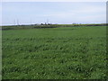
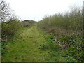
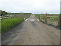
Nearby Images from Geograph Britain and Ireland:
©2015(licence)
©2021(licence)
©2008(licence)
©2008(licence)
©2005(licence)
The above images may not be of the site on this page, they are loaded from Geograph.
Please Submit an Image of this site or go out and take one for us!
Click here to see more info for this site
Nearby sites
Key: Red: member's photo, Blue: 3rd party photo, Yellow: other image, Green: no photo - please go there and take one, Grey: site destroyed
Download sites to:
KML (Google Earth)
GPX (GPS waypoints)
CSV (Garmin/Navman)
CSV (Excel)
To unlock full downloads you need to sign up as a Contributory Member. Otherwise downloads are limited to 50 sites.
Turn off the page maps and other distractions
Nearby sites listing. In the following links * = Image available
394m W 281° Mayon Farm Cross* Early Christian Sculptured Stone (SW3607625653)
607m WNW 290° Table Maen* Natural Stone / Erratic / Other Natural Feature (SW359258)
621m NE 42° Trevear Sennen* Standing Stone (Menhir) (SW369260)
760m W 263° Sennen Church* Ancient Cross (SW357255)
775m WNW 297° Mayon menhir* Standing Stone (Menhir) (SW3578625948)
907m WSW 242° Trevescan Cross* Early Christian Sculptured Stone (SW3563425178)
957m W 270° Sennen Hedge* Standing Stone (Menhir) (SW355256)
1.2km NNW 340° Carn Towan Cross* Ancient Cross (SW3612626668)
1.2km SW 217° Trevilley Cross* Early Christian Sculptured Stone (SW3569524648)
1.5km WNW 284° Whitesand Bay Stone Circle (SW350260)
1.7km NNW 348° Escalls Cliff Cairn* Cairn (SW362272)
1.7km W 274° Maen Castle* Promontory Fort / Cliff Castle (SW34762576)
1.7km WNW 283° Mayon Cliff cairn* Cairn (SW34812602)
1.7km SE 134° Trebehor Cross* Early Christian Sculptured Stone (SW3763824319)
2.0km SSW 199° Lower Bosistow Cliff Cave Cave or Rock Shelter (SW357237)
2.1km SW 224° Mushroom Rock* Rock Outcrop (SW34952415)
2.1km NNE 20° Trevedra Common Tumuli Barrow Cemetery (SW37292752)
2.2km SW 231° Pordenack Point* Promontory Fort / Cliff Castle (SW347243)
2.2km S 175° Higher Bosistow Menhir* Standing Stone (Menhir) (SW36532338)
2.2km WSW 258° Land’s End Iron Age Settlement* Hillfort (SW343252)
2.3km SW 229° Trevilley Cliff Tumuli* Barrow Cemetery (SW34682417)
2.3km NNE 17° Tregiffian Vean* Chambered Tomb (SW37252773)
2.4km SSW 194° Higher Bosistow Cliff Tumulus* Round Barrow(s) (SW35792330)
2.5km SSW 197° Carn Lês Boel* Promontory Fort / Cliff Castle (SW35642323)
2.8km NE 49° Treave Stonehenge* Modern Stone Circle etc (SW3869227316)
View more nearby sites and additional images


 We would like to know more about this location. Please feel free to add a brief description and any relevant information in your own language.
 Wir möchten mehr über diese Stätte erfahren. Bitte zögern Sie nicht, eine kurze Beschreibung und relevante Informationen in Deutsch hinzuzufügen.
 Nous aimerions en savoir encore un peu sur les lieux. S'il vous plaît n'hesitez pas à ajouter une courte description et tous les renseignements pertinents dans votre propre langue.
 Quisieramos informarnos un poco más de las lugares. No dude en añadir una breve descripción y otros datos relevantes en su propio idioma.