


<< Other Photo Pages >> North Down Museum - Museum in Ireland (Northern) in Co. Down
Submitted by Andy B on Tuesday, 16 July 2013 Page Views: 4929
MuseumsSite Name: North Down Museum Alternative Name: North Down Heritage CentreCountry: Ireland (Northern) County: Co. Down Type: Museum
Nearest Town: Bangor
Map Ref: NW634352
Latitude: 54.656207N Longitude: 5.669641W
Condition:
| 5 | Perfect |
| 4 | Almost Perfect |
| 3 | Reasonable but with some damage |
| 2 | Ruined but still recognisable as an ancient site |
| 1 | Pretty much destroyed, possibly visible as crop marks |
| 0 | No data. |
| -1 | Completely destroyed |
| 5 | Superb |
| 4 | Good |
| 3 | Ordinary |
| 2 | Not Good |
| 1 | Awful |
| 0 | No data. |
| 5 | Can be driven to, probably with disabled access |
| 4 | Short walk on a footpath |
| 3 | Requiring a bit more of a walk |
| 2 | A long walk |
| 1 | In the middle of nowhere, a nightmare to find |
| 0 | No data. |
| 5 | co-ordinates taken by GPS or official recorded co-ordinates |
| 4 | co-ordinates scaled from a detailed map |
| 3 | co-ordinates scaled from a bad map |
| 2 | co-ordinates of the nearest village |
| 1 | co-ordinates of the nearest town |
| 0 | no data |
Internal Links:
External Links:
")
Key artifacts on display include the Bronze Age Ballycroghan Swords, the Bangor Bell from the hugely important Bangor Abbey settlement, and the Raven Maps, the only complete folio of Plantation era maps in Ireland.
The Ballycroghan Swords were discovered in 1949 by Mr Patterson, while ploughing his fields on the outskirts of Bangor. The hoard is important as it demonstrates the different stages in sword production during the Bronze Age. The swords are dated to c. 500BC and are the key pieces in the Archaeology collection. Bangor Bell
There is also a museum shop and coffee shop with 'barista brewed' coffee!
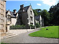
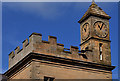
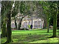
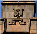
North Down Museum
Town Hall
The Castle
Bangor
BT20 4BT
United Kingdom
+44 (0) 28 9127 1200
museum@northdown.gov.uk
Opening Times
Tuesday - Saturday: 10.00am - 4.30pm
Sunday: 12.00pm - 4.30pm
Closed on Mondays, except July and August and Bank Holidays
Accessible for people with disabilities Admission is free
Official Web Site: http://www.northdownmuseum.com/
Note: Archaeology Day featuring Bronze Age music from Ancient Music Ireland, Sat 27th July
You may be viewing yesterday's version of this page. To see the most up to date information please register for a free account.
")
Do not use the above information on other web sites or publications without permission of the contributor.
Nearby Images from Geograph Britain and Ireland:
©2017(licence)
©2011(licence)
©2011(licence)
©2008(licence)
©2011(licence)
The above images may not be of the site on this page, they are loaded from Geograph.
Please Submit an Image of this site or go out and take one for us!
Click here to see more info for this site
Nearby sites
Click here to view sites on an interactive map of the areaKey: Red: member's photo, Blue: 3rd party photo, Yellow: other image, Green: no photo - please go there and take one, Grey: site destroyed
Download sites to:
KML (Google Earth)
GPX (GPS waypoints)
CSV (Garmin/Navman)
CSV (Excel)
To unlock full downloads you need to sign up as a Contributory Member. Otherwise downloads are limited to 50 sites.
Turn off the page maps and other distractions
Nearby sites listing. In the following links * = Image available
3.5km SSW 200° Conlig Standing Stone* Standing Stone (Menhir) (J49377783)
6.8km E 85° Portavoe* Standing Stone (Menhir)
7.1km ESE 109° Hogstown Standing Stone (Menhir) (J57257904)
7.8km ESE 109° Carryreagh Standing Stone (Menhir) (J5790078820)
9.6km SW 220° Greengraves* Portal Tomb (J4454073630)
9.6km ESE 114° Templepatrick* Modern Stone Circle etc (J5935077610)
13.1km SSE 156° Mount Stewart Cist* Cist (J5624069380)
14.3km SSW 195° Ballygraffan Portal Tomb* Portal Tomb
17.8km W 268° The Devil's Punchbowl Cave or Rock Shelter
17.9km W 267° McArts Fort* Stone Fort or Dun
18.1km W 267° Ballyaghagan Cairn* Cairn
18.2km WNW 296° West Division Stone Row / Alignment (J338887)
18.3km S 181° Ballymartin Rock Art Rock Art (J50766285)
18.5km W 269° Collinward Cairn* Cairn
19.0km WSW 245° Belfast (Ulster Museum)* Court Tomb (J335725)
19.2km W 266° Ballyaghagan Cashel Ancient Village or Settlement (J31287936)
21.3km SE 142° Ballyhemlin* Standing Stone (Menhir) (J6407064750)
21.4km NW 316° Tureagh Stone Circle (J350960)
21.4km W 267° Ballyutoag Court Tomb Court Tomb
21.7km NNW 342° Ballylumford Dolmen* Burial Chamber or Dolmen (D4305201603)
22.1km NW 322° Ballrickard More Stone Circle (J362981)
22.2km SW 235° Ballynahatty* Henge (J32726770)
22.3km W 259° Ballygomartin Standing Stone* Standing Stone (Menhir)
22.6km SE 143° Ballyhalbert Motte* Standing Stones (J6467563509)
23.6km W 279° Craigarogan* Chambered Tomb (J270842)
View more nearby sites and additional images


 We would like to know more about this location. Please feel free to add a brief description and any relevant information in your own language.
 Wir möchten mehr über diese Stätte erfahren. Bitte zögern Sie nicht, eine kurze Beschreibung und relevante Informationen in Deutsch hinzuzufügen.
 Nous aimerions en savoir encore un peu sur les lieux. S'il vous plaît n'hesitez pas à ajouter une courte description et tous les renseignements pertinents dans votre propre langue.
 Quisieramos informarnos un poco más de las lugares. No dude en añadir una breve descripción y otros datos relevantes en su propio idioma.