


<< Text Pages >> El Teriñuelo - Passage Grave in Spain in Castilla y León
Submitted by MMG on Wednesday, 25 January 2006 Page Views: 2889
Neolithic and Bronze AgeSite Name: El Teriñuelo Alternative Name: AldeaviejaCountry: Spain
NOTE: This site is 9.184 km away from the location you searched for.
Region: Castilla y León Type: Passage Grave
Latitude: 40.576665N Longitude: 5.608682W
Condition:
| 5 | Perfect |
| 4 | Almost Perfect |
| 3 | Reasonable but with some damage |
| 2 | Ruined but still recognisable as an ancient site |
| 1 | Pretty much destroyed, possibly visible as crop marks |
| 0 | No data. |
| -1 | Completely destroyed |
| 5 | Superb |
| 4 | Good |
| 3 | Ordinary |
| 2 | Not Good |
| 1 | Awful |
| 0 | No data. |
| 5 | Can be driven to, probably with disabled access |
| 4 | Short walk on a footpath |
| 3 | Requiring a bit more of a walk |
| 2 | A long walk |
| 1 | In the middle of nowhere, a nightmare to find |
| 0 | No data. |
| 5 | co-ordinates taken by GPS or official recorded co-ordinates |
| 4 | co-ordinates scaled from a detailed map |
| 3 | co-ordinates scaled from a bad map |
| 2 | co-ordinates of the nearest village |
| 1 | co-ordinates of the nearest town |
| 0 | no data |
Be the first person to rate this site - see the 'Contribute!' box in the right hand menu.
Internal Links:
External Links:
Passage Grave in Salamanca (Castilla y León)
For more details visit Megalitos.es.
You may be viewing yesterday's version of this page. To see the most up to date information please register for a free account.
Do not use the above information on other web sites or publications without permission of the contributor.
Nearby Images from Flickr
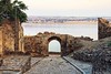
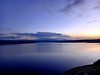
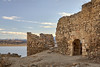
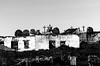

The above images may not be of the site on this page, but were taken nearby. They are loaded from Flickr so please click on them for image credits.
Click here to see more info for this site
Nearby sites
Click here to view sites on an interactive map of the areaKey: Red: member's photo, Blue: 3rd party photo, Yellow: other image, Green: no photo - please go there and take one, Grey: site destroyed
Download sites to:
KML (Google Earth)
GPX (GPS waypoints)
CSV (Garmin/Navman)
CSV (Excel)
To unlock full downloads you need to sign up as a Contributory Member. Otherwise downloads are limited to 50 sites.
Turn off the page maps and other distractions
Nearby sites listing. In the following links * = Image available
995m NW 315° Dehesa de Aldeavieja Castro or Chafurdão
4.1km WNW 291° Cabezuela de Salvatierra Round Barrow(s)
18.0km NNE 14° La Ermita Round Barrow(s)
20.4km W 272° Las Yeguerizas Castro or Chafurdão
20.4km W 273° Los Duranes Castro or Chafurdão
23.8km NNE 16° Éjeme: El Canturral Round Barrow(s)
26.7km NNE 14° Alba de Tormes: El Torrejón Burial Chamber or Dolmen
36.8km NNW 335° Valmuza: La Torrecilla Burial Chamber or Dolmen
37.0km NNW 335° Valmuza: Carrascalino Round Barrow(s)
37.0km NNW 335° Valmuza: túmulo Round Barrow(s)
37.0km NNW 335° Valmuza: Iglesia Round Barrow(s)
43.6km WSW 257° Majadas Viejas Castro or Chafurdão
46.3km NW 316° Robliza de Cojos Burial Chamber or Dolmen
46.7km SE 130° Juego de los Bolos* Cairn
46.7km SSW 200° Dolmen de Cabezuela Burial Chamber or Dolmen
47.4km E 82° Necrópolis Medieval de La Coba Ancient Village or Settlement
47.7km WSW 256° Canchal del Zarzalon Rock Art
48.7km SSE 154° El Raso de Candeleda Castro or Chafurdão
51.1km S 179° Losar de la Vera Burial Chamber or Dolmen
51.2km S 172° Cerro del Tejar Burial Chamber or Dolmen
52.2km SSE 168° Cruz del Pobre Burial Chamber or Dolmen
52.2km SSE 168° Vega del Nino Burial Chamber or Dolmen
55.1km SSW 202° San Roque Castro or Chafurdão
56.9km NW 325° Gejo de Diego Gómez Round Barrow(s)
57.0km ENE 74° Castro de la Mesa de Miranda* Castro or Chafurdão
View more nearby sites and additional images


 We would like to know more about this location. Please feel free to add a brief description and any relevant information in your own language.
 Wir möchten mehr über diese Stätte erfahren. Bitte zögern Sie nicht, eine kurze Beschreibung und relevante Informationen in Deutsch hinzuzufügen.
 Nous aimerions en savoir encore un peu sur les lieux. S'il vous plaît n'hesitez pas à ajouter une courte description et tous les renseignements pertinents dans votre propre langue.
 Quisieramos informarnos un poco más de las lugares. No dude en añadir una breve descripción y otros datos relevantes en su propio idioma.