


<< Text Pages >> El Acebuchal - Castro or Chafurdão in Spain in Andalucía
Submitted by TheCaptain on Wednesday, 08 September 2010 Page Views: 2801
Iron Age and Later PrehistorySite Name: El AcebuchalCountry: Spain
NOTE: This site is 3.245 km away from the location you searched for.
Region: Andalucía Type: Castro or Chafurdão
Nearest Town: Sevilla Nearest Village: Carmona
Latitude: 37.471000N Longitude: 5.642W
Condition:
| 5 | Perfect |
| 4 | Almost Perfect |
| 3 | Reasonable but with some damage |
| 2 | Ruined but still recognisable as an ancient site |
| 1 | Pretty much destroyed, possibly visible as crop marks |
| 0 | No data. |
| -1 | Completely destroyed |
| 5 | Superb |
| 4 | Good |
| 3 | Ordinary |
| 2 | Not Good |
| 1 | Awful |
| 0 | No data. |
| 5 | Can be driven to, probably with disabled access |
| 4 | Short walk on a footpath |
| 3 | Requiring a bit more of a walk |
| 2 | A long walk |
| 1 | In the middle of nowhere, a nightmare to find |
| 0 | No data. |
| 5 | co-ordinates taken by GPS or official recorded co-ordinates |
| 4 | co-ordinates scaled from a detailed map |
| 3 | co-ordinates scaled from a bad map |
| 2 | co-ordinates of the nearest village |
| 1 | co-ordinates of the nearest town |
| 0 | no data |
Be the first person to rate this site - see the 'Contribute!' box in the right hand menu.
Internal Links:
External Links:
Castro in Andalusia
El Acebuchal is a Castro in the community of Carmona, Province of Sevilla, region of Andalusia
You may be viewing yesterday's version of this page. To see the most up to date information please register for a free account.
Do not use the above information on other web sites or publications without permission of the contributor.
Nearby Images from Flickr
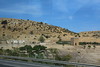
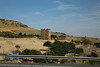


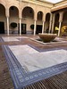
The above images may not be of the site on this page, but were taken nearby. They are loaded from Flickr so please click on them for image credits.
Click here to see more info for this site
Nearby sites
Click here to view sites on an interactive map of the areaKey: Red: member's photo, Blue: 3rd party photo, Yellow: other image, Green: no photo - please go there and take one, Grey: site destroyed
Download sites to:
KML (Google Earth)
GPX (GPS waypoints)
CSV (Garmin/Navman)
CSV (Excel)
To unlock full downloads you need to sign up as a Contributory Member. Otherwise downloads are limited to 50 sites.
Turn off the page maps and other distractions
Nearby sites listing. In the following links * = Image available
547m ENE 61° City Museum de Carmona* Museum
18.1km SW 219° El Término Chambered Tomb
18.7km SW 221° El Vaquero Chambered Tomb
18.7km SW 221° Las Canteras Ancient Village or Settlement
28.3km NNW 342° Mulva-Munigua Ruinas Romanas Ancient Village or Settlement
30.0km SE 133° Necrópolis Romana de Carmona* Barrow Cemetery
32.5km WSW 250° Museo Arqueológico de Sevilla* Museum
35.8km W 265° Itálica Santiponce Ancient Village or Settlement
37.4km W 260° Dolmen de Montelirio* Burial Chamber or Dolmen
37.8km W 260° La Pastora Dolmen* Chambered Tomb
38.5km W 259° Matarrubilla Dolmen* Burial Chamber or Dolmen
66.5km W 260° Mina del Chiflón* Ancient Mine, Quarry or other Industry
72.8km S 180° Alberite Dolmen* Chambered Tomb
73.7km SE 142° Dólmen de los Tomillos 1* Burial Chamber or Dolmen
73.7km SE 142° Dólmen de los Tomillos 2* Burial Chamber or Dolmen
73.7km SE 142° Dólmen de los Tomillos 3* Chambered Tomb
75.0km SSE 158° El Charcón II* Burial Chamber or Dolmen
75.2km SSE 158° Dolmen El Charcón* Burial Chamber or Dolmen
75.4km S 180° Menhir de La Lancha* Standing Stone (Menhir)
78.2km W 280° Casullo Dolmen Burial Chamber or Dolmen
79.5km SSE 153° Acinipo* Ancient Village or Settlement
80.5km WNW 282° Dolmen Puerto Huertos Burial Chamber or Dolmen
81.1km E 94° Villa Romana de Fuente Álamo Ancient Village or Settlement
81.3km W 278° Mascotejo Dolmen Burial Chamber or Dolmen
81.7km WNW 286° La Lancha Dolmen Burial Chamber or Dolmen
View more nearby sites and additional images


 We would like to know more about this location. Please feel free to add a brief description and any relevant information in your own language.
 Wir möchten mehr über diese Stätte erfahren. Bitte zögern Sie nicht, eine kurze Beschreibung und relevante Informationen in Deutsch hinzuzufügen.
 Nous aimerions en savoir encore un peu sur les lieux. S'il vous plaît n'hesitez pas à ajouter une courte description et tous les renseignements pertinents dans votre propre langue.
 Quisieramos informarnos un poco más de las lugares. No dude en añadir una breve descripción y otros datos relevantes en su propio idioma.