


<< Other Photo Pages >> An Dun (Barnhill) - Stone Fort or Dun in Scotland in Highlands
Submitted by Andy B on Tuesday, 19 October 2010 Page Views: 2989
Multi-periodSite Name: An Dun (Barnhill)Country: Scotland
NOTE: This site is 1.34 km away from the location you searched for.
County: Highlands Type: Stone Fort or Dun
Map Ref: NG82441972
Latitude: 57.216392N Longitude: 5.60481W
Condition:
| 5 | Perfect |
| 4 | Almost Perfect |
| 3 | Reasonable but with some damage |
| 2 | Ruined but still recognisable as an ancient site |
| 1 | Pretty much destroyed, possibly visible as crop marks |
| 0 | No data. |
| -1 | Completely destroyed |
| 5 | Superb |
| 4 | Good |
| 3 | Ordinary |
| 2 | Not Good |
| 1 | Awful |
| 0 | No data. |
| 5 | Can be driven to, probably with disabled access |
| 4 | Short walk on a footpath |
| 3 | Requiring a bit more of a walk |
| 2 | A long walk |
| 1 | In the middle of nowhere, a nightmare to find |
| 0 | No data. |
| 5 | co-ordinates taken by GPS or official recorded co-ordinates |
| 4 | co-ordinates scaled from a detailed map |
| 3 | co-ordinates scaled from a bad map |
| 2 | co-ordinates of the nearest village |
| 1 | co-ordinates of the nearest town |
| 0 | no data |
Be the first person to rate this site - see the 'Contribute!' box in the right hand menu.
Internal Links:
External Links:
Stone Fort or Dun in Highlands
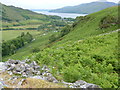
There is little doubt that this is the site of a thoroughly robbed dun (or possibly even a broch). The roughly circular level summit of the knoll, c. 10.5m in diameter, probably represents the original internal area whilst around its edge on the slope are patches of rubble which may represent the last traces of a robbed and quarried wall.
There are traces in the SE and NW of an outwork surrounding the dun at a distance varying between 4.0m and 8.0m from it. It is now best reserved in the NW as a short stretch of stony bank spread to 2.5m.
Source: Canmore
You may be viewing yesterday's version of this page. To see the most up to date information please register for a free account.
Do not use the above information on other web sites or publications without permission of the contributor.
Andy B has found this location on Google Street View:
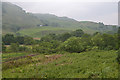
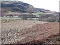
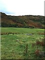
Nearby Images from Geograph Britain and Ireland:
©2011(licence)
©2013(licence)
©2011(licence)
©2020(licence)
©2012(licence)
The above images may not be of the site on this page, they are loaded from Geograph.
Please Submit an Image of this site or go out and take one for us!
Click here to see more info for this site
Nearby sites
Key: Red: member's photo, Blue: 3rd party photo, Yellow: other image, Green: no photo - please go there and take one, Grey: site destroyed
Download sites to:
KML (Google Earth)
GPX (GPS waypoints)
CSV (Garmin/Navman)
CSV (Excel)
To unlock full downloads you need to sign up as a Contributory Member. Otherwise downloads are limited to 50 sites.
Turn off the page maps and other distractions
Nearby sites listing. In the following links * = Image available
1.1km NNW 342° Am Baghan Galldair* Stone Fort or Dun (NG82162075)
2.3km WNW 303° Bernera Farm* Rock Art (NG80552110)
2.5km ENE 74° Serpent Mound (Scallasaig) Cairn (NG8484020288)
2.6km SSE 167° Dun Telve* Broch or Nuraghe (NG829172)
2.6km SSE 162° Corrary Prehistoric Site* Cairn (NG83121725)
2.7km SSE 156° Dun Troddan* Broch or Nuraghe (NG834172)
3.5km SSE 149° Balvraid Farm Cup Marked Stone* Rock Art (NG84081667)
3.7km SE 143° Balvraid Chambered Cairn* Chambered Cairn (NG8452416627)
4.2km SE 140° Balvraid Cup Marked Stone* Rock Art (NG84961635)
4.5km SE 140° Grugaig Hut Circle* Ancient Village or Settlement (NG8517616131)
4.7km SE 142° Dun Grugaig (Glenelg)* Broch or Nuraghe (NG85151591)
6.7km ENE 58° Torran a'Bharraich* Hillfort (NG88312296)
6.8km NE 35° Caisteal Grugaig* Broch or Nuraghe (NG86692508)
7.1km NE 35° Dun Totaig (Loch Duich) Broch or Nuraghe (NG868253)
7.2km ENE 60° Allt an Inbhir Souterrain* Souterrain (Fogou, Earth House) (NG88882296)
7.5km NE 38° Totaig Cup Markings* Rock Art (NG87432536)
7.7km N 2° Lochalsh* Stone Circle (NG831274)
7.7km N 2° Angels' Hill, Kirkton* Hillfort (NG83142745)
8.0km N 359° Dun Kirkton Stone Fort or Dun (NG82722768)
8.4km NNE 15° Dun Gleann Udalain Stone Fort or Dun (NG85062773)
8.7km NE 54° Carr Brae* Rock Art (NG89782451)
10.0km NNE 12° Gleann Udalain Cairn Cairn (NG85092942)
10.7km E 93° Sheil Henge* Henge (NG93081868)
11.0km NE 39° Bard's Castle* Hillfort (NG89822790)
11.3km N 351° Loch Achaidh na h-Inich* Crannog (NG81173095)
View more nearby sites and additional images


 We would like to know more about this location. Please feel free to add a brief description and any relevant information in your own language.
 Wir möchten mehr über diese Stätte erfahren. Bitte zögern Sie nicht, eine kurze Beschreibung und relevante Informationen in Deutsch hinzuzufügen.
 Nous aimerions en savoir encore un peu sur les lieux. S'il vous plaît n'hesitez pas à ajouter une courte description et tous les renseignements pertinents dans votre propre langue.
 Quisieramos informarnos un poco más de las lugares. No dude en añadir una breve descripción y otros datos relevantes en su propio idioma.