


<< Other Photo Pages >> Campbeltown Museum - Museum in Scotland in Argyll
Submitted by vicky on Saturday, 30 November 2002 Page Views: 5513
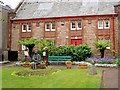
MuseumsSite Name: Campbeltown MuseumCountry: Scotland
NOTE: This site is 0.131 km away from the location you searched for.
County: Argyll Type: Museum
Nearest Town: Campbeltown
Map Ref: NR7211620336 Landranger Map Number: 68
Latitude: 55.423777N Longitude: 5.602776W
Condition:
| 5 | Perfect |
| 4 | Almost Perfect |
| 3 | Reasonable but with some damage |
| 2 | Ruined but still recognisable as an ancient site |
| 1 | Pretty much destroyed, possibly visible as crop marks |
| 0 | No data. |
| -1 | Completely destroyed |
| 5 | Superb |
| 4 | Good |
| 3 | Ordinary |
| 2 | Not Good |
| 1 | Awful |
| 0 | No data. |
| 5 | Can be driven to, probably with disabled access |
| 4 | Short walk on a footpath |
| 3 | Requiring a bit more of a walk |
| 2 | A long walk |
| 1 | In the middle of nowhere, a nightmare to find |
| 0 | No data. |
| 5 | co-ordinates taken by GPS or official recorded co-ordinates |
| 4 | co-ordinates scaled from a detailed map |
| 3 | co-ordinates scaled from a bad map |
| 2 | co-ordinates of the nearest village |
| 1 | co-ordinates of the nearest town |
| 0 | no data |
Be the first person to rate this site - see the 'Contribute!' box in the right hand menu.
Internal Links:
External Links:
I have visited· I would like to visit
FrothNinja has visited here
Local archaeology including Bronze Age jet necklace and bracelet.
Address: St John Street, PA28 6BS
Phone: 01586 552366
Opening Hours: 9.00 am to 5.00 pm Mon to Fri. Occasional weekends from 11.00 am to 3.00 pm in summer.
Admission: Free, donations appreciated.
More information on the Argyll & Bute Council Campbeltown Museum website.
You may be viewing yesterday's version of this page. To see the most up to date information please register for a free account.
Do not use the above information on other web sites or publications without permission of the contributor.
davidmorgan has found this location on Google Street View:
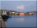
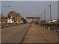
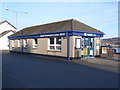
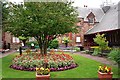
Nearby Images from Geograph Britain and Ireland:
©2008(licence)
©2019(licence)
©2008(licence)
©2013(licence)
©2013(licence)
The above images may not be of the site on this page, they are loaded from Geograph.
Please Submit an Image of this site or go out and take one for us!
Click here to see more info for this site
Nearby sites
Key: Red: member's photo, Blue: 3rd party photo, Yellow: other image, Green: no photo - please go there and take one, Grey: site destroyed
Download sites to:
KML (Google Earth)
GPX (GPS waypoints)
CSV (Garmin/Navman)
CSV (Excel)
To unlock full downloads you need to sign up as a Contributory Member. Otherwise downloads are limited to 50 sites.
Turn off the page maps and other distractions
Nearby sites listing. In the following links * = Image available
938m NNE 14° Campbeltown* Standing Stone (Menhir) (NR7239321234)
2.2km WSW 254° Stewarton Recumbent Stone Standing Stone (Menhir) (NR6995719821)
2.2km WSW 254° Culinlongart Recumbent Standing Stone (Menhir) (NR69951982)
3.0km SE 124° Glenramskill Fort* Hillfort (NR7455118507)
4.2km NW 316° Craigs East (Kintyre)* Standing Stone (Menhir) (NR6932623544)
4.3km NNE 27° Greenland Chambered Cairn (NR743241)
4.5km NW 314° Craigs (Kintyre)* Standing Stone (Menhir) (NR6903123633)
4.6km NW 322° Craigs NE (Kintyre) Recumbent Standing Stone (Menhir) (NR6949924121)
6.0km NNW 331° High Park Stone* Standing Stone (Menhir) (NR69442573)
6.5km NNE 26° Kilkeddan Farm cist burial Cist (NR75252600)
6.5km NE 35° Glenlussa Lodge* Standing Stone (Menhir) (NR76152543)
6.8km NNW 347° Skeroblin Stone* Standing Stone (Menhir) (NR70932701)
6.8km NE 35° Peninver Bridge Standing Stone* Standing Stone (Menhir) (NR76352570)
7.0km NNE 17° Gort na H'ulaidhe Chambered Cairn (NR745269)
7.1km NNW 345° Skeroblin Row Stone Row / Alignment (NR706273)
7.2km NE 36° The Priest's Grave (Ardnacross)* Cist (NR76662592)
7.4km SW 226° Lochorodale Stone Standing Stone (Menhir) (NR66571546)
7.4km NE 36° Ardnacross 2 Chambered Cairn (NR768261)
7.5km SW 234° Lochorodale Cairn (NR658163)
7.5km WNW 300° Clochkeil* Stone Row / Alignment (NR6577824456)
7.7km W 269° Macrihanish Stone Row / Alignment (NR644206)
7.8km SW 226° Lochorodale Chambered Cairn* Chambered Cairn (NR66231522)
8.1km S 190° Knockstapple* Standing Stone (Menhir) (NR70261241)
8.2km NNE 30° Ardnacross 1 Chambered Cairn (NR766272)
8.8km NNW 337° Tangy Loch Cairn (NR691286)
View more nearby sites and additional images


 We would like to know more about this location. Please feel free to add a brief description and any relevant information in your own language.
 Wir möchten mehr über diese Stätte erfahren. Bitte zögern Sie nicht, eine kurze Beschreibung und relevante Informationen in Deutsch hinzuzufügen.
 Nous aimerions en savoir encore un peu sur les lieux. S'il vous plaît n'hesitez pas à ajouter une courte description et tous les renseignements pertinents dans votre propre langue.
 Quisieramos informarnos un poco más de las lugares. No dude en añadir una breve descripción y otros datos relevantes en su propio idioma.