


<< Text Pages >> Dun Gleann Udalain - Stone Fort or Dun in Scotland in Highlands
Submitted by SolarMegalith on Sunday, 08 May 2011 Page Views: 3874
Multi-periodSite Name: Dun Gleann UdalainCountry: Scotland
NOTE: This site is 0.892 km away from the location you searched for.
County: Highlands Type: Stone Fort or Dun
Nearest Village: Nostie
Map Ref: NG85062773
Latitude: 57.289442N Longitude: 5.568457W
Condition:
| 5 | Perfect |
| 4 | Almost Perfect |
| 3 | Reasonable but with some damage |
| 2 | Ruined but still recognisable as an ancient site |
| 1 | Pretty much destroyed, possibly visible as crop marks |
| 0 | No data. |
| -1 | Completely destroyed |
| 5 | Superb |
| 4 | Good |
| 3 | Ordinary |
| 2 | Not Good |
| 1 | Awful |
| 0 | No data. |
| 5 | Can be driven to, probably with disabled access |
| 4 | Short walk on a footpath |
| 3 | Requiring a bit more of a walk |
| 2 | A long walk |
| 1 | In the middle of nowhere, a nightmare to find |
| 0 | No data. |
| 5 | co-ordinates taken by GPS or official recorded co-ordinates |
| 4 | co-ordinates scaled from a detailed map |
| 3 | co-ordinates scaled from a bad map |
| 2 | co-ordinates of the nearest village |
| 1 | co-ordinates of the nearest town |
| 0 | no data |
Internal Links:
External Links:
Stone Fort or Dun in Highlands
Remains of an oval dun on a rocky knoll.
Read More at ScotlandsPlaces.
You may be viewing yesterday's version of this page. To see the most up to date information please register for a free account.
Do not use the above information on other web sites or publications without permission of the contributor.
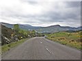
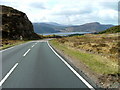
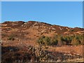
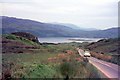
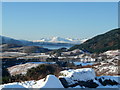
Nearby Images from Geograph Britain and Ireland:
©2015(licence)
©2010(licence)
©2015(licence)
©2015(licence)
©2009(licence)
The above images may not be of the site on this page, they are loaded from Geograph.
Please Submit an Image of this site or go out and take one for us!
Click here to see more info for this site
Nearby sites
Key: Red: member's photo, Blue: 3rd party photo, Yellow: other image, Green: no photo - please go there and take one, Grey: site destroyed
Download sites to:
KML (Google Earth)
GPX (GPS waypoints)
CSV (Garmin/Navman)
CSV (Excel)
To unlock full downloads you need to sign up as a Contributory Member. Otherwise downloads are limited to 50 sites.
Turn off the page maps and other distractions
Nearby sites listing. In the following links * = Image available
1.7km N 358° Gleann Udalain Cairn Cairn (NG85092942)
1.9km WSW 259° Angels' Hill, Kirkton* Hillfort (NG83142745)
2.0km WSW 257° Lochalsh* Stone Circle (NG831274)
2.3km W 266° Dun Kirkton Stone Fort or Dun (NG82722768)
3.0km SE 141° Dun Totaig (Loch Duich) Broch or Nuraghe (NG868253)
3.1km SE 145° Caisteal Grugaig* Broch or Nuraghe (NG86692508)
3.3km SE 132° Totaig Cup Markings* Rock Art (NG87432536)
4.7km E 85° Bard's Castle* Hillfort (NG89822790)
4.9km NW 317° Carn na Sean-chreige* Hillfort (NG81893146)
5.0km NW 307° Loch Achaidh na h-Inich* Crannog (NG81173095)
5.7km ESE 121° Carr Brae* Rock Art (NG89782451)
5.8km SE 143° Torran a'Bharraich* Hillfort (NG88312296)
6.1km SE 138° Allt an Inbhir Souterrain* Souterrain (Fogou, Earth House) (NG88882296)
7.4km S 179° Serpent Mound (Scallasaig) Cairn (NG8484020288)
7.5km SSW 200° Am Baghan Galldair* Stone Fort or Dun (NG82162075)
8.0km SSW 211° Bernera Farm* Rock Art (NG80552110)
8.4km SSW 195° An Dun (Barnhill)* Stone Fort or Dun (NG82441972)
9.5km E 79° Camas Luinie* Rock Art (NG94492909)
10.4km E 82° Faddoch* Rock Art (NG95452863)
10.6km S 187° Corrary Prehistoric Site* Cairn (NG83121725)
10.6km S 186° Dun Troddan* Broch or Nuraghe (NG834172)
10.7km S 189° Dun Telve* Broch or Nuraghe (NG829172)
11.1km S 182° Balvraid Farm Cup Marked Stone* Rock Art (NG84081667)
11.1km S 180° Balvraid Chambered Cairn* Chambered Cairn (NG8452416627)
11.2km SE 125° Diarmaid's Grave* Standing Stones (NG93992085)
View more nearby sites and additional images


 We would like to know more about this location. Please feel free to add a brief description and any relevant information in your own language.
 Wir möchten mehr über diese Stätte erfahren. Bitte zögern Sie nicht, eine kurze Beschreibung und relevante Informationen in Deutsch hinzuzufügen.
 Nous aimerions en savoir encore un peu sur les lieux. S'il vous plaît n'hesitez pas à ajouter une courte description et tous les renseignements pertinents dans votre propre langue.
 Quisieramos informarnos un poco más de las lugares. No dude en añadir una breve descripción y otros datos relevantes en su propio idioma.