


<< Our Photo Pages >> Crinan Woods Cup Stone - Rock Art in Scotland in Argyll
Submitted by hidebasket on Sunday, 12 March 2023 Page Views: 851
Rock ArtSite Name: Crinan Woods Cup StoneCountry: Scotland
NOTE: This site is 1.063 km away from the location you searched for.
County: Argyll Type: Rock Art
Nearest Village: Crinan
Map Ref: NR79019382
Latitude: 56.085941N Longitude: 5.553556W
Condition:
| 5 | Perfect |
| 4 | Almost Perfect |
| 3 | Reasonable but with some damage |
| 2 | Ruined but still recognisable as an ancient site |
| 1 | Pretty much destroyed, possibly visible as crop marks |
| 0 | No data. |
| -1 | Completely destroyed |
| 5 | Superb |
| 4 | Good |
| 3 | Ordinary |
| 2 | Not Good |
| 1 | Awful |
| 0 | No data. |
| 5 | Can be driven to, probably with disabled access |
| 4 | Short walk on a footpath |
| 3 | Requiring a bit more of a walk |
| 2 | A long walk |
| 1 | In the middle of nowhere, a nightmare to find |
| 0 | No data. |
| 5 | co-ordinates taken by GPS or official recorded co-ordinates |
| 4 | co-ordinates scaled from a detailed map |
| 3 | co-ordinates scaled from a bad map |
| 2 | co-ordinates of the nearest village |
| 1 | co-ordinates of the nearest town |
| 0 | no data |
Internal Links:
External Links:
I have visited· I would like to visit
hidebasket visited - their rating: Cond: 3 Amb: 4 Access: 3
")
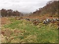
Along the path that takes you up the hill beside the village of Crinan, at the highest point there will be an outcrop of large rocks, with one visible cup mark in the stone.
You may be viewing yesterday's version of this page. To see the most up to date information please register for a free account.
Do not use the above information on other web sites or publications without permission of the contributor.
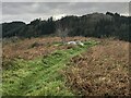
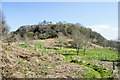
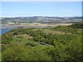
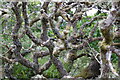
Nearby Images from Geograph Britain and Ireland:
©2023(licence)
©2023(licence)
©2019(licence)
©2021(licence)
©2009(licence)
The above images may not be of the site on this page, they are loaded from Geograph.
Please Submit an Image of this site or go out and take one for us!
Click here to see more info for this site
Nearby sites
Key: Red: member's photo, Blue: 3rd party photo, Yellow: other image, Green: no photo - please go there and take one, Grey: site destroyed
Download sites to:
KML (Google Earth)
GPX (GPS waypoints)
CSV (Garmin/Navman)
CSV (Excel)
To unlock full downloads you need to sign up as a Contributory Member. Otherwise downloads are limited to 50 sites.
Turn off the page maps and other distractions
Nearby sites listing. In the following links * = Image available
1.8km ENE 79° Crinan Moss Stones* Standing Stones (NR80839409)
1.9km E 79° Crinan Moss Cairn Cairn (NR80909408)
2.4km NNE 27° Duntroon Stone Fort or Dun (NR802959)
2.9km NE 49° Barsloisnoch* Cist (NR813956)
3.1km N 355° Dun Ardifuir 1 Stone Fort or Dun (NR789969)
3.2km S 190° Kilmory Oib Enclosure* Standing Stones (NR78289070)
3.2km NNE 31° Kilchoan* Chambered Cairn (NR8083596488)
3.4km NE 39° Poltalloch House Rock Art* Rock Art (NR813964)
3.5km N 359° Dun Ardifuir 2 Stone Fort or Dun (NR791973)
3.5km S 179° Gartnagreanoch* Chambered Cairn (NR789903)
3.6km NE 53° Rowanfield Cottage* Standing Stone (Menhir) (NR82059585)
3.8km SSW 193° Holy Well (Kilmory Oib)* Holy Well or Sacred Spring (NR780902)
3.9km ESE 123° Barnakill Rock Art (NR82199154)
3.9km NE 50° Rowanfield Cist* Cist (NR8216096208)
4.5km NE 39° Poltalloch Cist* Cist (NR82049714)
4.5km NNE 26° Barr A Chuirn Cairn (NR812978)
4.7km E 90° Dunadd Fort* Hillfort (NR8367693573)
4.7km NE 38° Cnoc-an-teallaidh* Cist (NR82129735)
4.7km NNE 30° Ballygowan Rock Art* Rock Art (NR8162097782)
4.8km NE 44° Ri Cruin* Rock Art (NR825971)
4.8km NNE 27° Dun Ballygowan Stone Fort or Dun (NR814980)
4.8km NE 44° Ri Cruin* Cairn (NR8254897119)
4.8km E 89° Dunadd Standing Stone* Standing Stone (Menhir) (NR8386993612)
4.9km N 10° Dun Loch Michean Stone Fort or Dun (NR801986)
4.9km ENE 57° Ballymeanoch Henge* Henge (NR83319628)
View more nearby sites and additional images


 We would like to know more about this location. Please feel free to add a brief description and any relevant information in your own language.
 Wir möchten mehr über diese Stätte erfahren. Bitte zögern Sie nicht, eine kurze Beschreibung und relevante Informationen in Deutsch hinzuzufügen.
 Nous aimerions en savoir encore un peu sur les lieux. S'il vous plaît n'hesitez pas à ajouter une courte description et tous les renseignements pertinents dans votre propre langue.
 Quisieramos informarnos un poco más de las lugares. No dude en añadir una breve descripción y otros datos relevantes en su propio idioma.