


<< Our Photo Pages >> Dun Skeig - Hillfort in Scotland in Argyll
Submitted by lynswan on Tuesday, 15 July 2008 Page Views: 7128
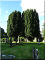
Iron Age and Later PrehistorySite Name: Dun SkeigCountry: Scotland County: Argyll Type: Hillfort
Nearest Town: Tarbert Nearest Village: Clachan
Map Ref: NR76315612
Latitude: 55.746621N Longitude: 5.565652W
Condition:
| 5 | Perfect |
| 4 | Almost Perfect |
| 3 | Reasonable but with some damage |
| 2 | Ruined but still recognisable as an ancient site |
| 1 | Pretty much destroyed, possibly visible as crop marks |
| 0 | No data. |
| -1 | Completely destroyed |
| 5 | Superb |
| 4 | Good |
| 3 | Ordinary |
| 2 | Not Good |
| 1 | Awful |
| 0 | No data. |
| 5 | Can be driven to, probably with disabled access |
| 4 | Short walk on a footpath |
| 3 | Requiring a bit more of a walk |
| 2 | A long walk |
| 1 | In the middle of nowhere, a nightmare to find |
| 0 | No data. |
| 5 | co-ordinates taken by GPS or official recorded co-ordinates |
| 4 | co-ordinates scaled from a detailed map |
| 3 | co-ordinates scaled from a bad map |
| 2 | co-ordinates of the nearest village |
| 1 | co-ordinates of the nearest town |
| 0 | no data |
Internal Links:
External Links:
")
Easiest way to get there is to drive to the tiny harbour of Portachoillan then follow the path up to the fort. Or you could walk from Clachan, past the campsite, follow the river to the coast and then walking round to Portachoillan.
You may be viewing yesterday's version of this page. To see the most up to date information please register for a free account.
")
")
")
")
Do not use the above information on other web sites or publications without permission of the contributor.
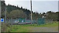
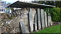
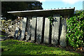
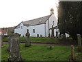
Nearby Images from Geograph Britain and Ireland:
©2023(licence)
©2023(licence)
©2021(licence)
©2013(licence)
©2021(licence)
The above images may not be of the site on this page, they are loaded from Geograph.
Please Submit an Image of this site or go out and take one for us!
Click here to see more info for this site
Nearby sites
Key: Red: member's photo, Blue: 3rd party photo, Yellow: other image, Green: no photo - please go there and take one, Grey: site destroyed
Download sites to:
KML (Google Earth)
GPX (GPS waypoints)
CSV (Garmin/Navman)
CSV (Excel)
To unlock full downloads you need to sign up as a Contributory Member. Otherwise downloads are limited to 50 sites.
Turn off the page maps and other distractions
Nearby sites listing. In the following links * = Image available
2.2km SE 125° Loch Ciaran* Standing Stone (Menhir) (NR78035479)
3.3km SW 227° Correchrevie Cairn* Cairn (NR738540)
4.0km NNW 348° Ardpatrick* Standing Stone (Menhir) (NR757601)
4.9km SW 218° Ballochroy* Stone Row / Alignment (NR7309352426)
5.2km N 7° Tobar Cill'An Aonghais* Holy Well or Sacred Spring (NR772613)
5.9km NNW 337° Carse Standing Stones East* Standing Stones (NR7424661640)
5.9km NNW 336° Carse Standing Stones West* Standing Stone (Menhir) (NR74146166)
9.8km NW 324° Kilberry* Sculptured Stone (NR709643)
10.4km WSW 256° Cnoc nan Gobhar Stone* Standing Stone (Menhir) (NR6607454042)
10.5km ENE 75° Glenreasdale* Chambered Cairn (NR866583)
11.0km WSW 252° Kinerarach (Gigha)* Standing Stone (Menhir) (NR6568453210)
11.4km WSW 247° Tarbert (Gigha)* Standing Stone (Menhir) (NR6554952292)
11.4km WSW 248° Old Wife's Grave, The (Gigha, Isle of) Cairn (NR655524)
12.1km NNW 330° Cretshengan* Standing Stone (Menhir) (NR70726689)
13.0km NNW 333° Dun Cragach Stone Fort or Dun (NR71086805)
13.3km WSW 238° Druimyeonbeg (Isle of Gigha) Cairn (NR64634958)
13.4km E 81° Skipness Rock Art (NR8967357519)
13.4km SW 235° Ardminish Cist (NR64954890)
13.5km NE 35° Escart* Stone Row / Alignment (NR8464266794)
13.6km NNE 31° Avinagillan* Standing Stone (Menhir) (NR8390367461)
14.2km SW 234° Cnoc na Croise (Gigha) Cairn (NR64394828)
14.4km SW 234° Cnoc na Carraigh Ogham Stone* Sculptured Stone (NR6426548173)
14.5km SW 233° Cnoc na Carraigh (Gigha) Standing Stone (Menhir) (NR64204806)
14.6km SSE 165° Brackley* Chambered Cairn (NR79374187)
14.6km SSW 206° Beacharra* Standing Stone (Menhir) (NR69264332)
View more nearby sites and additional images


 We would like to know more about this location. Please feel free to add a brief description and any relevant information in your own language.
 Wir möchten mehr über diese Stätte erfahren. Bitte zögern Sie nicht, eine kurze Beschreibung und relevante Informationen in Deutsch hinzuzufügen.
 Nous aimerions en savoir encore un peu sur les lieux. S'il vous plaît n'hesitez pas à ajouter une courte description et tous les renseignements pertinents dans votre propre langue.
 Quisieramos informarnos un poco más de las lugares. No dude en añadir una breve descripción y otros datos relevantes en su propio idioma.