

<< Text Pages >> El Corón - Castro or Chafurdão in Spain in Asturias
Submitted by johnstone on Saturday, 29 February 2020 Page Views: 307
Iron Age and Later PrehistorySite Name: El CorónCountry: Spain
NOTE: This site is 4.021 km away from the location you searched for.
Region: Asturias Type: Castro or Chafurdão
Nearest Town: La Pola Llaviana Nearest Village: Condado
Latitude: 43.239543N Longitude: 5.499129W
Condition:
| 5 | Perfect |
| 4 | Almost Perfect |
| 3 | Reasonable but with some damage |
| 2 | Ruined but still recognisable as an ancient site |
| 1 | Pretty much destroyed, possibly visible as crop marks |
| 0 | No data. |
| -1 | Completely destroyed |
| 5 | Superb |
| 4 | Good |
| 3 | Ordinary |
| 2 | Not Good |
| 1 | Awful |
| 0 | No data. |
| 5 | Can be driven to, probably with disabled access |
| 4 | Short walk on a footpath |
| 3 | Requiring a bit more of a walk |
| 2 | A long walk |
| 1 | In the middle of nowhere, a nightmare to find |
| 0 | No data. |
| 5 | co-ordinates taken by GPS or official recorded co-ordinates |
| 4 | co-ordinates scaled from a detailed map |
| 3 | co-ordinates scaled from a bad map |
| 2 | co-ordinates of the nearest village |
| 1 | co-ordinates of the nearest town |
| 0 | no data |
Be the first person to rate this site - see the 'Contribute!' box in the right hand menu.
Internal Links:
External Links:
Castro in Asturias
You may be viewing yesterday's version of this page. To see the most up to date information please register for a free account.
Do not use the above information on other web sites or publications without permission of the contributor.
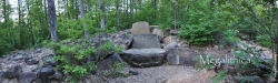
Nearby Images from Flickr
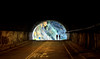
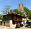
The above images may not be of the site on this page, but were taken nearby. They are loaded from Flickr so please click on them for image credits.
Click here to see more info for this site
Nearby sites
Click here to view sites on an interactive map of the areaKey: Red: member's photo, Blue: 3rd party photo, Yellow: other image, Green: no photo - please go there and take one, Grey: site destroyed
Download sites to:
KML (Google Earth)
GPX (GPS waypoints)
CSV (Garmin/Navman)
CSV (Excel)
To unlock full downloads you need to sign up as a Contributory Member. Otherwise downloads are limited to 50 sites.
Turn off the page maps and other distractions
Nearby sites listing. In the following links * = Image available
3.9km ESE 108° La Corona (Campiellos) Castro or Chafurdão
4.5km SE 134° El Castrín Castro or Chafurdão
8.8km NNW 342° El Picu Castiellu (Melendreros) Castro or Chafurdão
13.0km N 3° Castiellu de Sales Castro or Chafurdão
13.2km SSW 197° Les Mueles Castro or Chafurdão
13.3km WNW 292° El Picu Castiellu (Pumarín) Castro or Chafurdão
13.6km S 190° Los Castiellos (La Polavieya) Castro or Chafurdão
14.7km WSW 257° Llana del Rebollo Castro or Chafurdão
15.2km ESE 119° Colláu Castiellu Castro or Chafurdão
15.6km S 186° El Castiellu (Felechosa) Castro or Chafurdão
16.6km WSW 259° El Cuitu Castiello Castro or Chafurdão
16.7km W 262° El Picu Escucha Castro or Chafurdão
17.0km NNE 19° La Corona'l Castru Castro or Chafurdão
18.3km N 357° El Castiellu (Acéu) Castro or Chafurdão
20.2km NNW 332° El Picu Castiellu (Marcenao) Castro or Chafurdão
20.3km W 259° El Cantu Castrillón Castro or Chafurdão
20.4km NNW 338° La Pica'l Castru (Aramanti) Castro or Chafurdão
20.5km NNW 341° Castiellu el Peñón Castro or Chafurdão
21.4km NE 40° Cueva del Sidrón* Cave or Rock Shelter
21.7km WSW 249° El Questru (Morea) Castro or Chafurdão
21.9km W 272° Castiello de Ladreo Castro or Chafurdão
22.1km W 260° El Castiello (Sarabia) Castro or Chafurdão
22.6km NNW 335° El Picu Castiellu (La Collá) Castro or Chafurdão
23.2km W 269° Peña Taya Castro or Chafurdão
23.6km WNW 299° Cuetu La Pila Castro or Chafurdão
View more nearby sites and additional images


 We would like to know more about this location. Please feel free to add a brief description and any relevant information in your own language.
 Wir möchten mehr über diese Stätte erfahren. Bitte zögern Sie nicht, eine kurze Beschreibung und relevante Informationen in Deutsch hinzuzufügen.
 Nous aimerions en savoir encore un peu sur les lieux. S'il vous plaît n'hesitez pas à ajouter une courte description et tous les renseignements pertinents dans votre propre langue.
 Quisieramos informarnos un poco más de las lugares. No dude en añadir una breve descripción y otros datos relevantes en su propio idioma.