 with our Megalithic Portal iPhone app")


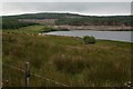
<< Our Photo Pages >> Loch Ciaran - Standing Stone (Menhir) in Scotland in Argyll
Submitted by petesx on Monday, 17 April 2017 Page Views: 4853
Neolithic and Bronze AgeSite Name: Loch CiaranCountry: Scotland
NOTE: This site is 3.871 km away from the location you searched for.
County: Argyll Type: Standing Stone (Menhir)
Map Ref: NR78035479 Landranger Map Number: 62
Latitude: 55.735485N Longitude: 5.537225W
Condition:
| 5 | Perfect |
| 4 | Almost Perfect |
| 3 | Reasonable but with some damage |
| 2 | Ruined but still recognisable as an ancient site |
| 1 | Pretty much destroyed, possibly visible as crop marks |
| 0 | No data. |
| -1 | Completely destroyed |
| 5 | Superb |
| 4 | Good |
| 3 | Ordinary |
| 2 | Not Good |
| 1 | Awful |
| 0 | No data. |
| 5 | Can be driven to, probably with disabled access |
| 4 | Short walk on a footpath |
| 3 | Requiring a bit more of a walk |
| 2 | A long walk |
| 1 | In the middle of nowhere, a nightmare to find |
| 0 | No data. |
| 5 | co-ordinates taken by GPS or official recorded co-ordinates |
| 4 | co-ordinates scaled from a detailed map |
| 3 | co-ordinates scaled from a bad map |
| 2 | co-ordinates of the nearest village |
| 1 | co-ordinates of the nearest town |
| 0 | no data |
Internal Links:
External Links:
I have visited· I would like to visit
petesx visited on 13th Apr 2017 - their rating: Cond: 3 Amb: 4 Access: 3
")
Kyntire
Canmore site no. 38949.
Page originally from 2001
You may be viewing yesterday's version of this page. To see the most up to date information please register for a free account.
")
Do not use the above information on other web sites or publications without permission of the contributor.
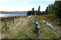
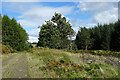
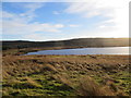
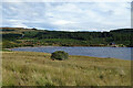
Nearby Images from Geograph Britain and Ireland:
©2021(licence)
©2021(licence)
©2013(licence)
©2021(licence)
©2008(licence)
The above images may not be of the site on this page, they are loaded from Geograph.
Please Submit an Image of this site or go out and take one for us!
Click here to see more info for this site
Nearby sites
Key: Red: member's photo, Blue: 3rd party photo, Yellow: other image, Green: no photo - please go there and take one, Grey: site destroyed
Download sites to:
KML (Google Earth)
GPX (GPS waypoints)
CSV (Garmin/Navman)
CSV (Excel)
To unlock full downloads you need to sign up as a Contributory Member. Otherwise downloads are limited to 50 sites.
![]()
Turn off the page maps and other distractions
Nearby sites listing. In the following links * = Image available
2.2km NW 305° Dun Skeig* Hillfort (NR76315612)
4.3km WSW 256° Correchrevie Cairn* Cairn (NR738540)
5.5km WSW 241° Ballochroy* Stone Row / Alignment (NR7309352426)
5.8km NNW 333° Ardpatrick* Standing Stone (Menhir) (NR757601)
6.6km N 350° Tobar Cill'An Aonghais* Holy Well or Sacred Spring (NR772613)
7.8km NNW 328° Carse Standing Stones East* Standing Stones (NR7424661640)
7.9km NNW 328° Carse Standing Stones West* Standing Stone (Menhir) (NR74146166)
9.2km ENE 65° Glenreasdale* Chambered Cairn (NR866583)
11.9km NW 320° Kilberry* Sculptured Stone (NR709643)
11.9km ENE 74° Skipness Rock Art (NR8967357519)
11.9km W 263° Cnoc nan Gobhar Stone* Standing Stone (Menhir) (NR6607454042)
12.4km W 260° Kinerarach (Gigha)* Standing Stone (Menhir) (NR6568453210)
12.7km WSW 256° Tarbert (Gigha)* Standing Stone (Menhir) (NR6554952292)
12.7km WSW 256° Old Wife's Grave, The (Gigha, Isle of) Cairn (NR655524)
12.9km SE 127° Tobar Chaluim Chille (Arran)* Holy Well or Sacred Spring (NR880465)
13.0km S 171° Brackley* Chambered Cairn (NR79374187)
13.7km NNE 26° Escart* Stone Row / Alignment (NR8464266794)
13.9km NNE 22° Avinagillan* Standing Stone (Menhir) (NR8390367461)
14.1km NW 326° Cretshengan* Standing Stone (Menhir) (NR70726689)
14.3km WSW 243° Ardminish Cist (NR64954890)
14.3km WSW 246° Druimyeonbeg (Isle of Gigha) Cairn (NR64634958)
14.4km ESE 105° Cnoc An Uird Standing Stone (Menhir) (NR91785046)
14.4km SW 214° Beacharra* Standing Stone (Menhir) (NR69264332)
14.9km NNW 329° Dun Cragach Stone Fort or Dun (NR71086805)
15.1km WSW 242° Cnoc na Croise (Gigha) Cairn (NR64394828)
View more nearby sites and additional images


 We would like to know more about this location. Please feel free to add a brief description and any relevant information in your own language.
 Wir möchten mehr über diese Stätte erfahren. Bitte zögern Sie nicht, eine kurze Beschreibung und relevante Informationen in Deutsch hinzuzufügen.
 Nous aimerions en savoir encore un peu sur les lieux. S'il vous plaît n'hesitez pas à ajouter une courte description et tous les renseignements pertinents dans votre propre langue.
 Quisieramos informarnos un poco más de las lugares. No dude en añadir una breve descripción y otros datos relevantes en su propio idioma.