


<< Our Photo Pages >> Ariogan Cairn - Cairn in Scotland in Argyll
Submitted by caradoc68 on Tuesday, 24 January 2012 Page Views: 2600
Neolithic and Bronze AgeSite Name: Ariogan CairnCountry: Scotland
NOTE: This site is 1.78 km away from the location you searched for.
County: Argyll Type: Cairn
Nearest Town: Oban
Map Ref: NM85602731
Latitude: 56.389278N Longitude: 5.474976W
Condition:
| 5 | Perfect |
| 4 | Almost Perfect |
| 3 | Reasonable but with some damage |
| 2 | Ruined but still recognisable as an ancient site |
| 1 | Pretty much destroyed, possibly visible as crop marks |
| 0 | No data. |
| -1 | Completely destroyed |
| 5 | Superb |
| 4 | Good |
| 3 | Ordinary |
| 2 | Not Good |
| 1 | Awful |
| 0 | No data. |
| 5 | Can be driven to, probably with disabled access |
| 4 | Short walk on a footpath |
| 3 | Requiring a bit more of a walk |
| 2 | A long walk |
| 1 | In the middle of nowhere, a nightmare to find |
| 0 | No data. |
| 5 | co-ordinates taken by GPS or official recorded co-ordinates |
| 4 | co-ordinates scaled from a detailed map |
| 3 | co-ordinates scaled from a bad map |
| 2 | co-ordinates of the nearest village |
| 1 | co-ordinates of the nearest town |
| 0 | no data |
Internal Links:
External Links:
")
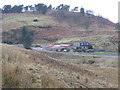
This irregularly-shaped stony mound appears to represent the remains of a prehistoric burial cairn. It measures about 6 metres across, stands to a height of 0.6 metres and has been severely disturbed by stone-robbing.
RCAHMS 1975, visited May 1967.
As described. It is apparently made of fairly large boulders and has been quarried in the centre and at the sides. There is one larger boulder, 0.5 by 0.6 metres on its south periphery, but no real evidence of a built kerb.
You may be viewing yesterday's version of this page. To see the most up to date information please register for a free account.
Do not use the above information on other web sites or publications without permission of the contributor.
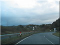
Nearby Images from Geograph Britain and Ireland:
©2006(licence)
©2006(licence)
©2010(licence)
©2010(licence)
©2017(licence)
The above images may not be of the site on this page, they are loaded from Geograph.
Please Submit an Image of this site or go out and take one for us!
Click here to see more info for this site
Nearby sites
Key: Red: member's photo, Blue: 3rd party photo, Yellow: other image, Green: no photo - please go there and take one, Grey: site destroyed
Download sites to:
KML (Google Earth)
GPX (GPS waypoints)
CSV (Garmin/Navman)
CSV (Excel)
To unlock full downloads you need to sign up as a Contributory Member. Otherwise downloads are limited to 50 sites.
Turn off the page maps and other distractions
Nearby sites listing. In the following links * = Image available
1.0km WSW 253° Glenshellach* Rock Art (NM8459027055)
2.4km E 99° Dalinaneun Farm Cairn 3 Cairn (NM880268)
2.4km E 99° Serpent Mound - Loch Nell* Artificial Mound (NM880268)
2.5km E 101° Dalineun* Chambered Tomb (NM8799326710)
2.5km E 86° Killiechonich* Rock Art (NM88082736)
2.7km ESE 109° Moleigh* Cairn (NM88082631)
2.8km ESE 113° Possible cairn at Kilmore* Cairn (NM88092609)
2.8km ESE 114° Cleigh* Misc. Earthwork (NM88112602)
2.8km ESE 115° Dalinaneun Farm Cairn 2* Cairn (NM881260)
2.8km E 101° Barnacarry* Crannog (NM88362662)
2.9km WSW 247° Dun Ormidale* Stone Fort or Dun (NM82902630)
3.1km N 3° Macarthur Cave, Oban* Cave or Rock Shelter (NM85923043)
3.1km SE 126° Cnoc Buidhe* Cairn (NM88032532)
3.2km SE 125° Kilmore Cairn* Cairn (NM88172533)
3.3km SSW 196° Dunan Molach Stone Fort or Dun (NM84522416)
3.4km SE 126° Kilmore House* Cairn (NM88292515)
3.5km WSW 245° Dun Gallanach* Stone Fort or Dun (NM823260)
3.7km N 352° Oban cup marked stone* Rock Art (NM85243097)
3.9km ENE 71° Skull Shaped Stone - Loch Nell* Natural Stone / Erratic / Other Natural Feature (NM8939628383)
4.2km WNW 300° Sidhean Riabhach* Cist (NM82092959)
4.2km N 352° Dunollie Stone Fort or Dun (NM85223148)
4.2km NNE 16° Pennyfuir Cairn Cairn (NM86993128)
4.3km ENE 77° Rubha Na Moine* Crannog (NM89812807)
4.5km NW 304° Slatrach Cairn Cairn (NM82043002)
5.3km ESE 122° Dalnacabaig* Cairn (NM90002429)
View more nearby sites and additional images


 We would like to know more about this location. Please feel free to add a brief description and any relevant information in your own language.
 Wir möchten mehr über diese Stätte erfahren. Bitte zögern Sie nicht, eine kurze Beschreibung und relevante Informationen in Deutsch hinzuzufügen.
 Nous aimerions en savoir encore un peu sur les lieux. S'il vous plaît n'hesitez pas à ajouter une courte description et tous les renseignements pertinents dans votre propre langue.
 Quisieramos informarnos un poco más de las lugares. No dude en añadir una breve descripción y otros datos relevantes en su propio idioma.