

<< Our Photo Pages >> Chinchilla - Ancient Village or Settlement in Spain in Andalucía
Submitted by Maatje on Tuesday, 27 February 2024 Page Views: 54
Multi-periodSite Name: Chinchilla Alternative Name: Espacio de biodiversidad, histórico y culturalCountry: Spain
NOTE: This site is 12.572 km away from the location you searched for.
Region: Andalucía Type: Ancient Village or Settlement
Nearest Town: Ronda Nearest Village: Jimena de la Frontera
Latitude: 36.429480N Longitude: 5.45918W
Condition:
| 5 | Perfect |
| 4 | Almost Perfect |
| 3 | Reasonable but with some damage |
| 2 | Ruined but still recognisable as an ancient site |
| 1 | Pretty much destroyed, possibly visible as crop marks |
| 0 | No data. |
| -1 | Completely destroyed |
| 5 | Superb |
| 4 | Good |
| 3 | Ordinary |
| 2 | Not Good |
| 1 | Awful |
| 0 | No data. |
| 5 | Can be driven to, probably with disabled access |
| 4 | Short walk on a footpath |
| 3 | Requiring a bit more of a walk |
| 2 | A long walk |
| 1 | In the middle of nowhere, a nightmare to find |
| 0 | No data. |
| 5 | co-ordinates taken by GPS or official recorded co-ordinates |
| 4 | co-ordinates scaled from a detailed map |
| 3 | co-ordinates scaled from a bad map |
| 2 | co-ordinates of the nearest village |
| 1 | co-ordinates of the nearest town |
| 0 | no data |
Internal Links:
External Links:
")
You can walk or bike the gravelroad along the Hozgarganta River to the signposted Fábrica de Bombas. This ancient Artillery Factory (1779) has a 700 meter long canal. Almost at the end of it is this wonderfull Chinchilla Place. You can walk in through the gates and wander around.
This hillside has been inhabited since for thousand of years.
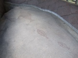
There are 2 caves with rockpainting - unfortunately not signposted, Chinchilla 1 and 2.
Since then it was inhabited by Iberians, Phoenicians, Greeks, Carthaginians, Romans, Visigoths, Muslims and untill the middleages.
The roman city was named Oba.
In the place we can find cave paintings that can belong to the so called 'southern art' with schematic drawings in which a hunting scene with a hunter-archer and a deer are represented. The architectural remains of past cultures are innumerable, old stone walls, stones carved with square holes, a limekiln, wineries or commenly known as Tajo de la Reina Mora, which could be a Mozarabic church, due to the niches that appear carved in the rock as sacred relics.
We could not find both the caves, they seem to be pretty high where the rockcolour is yellow. Even on internet it was kept a secret location.
But the place appeals to your imagination, the stones with marks of water, the old brick walls, the carved squares and the riverside location on this side of the mountain.
You may be viewing yesterday's version of this page. To see the most up to date information please register for a free account.
")
")
")
")
")
Do not use the above information on other web sites or publications without permission of the contributor.
Click here to see more info for this site
Nearby sites
Click here to view sites on an interactive map of the areaKey: Red: member's photo, Blue: 3rd party photo, Yellow: other image, Green: no photo - please go there and take one, Grey: site destroyed
Download sites to:
KML (Google Earth)
GPX (GPS waypoints)
CSV (Garmin/Navman)
CSV (Excel)
To unlock full downloads you need to sign up as a Contributory Member. Otherwise downloads are limited to 50 sites.
Turn off the page maps and other distractions
Nearby sites listing. In the following links * = Image available
569m NE 36° Castillo de Jimena de la Frontera* Hillfort
13.9km E 84° Ruinas Romanas de Lacipo* Ancient Village or Settlement
20.6km SE 136° Yacimiento Arqueológico Barbesula Ancient Village or Settlement
22.6km E 85° Necrópolis Prehistórica de Corominas* Museum
27.5km S 171° Carteia* Ancient Village or Settlement
27.6km WSW 243° Cueva Tajo de Las Figuras Cave or Rock Shelter
28.1km N 3° Calzada Ubrique-Benaocaz* Ancient Trackway
28.6km N 2° Ciudad Palatina Ocuri Ancient Village or Settlement
33.7km NNE 30° La Pileta* Cave or Rock Shelter
33.8km NE 40° Dólmen del Cortijo de la Mimbre Burial Chamber or Dolmen
34.8km NE 39° Dólmen de Monteiro* Burial Chamber or Dolmen
35.3km E 86° Villa Romana de las Torres* Ancient Village or Settlement
35.8km NE 39° Dolmen del puerto de Encinas Borrachas* Burial Chamber or Dolmen
35.8km NE 39° Encinas Boracchas* Burial Chamber or Dolmen
37.6km NNE 13° Caldaza Medieval Trackway* Ancient Trackway
38.6km SSW 213° Menhir de Tribucio Standing Stone (Menhir)
39.1km SSW 214° Dolmen del Bujeo* Burial Chamber or Dolmen
42.8km NNE 23° Ronda Dolmen* Burial Chamber or Dolmen
43.4km NE 37° Water Mine / Fortress Ronda* Ancient Mine, Quarry or other Industry
43.6km NNW 338° Menhir de La Lancha* Standing Stone (Menhir)
43.7km SW 219° Silla del Papa* Hillfort
44.9km SSW 209° Los Algarbes* Rock Cut Tomb
45.8km NNW 340° Alberite Dolmen* Chambered Tomb
47.1km SW 217° Baelo Claudia* Ancient Village or Settlement
47.2km SW 219° Cueva del Moro (Tarifa) Cave or Rock Shelter
View more nearby sites and additional images


 We would like to know more about this location. Please feel free to add a brief description and any relevant information in your own language.
 Wir möchten mehr über diese Stätte erfahren. Bitte zögern Sie nicht, eine kurze Beschreibung und relevante Informationen in Deutsch hinzuzufügen.
 Nous aimerions en savoir encore un peu sur les lieux. S'il vous plaît n'hesitez pas à ajouter une courte description et tous les renseignements pertinents dans votre propre langue.
 Quisieramos informarnos un poco más de las lugares. No dude en añadir una breve descripción y otros datos relevantes en su propio idioma.