


<< Our Photo Pages >> Juego de los Bolos - Cairn in Spain in Castilla y León
Submitted by h_fenton on Tuesday, 04 March 2008 Page Views: 4949
Neolithic and Bronze AgeSite Name: Juego de los BolosCountry: Spain
NOTE: This site is 21.854 km away from the location you searched for.
Region: Castilla y León Type: Cairn
Nearest Village: Hoyos del Espino
Latitude: 40.305240N Longitude: 5.188278W
Condition:
| 5 | Perfect |
| 4 | Almost Perfect |
| 3 | Reasonable but with some damage |
| 2 | Ruined but still recognisable as an ancient site |
| 1 | Pretty much destroyed, possibly visible as crop marks |
| 0 | No data. |
| -1 | Completely destroyed |
| 5 | Superb |
| 4 | Good |
| 3 | Ordinary |
| 2 | Not Good |
| 1 | Awful |
| 0 | No data. |
| 5 | Can be driven to, probably with disabled access |
| 4 | Short walk on a footpath |
| 3 | Requiring a bit more of a walk |
| 2 | A long walk |
| 1 | In the middle of nowhere, a nightmare to find |
| 0 | No data. |
| 5 | co-ordinates taken by GPS or official recorded co-ordinates |
| 4 | co-ordinates scaled from a detailed map |
| 3 | co-ordinates scaled from a bad map |
| 2 | co-ordinates of the nearest village |
| 1 | co-ordinates of the nearest town |
| 0 | no data |
Internal Links:
External Links:
I have visited· I would like to visit
h_fenton has visited here
")
Near to Km6 on the AV-931Hoyos del Espino - Plataforma road
You may be viewing yesterday's version of this page. To see the most up to date information please register for a free account.
")
")
")
Do not use the above information on other web sites or publications without permission of the contributor.
Nearby Images from Flickr
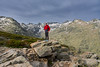
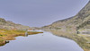
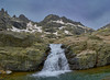
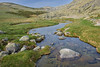
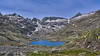

The above images may not be of the site on this page, but were taken nearby. They are loaded from Flickr so please click on them for image credits.
Click here to see more info for this site
Nearby sites
Click here to view sites on an interactive map of the areaKey: Red: member's photo, Blue: 3rd party photo, Yellow: other image, Green: no photo - please go there and take one, Grey: site destroyed
Download sites to:
KML (Google Earth)
GPX (GPS waypoints)
CSV (Garmin/Navman)
CSV (Excel)
To unlock full downloads you need to sign up as a Contributory Member. Otherwise downloads are limited to 50 sites.
Turn off the page maps and other distractions
Nearby sites listing. In the following links * = Image available
19.8km SW 227° El Raso de Candeleda Castro or Chafurdão
32.6km SW 230° Vega del Nino Burial Chamber or Dolmen
32.7km SW 230° Cruz del Pobre Burial Chamber or Dolmen
34.8km SW 234° Cerro del Tejar Burial Chamber or Dolmen
35.8km NE 46° Ulaca* Castro or Chafurdão
38.1km NNE 18° Necrópolis Medieval de La Coba Ancient Village or Settlement
40.7km WSW 239° Losar de la Vera Burial Chamber or Dolmen
46.7km NW 310° El Teriñuelo Passage Grave
47.6km NW 311° Dehesa de Aldeavieja Castro or Chafurdão
49.8km NNE 23° Castro de la Mesa de Miranda* Castro or Chafurdão
50.5km NW 309° Cabezuela de Salvatierra Round Barrow(s)
51.4km SW 223° Cerro del Puchero Burial Chamber or Dolmen
51.4km SW 223° Las Lomas Burial Chamber or Dolmen
53.7km WSW 256° Dolmen de Cabezuela Burial Chamber or Dolmen
55.3km WSW 240° El Canchal 9 Burial Chamber or Dolmen
55.4km WSW 239° El Canchal 5 Burial Chamber or Dolmen
55.4km WSW 240° El Canchal 10 Burial Chamber or Dolmen
55.5km WSW 240° El Canchal 6 Burial Chamber or Dolmen
55.5km WSW 240° El Canchal 11 Burial Chamber or Dolmen
55.5km WSW 239° El Canchal 13 Burial Chamber or Dolmen
55.5km WSW 239° El Canchal 2 Burial Chamber or Dolmen
55.5km WSW 240° El Canchal 7 Burial Chamber or Dolmen
55.6km WSW 240° El Canchal 12 Burial Chamber or Dolmen
55.6km WSW 239° El Canchal 17 Burial Chamber or Dolmen
55.6km WSW 239° El Canchal 14 Burial Chamber or Dolmen
View more nearby sites and additional images


 We would like to know more about this location. Please feel free to add a brief description and any relevant information in your own language.
 Wir möchten mehr über diese Stätte erfahren. Bitte zögern Sie nicht, eine kurze Beschreibung und relevante Informationen in Deutsch hinzuzufügen.
 Nous aimerions en savoir encore un peu sur les lieux. S'il vous plaît n'hesitez pas à ajouter une courte description et tous les renseignements pertinents dans votre propre langue.
 Quisieramos informarnos un poco más de las lugares. No dude en añadir una breve descripción y otros datos relevantes en su propio idioma.