


<< Text Pages >> Cnoc An Uird - Standing Stone (Menhir) in Scotland in Isle of Arran
Submitted by Andy B on Tuesday, 16 August 2016 Page Views: 1097
Neolithic and Bronze AgeSite Name: Cnoc An UirdCountry: Scotland County: Isle of Arran Type: Standing Stone (Menhir)
Map Ref: NR91785046
Latitude: 55.702751N Longitude: 5.315338W
Condition:
| 5 | Perfect |
| 4 | Almost Perfect |
| 3 | Reasonable but with some damage |
| 2 | Ruined but still recognisable as an ancient site |
| 1 | Pretty much destroyed, possibly visible as crop marks |
| 0 | No data. |
| -1 | Completely destroyed |
| 5 | Superb |
| 4 | Good |
| 3 | Ordinary |
| 2 | Not Good |
| 1 | Awful |
| 0 | No data. |
| 5 | Can be driven to, probably with disabled access |
| 4 | Short walk on a footpath |
| 3 | Requiring a bit more of a walk |
| 2 | A long walk |
| 1 | In the middle of nowhere, a nightmare to find |
| 0 | No data. |
| 5 | co-ordinates taken by GPS or official recorded co-ordinates |
| 4 | co-ordinates scaled from a detailed map |
| 3 | co-ordinates scaled from a bad map |
| 2 | co-ordinates of the nearest village |
| 1 | co-ordinates of the nearest town |
| 0 | no data |
Be the first person to rate this site - see the 'Contribute!' box in the right hand menu.
Internal Links:
External Links:
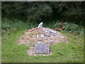
Standing Stone - Almost square in section with a flat top steeply splayed to one edge. It is 0.75m high on that side, its tallest and 0.60m high on the opposite side, its lowest.
Also: Possible Fallen Stone - A large slab 2.0m by 1.0m and 0.30m thick lying toppled with the suggestion of a socket hole from which it may have fallen.
Stone Setting and Field (Feature 4). Some 20m to the northwest of the cairn is a slightly sunken grassy area 40m long by 15m wide. A shape outlined in stones, is situated at the northwest end of the 'field'.
Cairn - Almost circular in plan being 7.0m from north to south but smaller at 6.0m from east to west.
More details at Canmore
You may be viewing yesterday's version of this page. To see the most up to date information please register for a free account.
Do not use the above information on other web sites or publications without permission of the contributor.
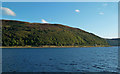
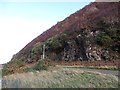
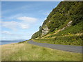
Nearby Images from Geograph Britain and Ireland:
©2017(licence)

©2018(licence)
©2011(licence)
©2005(licence)
©2005(licence)
The above images may not be of the site on this page, they are loaded from Geograph.
Please Submit an Image of this site or go out and take one for us!
Click here to see more info for this site
Nearby sites
Key: Red: member's photo, Blue: 3rd party photo, Yellow: other image, Green: no photo - please go there and take one, Grey: site destroyed
Download sites to:
KML (Google Earth)
GPX (GPS waypoints)
CSV (Garmin/Navman)
CSV (Excel)
To unlock full downloads you need to sign up as a Contributory Member. Otherwise downloads are limited to 50 sites.
Turn off the page maps and other distractions
Nearby sites listing. In the following links * = Image available
1.0km E 97° Torr An T' Sean Chaisteal Stone Fort or Dun (NR92775029)
1.7km SSE 166° Madadh Lounie Standing Stones (NR921488)
2.0km E 84° Lochranza Golf Course Standing Stone* Standing Stone (Menhir) (NR93795058)
5.5km SW 221° Tobar Chaluim Chille (Arran)* Holy Well or Sacred Spring (NR880465)
7.3km ESE 110° Allt Lon Na Cuilc Marker Stone (NR98524766)
7.4km NNW 341° Skipness Rock Art (NR8967357519)
8.9km ESE 110° Allt Carn Bhain Chambered Cairn (NR99994707)
9.4km NW 324° Glenreasdale* Chambered Cairn (NR866583)
10.0km ESE 109° North Sannox Farm* Chambered Cairn (NS01114676)
10.4km ESE 109° North Sannox Chambered Cairn* Chambered Cairn (NS01424659)
10.4km SSW 194° Lean An Tubhaidh Standing Stone (Menhir) (NR88724049)
10.7km ESE 113° Mid Sannox Standing Stone* Standing Stone (Menhir) (NS0143345782)
10.8km ESE 118° South Sannox* Stone Circle (NS0106044907)
10.9km ESE 114° Sannox Cist* Cist (NS015455)
11.0km ESE 114° Sannox Bay Standing Stone* Standing Stone (Menhir) (NS01644558)
11.4km ESE 117° Sannox Chambered Cairn Chambered Cairn (NS017448)
11.9km SE 124° Corrie possible Four-Poster Stone Circle (NS01404334)
14.4km WNW 285° Loch Ciaran* Standing Stone (Menhir) (NR78035479)
14.4km S 188° Auchencar* Standing Stones (NR89053633)
14.8km NE 41° Inchmarnock Cists Cist (NS0199361233)
15.1km SW 233° Brackley* Chambered Cairn (NR79374187)
15.3km SSE 169° Moinechoill* Chambered Cairn (NR941353)
15.3km S 169° Monyquil* Standing Stones (NR9405735284)
15.4km S 181° Machrie Burn* Stone Circle (NR90843511)
15.7km SE 143° Glen Shiel* Stone Row / Alignment (NS0061337447)
View more nearby sites and additional images


 We would like to know more about this location. Please feel free to add a brief description and any relevant information in your own language.
 Wir möchten mehr über diese Stätte erfahren. Bitte zögern Sie nicht, eine kurze Beschreibung und relevante Informationen in Deutsch hinzuzufügen.
 Nous aimerions en savoir encore un peu sur les lieux. S'il vous plaît n'hesitez pas à ajouter une courte description et tous les renseignements pertinents dans votre propre langue.
 Quisieramos informarnos un poco más de las lugares. No dude en añadir una breve descripción y otros datos relevantes en su propio idioma.