


<< Our Photo Pages >> Faddoch - Rock Art in Scotland in Highlands
Submitted by uisdean on Saturday, 12 May 2007 Page Views: 4741
Rock ArtSite Name: FaddochCountry: Scotland
NOTE: This site is 13.39 km away from the location you searched for.
County: Highlands Type: Rock Art
Nearest Village: Killilan
Map Ref: NG95452863
Latitude: 57.302283N Longitude: 5.397139W
Condition:
| 5 | Perfect |
| 4 | Almost Perfect |
| 3 | Reasonable but with some damage |
| 2 | Ruined but still recognisable as an ancient site |
| 1 | Pretty much destroyed, possibly visible as crop marks |
| 0 | No data. |
| -1 | Completely destroyed |
| 5 | Superb |
| 4 | Good |
| 3 | Ordinary |
| 2 | Not Good |
| 1 | Awful |
| 0 | No data. |
| 5 | Can be driven to, probably with disabled access |
| 4 | Short walk on a footpath |
| 3 | Requiring a bit more of a walk |
| 2 | A long walk |
| 1 | In the middle of nowhere, a nightmare to find |
| 0 | No data. |
| 5 | co-ordinates taken by GPS or official recorded co-ordinates |
| 4 | co-ordinates scaled from a detailed map |
| 3 | co-ordinates scaled from a bad map |
| 2 | co-ordinates of the nearest village |
| 1 | co-ordinates of the nearest town |
| 0 | no data |
Internal Links:
External Links:
")
Cup marked boulder on a rise above the clachan of Faddoch. The boulder is lozenge shaped, some 8 feet by 6 feet 6 inches, with its main cup marked surface facing SE. There are about twenty shallow cup-marks, some conjoined, of 2 to 2 ½ inches in diameter. The boulder contains a considerable amount of quartz; this apparently inhibited the drilling of the cups, accounting for their exceptional shallowness.
The boulder is at an elevation of 112 feet on the highest point of a slope which rises steeply from the track at Faddoch to the east and falls gently in the other directions. The boulder at Camas Luinie is visible from that at Faddoch at an azimuth of 292°.
The site was noted by Thomas Wallace in 1897 (Wallace, T (1897) 'Notes of Antiquities in Loch Alsh and Kintail', Proc Soc Antiq Scot, 31, 1896-7, p 87), who commented ‘In Glen Elchaig, at the head of Loch Long, there is one large boulder at Fadoch and another at Camus-liune (sic), on the opposite side of the river, covered with cups of the usual size and character, but no rings’. The OS failed to find the Faddoch boulder in 1966, commenting that ‘enquiries at Killilan and Faddoch proved negative’; apparently they did not undertake a ground survey (see Canmore NG92NE 1).
Tiompan, a contributor to the British Rock Art Collection, located the site in April 2007; and I tracked it down with the help of his photographs and advice from one of the estate workers.
You may be viewing yesterday's version of this page. To see the most up to date information please register for a free account.
")
")
")
Do not use the above information on other web sites or publications without permission of the contributor.
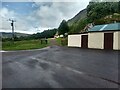
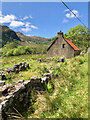
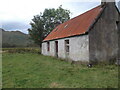
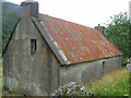
Nearby Images from Geograph Britain and Ireland:
©2021(licence)
©2023(licence)
©2022(licence)
©2007(licence)
©2021(licence)
The above images may not be of the site on this page, they are loaded from Geograph.
Please Submit an Image of this site or go out and take one for us!
Click here to see more info for this site
Nearby sites
Key: Red: member's photo, Blue: 3rd party photo, Yellow: other image, Green: no photo - please go there and take one, Grey: site destroyed
Download sites to:
KML (Google Earth)
GPX (GPS waypoints)
CSV (Garmin/Navman)
CSV (Excel)
To unlock full downloads you need to sign up as a Contributory Member. Otherwise downloads are limited to 50 sites.
Turn off the page maps and other distractions
Nearby sites listing. In the following links * = Image available
1.1km WNW 293° Camas Luinie* Rock Art (NG94492909)
5.7km W 260° Bard's Castle* Hillfort (NG89822790)
7.0km SW 231° Carr Brae* Rock Art (NG89782451)
7.0km SSE 166° Lienassie* Rock Art (NG968217)
7.2km S 179° Croe Bridge* Rock Art (NG95162141)
7.5km S 185° Tigh Geal* Rock Art (NG94452120)
7.9km S 188° Diarmaid's Grave* Standing Stones (NG93992085)
8.0km S 188° Dunan Diarmaid* Hillfort (NG93952071)
8.6km WSW 245° Totaig Cup Markings* Rock Art (NG87432536)
8.7km SW 226° Allt an Inbhir Souterrain* Souterrain (Fogou, Earth House) (NG88882296)
9.1km SW 229° Torran a'Bharraich* Hillfort (NG88312296)
9.2km WSW 246° Dun Totaig (Loch Duich) Broch or Nuraghe (NG868253)
9.4km WSW 245° Caisteal Grugaig* Broch or Nuraghe (NG86692508)
9.9km S 186° Cill Fhearchair* Standing Stone (Menhir) (NG93871879)
10.2km S 191° Sheil Henge* Henge (NG93081868)
10.4km W 272° Gleann Udalain Cairn Cairn (NG85092942)
10.4km W 262° Dun Gleann Udalain Stone Fort or Dun (NG85062773)
12.3km W 262° Angels' Hill, Kirkton* Hillfort (NG83142745)
12.4km W 261° Lochalsh* Stone Circle (NG831274)
12.7km W 263° Dun Kirkton Stone Fort or Dun (NG82722768)
13.5km SW 229° Serpent Mound (Scallasaig) Cairn (NG8484020288)
13.6km S 182° Sheil Bridge* Ancient Village or Settlement (NG9438215035)
13.8km W 279° Carn na Sean-chreige* Hillfort (NG81893146)
14.4km W 276° Loch Achaidh na h-Inich* Crannog (NG81173095)
15.0km E 82° Glen Cannich hut circles Ancient Village or Settlement (NH104301)
View more nearby sites and additional images


 We would like to know more about this location. Please feel free to add a brief description and any relevant information in your own language.
 Wir möchten mehr über diese Stätte erfahren. Bitte zögern Sie nicht, eine kurze Beschreibung und relevante Informationen in Deutsch hinzuzufügen.
 Nous aimerions en savoir encore un peu sur les lieux. S'il vous plaît n'hesitez pas à ajouter une courte description et tous les renseignements pertinents dans votre propre langue.
 Quisieramos informarnos un poco más de las lugares. No dude en añadir una breve descripción y otros datos relevantes en su propio idioma.