


<< Text Pages >> Dun Chathach (Connel) - Hillfort in Scotland in Argyll
Submitted by Anne T on Tuesday, 15 August 2017 Page Views: 1052
Iron Age and Later PrehistorySite Name: Dun Chathach (Connel) Alternative Name: Dun Cathich; AchnacloichCountry: Scotland
NOTE: This site is 1.773 km away from the location you searched for.
County: Argyll Type: Hillfort
Nearest Town: Oban Nearest Village: Achnacloich
Map Ref: NM96743401
Latitude: 56.454293N Longitude: 5.300055W
Condition:
| 5 | Perfect |
| 4 | Almost Perfect |
| 3 | Reasonable but with some damage |
| 2 | Ruined but still recognisable as an ancient site |
| 1 | Pretty much destroyed, possibly visible as crop marks |
| 0 | No data. |
| -1 | Completely destroyed |
| 5 | Superb |
| 4 | Good |
| 3 | Ordinary |
| 2 | Not Good |
| 1 | Awful |
| 0 | No data. |
| 5 | Can be driven to, probably with disabled access |
| 4 | Short walk on a footpath |
| 3 | Requiring a bit more of a walk |
| 2 | A long walk |
| 1 | In the middle of nowhere, a nightmare to find |
| 0 | No data. |
| 5 | co-ordinates taken by GPS or official recorded co-ordinates |
| 4 | co-ordinates scaled from a detailed map |
| 3 | co-ordinates scaled from a bad map |
| 2 | co-ordinates of the nearest village |
| 1 | co-ordinates of the nearest town |
| 0 | no data |
Be the first person to rate this site - see the 'Contribute!' box in the right hand menu.
Internal Links:
External Links:
Hillfort in Argyll
This dun, on the southern shore of Loch Etive, is recorded as Canmore ID 23261, which says: "This dun occupies the summit of a prominent hill. The approach from the SE is over gently undulating terrain but on the NW, the ground falls steeply down to the shore 50 metres below. The dun is circular on plan and measures 18.3 metres in diameter overall. The wall, which has been about 3.4 metres in average thickness is now reduced to a low grass-grown stony bank but considerable stretches of the outer face are still visible in situ. Many of the facing stones, which lie as much as 1.6 metres below the level of the summit, are of massive proportions. Three gaps in the wall are visible, in the NE, E and SW, but it is not certain which of these indicates the site of the original entrance. The interior is occupied by the foundations of a roughly circular enclosure of recent date, which has encroached upon the inner face of the dun wall."
The Northern Antiquarian (TNA) also feature this site - see their page Dun Chathach, Connel, Argyll, which contains directions for finding the site together with an 1885 drawing, a brief archaeology & history and local folklore: "Legend has it that this was a hill of battles. It was also said by R. Angus Smith (1885) to “have been used as one of a chain of beacons,” with the next fire on being lit upon a small hill nearer Connel called Tom na h-aire, ‘the mound of watching.’"
Note: Have you visited this site? Do you have any photographs or further information you can add?
You may be viewing yesterday's version of this page. To see the most up to date information please register for a free account.
Do not use the above information on other web sites or publications without permission of the contributor.
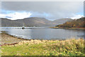
Nearby Images from Geograph Britain and Ireland:
©2006(licence)
©2014(licence)
©2011(licence)
©2014(licence)
©2012(licence)
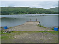
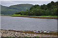
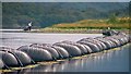
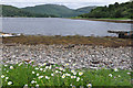
The above images may not be of the site on this page, they are loaded from Geograph.
Please Submit an Image of this site or go out and take one for us!
Click here to see more info for this site
Nearby sites
Key: Red: member's photo, Blue: 3rd party photo, Yellow: other image, Green: no photo - please go there and take one, Grey: site destroyed
Download sites to:
KML (Google Earth)
GPX (GPS waypoints)
CSV (Garmin/Navman)
CSV (Excel)
To unlock full downloads you need to sign up as a Contributory Member. Otherwise downloads are limited to 50 sites.
Turn off the page maps and other distractions
Nearby sites listing. In the following links * = Image available
958m NNE 19° Ardchattan Priory* Sculptured Stone (NM971349)
3.1km NW 311° Achnaba A* Cairn (NM94453616)
3.1km NW 313° Achnaba B* Cairn (NM94533626)
3.2km NW 315° Achnaba E* Cairn (NM94593639)
3.4km NW 310° Achnaba D* Cairn (NM94283631)
3.5km NW 308° Achnaba C* Cairn (NM94093630)
4.5km WNW 299° Achnacreebeag* Chambered Cairn (NM92963639)
4.8km SE 125° Nelson's monument, Taynuilt* Standing Stone (Menhir) (NN00513109)
5.0km W 268° Connel Station (Oban) Standing Stone (Menhir) (NM91693408)
5.1km WNW 294° Achnacree Cairn* Round Cairn (NM922363)
5.2km WNW 293° Dalvule* Cairn (NM92043626)
5.3km ESE 120° Taynault (Lorn)* Standing Stone (Menhir) (NN01203115)
5.3km ESE 105° Dun Leigh* Stone Fort or Dun (NN01813243)
5.8km W 274° North Connel Barrow* Round Barrow(s) (NM90923471)
5.9km WSW 239° Kilvaree standing stone* Standing Stone (Menhir) (NM91553124)
6.0km SE 128° Dun Mhuirageul* Stone Fort or Dun (NN01323008)
6.6km SSW 202° Clachadow* Cairn (NM93932806)
6.8km SSW 212° Glenamacrie Dun* Stone Fort or Dun (NM92862836)
6.9km SW 215° Clenamacrie Stone Row* Stone Row / Alignment (NM9251128550)
6.9km SW 215° Glenamacrie Farm* Cairn (NM92452854)
7.0km SW 218° Glenamachrie Cairn* Cairn (NM92132870)
7.1km NNW 338° Achacha standing stone* Standing Stone (Menhir) (NM94444075)
7.1km NNW 338° Achacha Cairn* Cairn (NM94364076)
7.6km WNW 299° Benderloch Standing Stone* Standing Stone (Menhir) (NM903380)
7.6km WNW 304° Benderloch Stone Circle* Stone Circle (NM90613853)
View more nearby sites and additional images


 We would like to know more about this location. Please feel free to add a brief description and any relevant information in your own language.
 Wir möchten mehr über diese Stätte erfahren. Bitte zögern Sie nicht, eine kurze Beschreibung und relevante Informationen in Deutsch hinzuzufügen.
 Nous aimerions en savoir encore un peu sur les lieux. S'il vous plaît n'hesitez pas à ajouter une courte description et tous les renseignements pertinents dans votre propre langue.
 Quisieramos informarnos un poco más de las lugares. No dude en añadir una breve descripción y otros datos relevantes en su propio idioma.