


<< Our Photo Pages >> Rubna na Fidhle - Class III Pictish Cross Slab in Scotland in Argyll
Submitted by h_fenton on Sunday, 03 June 2007 Page Views: 4689
Early Medieval (Dark Age)Site Name: Rubna na FidhleCountry: Scotland
NOTE: This site is 1.742 km away from the location you searched for.
County: Argyll Type: Class III Pictish Cross Slab
Map Ref: NM9377607789
Latitude: 56.217832N Longitude: 5.32751W
Condition:
| 5 | Perfect |
| 4 | Almost Perfect |
| 3 | Reasonable but with some damage |
| 2 | Ruined but still recognisable as an ancient site |
| 1 | Pretty much destroyed, possibly visible as crop marks |
| 0 | No data. |
| -1 | Completely destroyed |
| 5 | Superb |
| 4 | Good |
| 3 | Ordinary |
| 2 | Not Good |
| 1 | Awful |
| 0 | No data. |
| 5 | Can be driven to, probably with disabled access |
| 4 | Short walk on a footpath |
| 3 | Requiring a bit more of a walk |
| 2 | A long walk |
| 1 | In the middle of nowhere, a nightmare to find |
| 0 | No data. |
| 5 | co-ordinates taken by GPS or official recorded co-ordinates |
| 4 | co-ordinates scaled from a detailed map |
| 3 | co-ordinates scaled from a bad map |
| 2 | co-ordinates of the nearest village |
| 1 | co-ordinates of the nearest town |
| 0 | no data |
Be the first person to rate this site - see the 'Contribute!' box in the right hand menu.
Internal Links:
External Links:
I have visited· I would like to visit
h_fenton has visited here
")
Rubha na Fidhle, Chapel, Settlement and Rock Carvings - Historic Scotland Ref: 0288
The monument known as Rubha na Fidhle, chapel, settlement and rock carvings, Loch Awe comprises the site of an early Christian settlement on the headland called Rubha na Fidhle, on the NW shore of Loch Awe. The scheduled area includes the entire promontory and 10m of the loch bed on all sides. (taken from entry in RCHMS schedule of monuments)
Only one simple incised cross visible on the site which is incised into the natural bedrock, no visible signs of a chapel or settlement on the promontory
The area is overgrown with trees, small bushes, grass and moss. the incised cross is on the only piece of exposed bedrock, other crosses may be present but obscured by vegetation
Ten figure grid reference of incised cross (taken from GPS): NM 93776 07789
You may be viewing yesterday's version of this page. To see the most up to date information please register for a free account.
")
Do not use the above information on other web sites or publications without permission of the contributor.
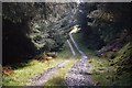
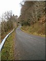
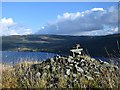
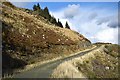
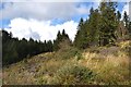
Nearby Images from Geograph Britain and Ireland:
©2014(licence)
©2006(licence)
©2014(licence)
©2014(licence)
©2014(licence)
The above images may not be of the site on this page, they are loaded from Geograph.
Please Submit an Image of this site or go out and take one for us!
Click here to see more info for this site
Nearby sites
Key: Red: member's photo, Blue: 3rd party photo, Yellow: other image, Green: no photo - please go there and take one, Grey: site destroyed
Download sites to:
KML (Google Earth)
GPX (GPS waypoints)
CSV (Garmin/Navman)
CSV (Excel)
To unlock full downloads you need to sign up as a Contributory Member. Otherwise downloads are limited to 50 sites.
Turn off the page maps and other distractions
Nearby sites listing. In the following links * = Image available
5.5km WSW 239° Inverliever Cairn (NM889052)
5.7km SW 236° Loch Awe (South) Crannog (NM889048)
6.0km NE 40° Innis Chonnel Crannog* Crannog (NM97841220)
6.4km WSW 239° Dun Toiseach (Kilmartin) Stone Fort or Dun (NM88080475)
6.5km WSW 241° Torran Standing Stone* Standing Stone (Menhir) (NM8790104877)
6.6km WSW 239° Torran Cup-marked rock* Rock Art (NM87960461)
7.4km NE 45° Ardchonnell* Chambered Cairn (NM99321275)
7.9km WSW 245° Dun Dubh Stone Fort or Dun (NM864048)
8.1km SW 236° Ford Cist* Cist (NM86890356)
8.4km SW 235° Ford Stone (Kilmartin)* Standing Stone (Menhir) (NM8668103317)
8.6km WSW 254° Tur A' Bhodaich Stone Fort or Dun (NM854059)
8.8km SW 230° Loch Ederline* Crannog (NM867025)
9.0km NW 317° Dun Toiseach Stone Fort or Dun (NM880147)
9.3km WSW 241° Dun Chonallaich* Stone Fort or Dun (NM85440365)
9.7km W 266° Sluggan Standing Stone* Standing Stone (Menhir) (NM8404207571)
9.8km W 267° Sluggan Cairn* Cairn (NM83940768)
9.8km SW 234° Creag A Chapuill* Stone Fort or Dun (NM855024)
10.0km SW 229° Creagantairbh Beag* Standing Stone (Menhir) (NM85950156)
10.1km WSW 238° Dun Na Nighinn Stone Fort or Dun (NM84910282)
10.4km W 263° Dunan Aula* Cist (NM83420697)
10.4km ESE 109° Creag Mhor Chambered Cairn (NN03450395)
10.4km WSW 246° Salachary* Stone Row / Alignment (NM8405604024)
10.4km SW 228° Glennan Standing Stone* Standing Stone (Menhir) (NM85730112)
10.4km WSW 251° Dun Na Ban-Oige* Stone Fort or Dun (NM837049)
10.5km SW 228° Creagantairbh Beag Cairns* Cairn (NM85670108)
View more nearby sites and additional images


 We would like to know more about this location. Please feel free to add a brief description and any relevant information in your own language.
 Wir möchten mehr über diese Stätte erfahren. Bitte zögern Sie nicht, eine kurze Beschreibung und relevante Informationen in Deutsch hinzuzufügen.
 Nous aimerions en savoir encore un peu sur les lieux. S'il vous plaît n'hesitez pas à ajouter une courte description et tous les renseignements pertinents dans votre propre langue.
 Quisieramos informarnos un poco más de las lugares. No dude en añadir una breve descripción y otros datos relevantes en su propio idioma.