


<< Our Photo Pages >> Lienassie - Rock Art in Scotland in Highlands
Submitted by uisdean on Friday, 30 March 2007 Page Views: 5505
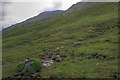
Rock ArtSite Name: Lienassie Alternative Name: DorusduainCountry: Scotland
NOTE: This site is 4.44 km away from the location you searched for.
County: Highlands Type: Rock Art
Nearest Village: Sheil Bridge
Map Ref: NG968217
Latitude: 57.240743N Longitude: 5.369088W
Condition:
| 5 | Perfect |
| 4 | Almost Perfect |
| 3 | Reasonable but with some damage |
| 2 | Ruined but still recognisable as an ancient site |
| 1 | Pretty much destroyed, possibly visible as crop marks |
| 0 | No data. |
| -1 | Completely destroyed |
| 5 | Superb |
| 4 | Good |
| 3 | Ordinary |
| 2 | Not Good |
| 1 | Awful |
| 0 | No data. |
| 5 | Can be driven to, probably with disabled access |
| 4 | Short walk on a footpath |
| 3 | Requiring a bit more of a walk |
| 2 | A long walk |
| 1 | In the middle of nowhere, a nightmare to find |
| 0 | No data. |
| 5 | co-ordinates taken by GPS or official recorded co-ordinates |
| 4 | co-ordinates scaled from a detailed map |
| 3 | co-ordinates scaled from a bad map |
| 2 | co-ordinates of the nearest village |
| 1 | co-ordinates of the nearest town |
| 0 | no data |
Internal Links:
External Links:
")
In the low lying ground between Lienassie farmhouse and Dorusduain there is a low rise with a number of rock outcrops, five of which have cup markings of some 1 to 2 inches in diameter. The site was noted by T Wallace in 1897 (Proceedings of the Society of Antiquaries of Scotland, vol 31, 1896-7, p 87), and is in the Canmore database of the Royal Commission of Ancient Monuments of Scotland (reference NG92SE).
You may be viewing yesterday's version of this page. To see the most up to date information please register for a free account.
")
")
")
Do not use the above information on other web sites or publications without permission of the contributor.
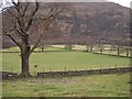
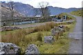
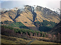
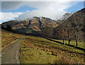
Nearby Images from Geograph Britain and Ireland:
©2011(licence)
©2013(licence)
©2011(licence)
©2011(licence)
©2009(licence)
The above images may not be of the site on this page, they are loaded from Geograph.
Please Submit an Image of this site or go out and take one for us!
Click here to see more info for this site
Nearby sites
Key: Red: member's photo, Blue: 3rd party photo, Yellow: other image, Green: no photo - please go there and take one, Grey: site destroyed
Download sites to:
KML (Google Earth)
GPX (GPS waypoints)
CSV (Garmin/Navman)
CSV (Excel)
To unlock full downloads you need to sign up as a Contributory Member. Otherwise downloads are limited to 50 sites.
Turn off the page maps and other distractions
Nearby sites listing. In the following links * = Image available
1.7km WSW 257° Croe Bridge* Rock Art (NG95162141)
2.4km WSW 255° Tigh Geal* Rock Art (NG94452120)
2.9km WSW 250° Diarmaid's Grave* Standing Stones (NG93992085)
3.0km WSW 248° Dunan Diarmaid* Hillfort (NG93952071)
4.1km SW 222° Cill Fhearchair* Standing Stone (Menhir) (NG93871879)
4.8km SW 228° Sheil Henge* Henge (NG93081868)
7.0km NNW 346° Faddoch* Rock Art (NG95452863)
7.1km SSW 197° Sheil Bridge* Ancient Village or Settlement (NG9438215035)
7.5km WNW 289° Carr Brae* Rock Art (NG89782451)
7.7km NNW 340° Camas Luinie* Rock Art (NG94492909)
8.0km W 276° Allt an Inbhir Souterrain* Souterrain (Fogou, Earth House) (NG88882296)
8.6km W 276° Torran a'Bharraich* Hillfort (NG88312296)
9.3km NW 309° Bard's Castle* Hillfort (NG89822790)
10.0km WNW 289° Totaig Cup Markings* Rock Art (NG87432536)
10.6km WNW 287° Dun Totaig (Loch Duich) Broch or Nuraghe (NG868253)
10.6km WNW 286° Caisteal Grugaig* Broch or Nuraghe (NG86692508)
12.0km W 260° Serpent Mound (Scallasaig) Cairn (NG8484020288)
12.8km WSW 242° Grugaig Hut Circle* Ancient Village or Settlement (NG8517616131)
13.0km WSW 243° Balvraid Cup Marked Stone* Rock Art (NG84961635)
13.0km WSW 241° Dun Grugaig (Glenelg)* Broch or Nuraghe (NG85151591)
13.2km WNW 294° Dun Gleann Udalain Stone Fort or Dun (NG85062773)
13.2km WSW 245° Balvraid Chambered Cairn* Chambered Cairn (NG8452416627)
13.6km WSW 246° Balvraid Farm Cup Marked Stone* Rock Art (NG84081667)
14.0km WNW 301° Gleann Udalain Cairn Cairn (NG85092942)
14.1km WSW 249° Dun Troddan* Broch or Nuraghe (NG834172)
View more nearby sites and additional images


 We would like to know more about this location. Please feel free to add a brief description and any relevant information in your own language.
 Wir möchten mehr über diese Stätte erfahren. Bitte zögern Sie nicht, eine kurze Beschreibung und relevante Informationen in Deutsch hinzuzufügen.
 Nous aimerions en savoir encore un peu sur les lieux. S'il vous plaît n'hesitez pas à ajouter une courte description et tous les renseignements pertinents dans votre propre langue.
 Quisieramos informarnos un poco más de las lugares. No dude en añadir una breve descripción y otros datos relevantes en su propio idioma.