


<< Our Photo Pages >> Auchachenna - Chambered Cairn in Scotland in Argyll
Submitted by caradoc68 on Sunday, 05 February 2012 Page Views: 2973
Neolithic and Bronze AgeSite Name: AuchachennaCountry: Scotland
NOTE: This site is 4.997 km away from the location you searched for.
County: Argyll Type: Chambered Cairn
Nearest Village: Kilchrenan
Map Ref: NN02372106
Latitude: 56.340524N Longitude: 5.19909W
Condition:
| 5 | Perfect |
| 4 | Almost Perfect |
| 3 | Reasonable but with some damage |
| 2 | Ruined but still recognisable as an ancient site |
| 1 | Pretty much destroyed, possibly visible as crop marks |
| 0 | No data. |
| -1 | Completely destroyed |
| 5 | Superb |
| 4 | Good |
| 3 | Ordinary |
| 2 | Not Good |
| 1 | Awful |
| 0 | No data. |
| 5 | Can be driven to, probably with disabled access |
| 4 | Short walk on a footpath |
| 3 | Requiring a bit more of a walk |
| 2 | A long walk |
| 1 | In the middle of nowhere, a nightmare to find |
| 0 | No data. |
| 5 | co-ordinates taken by GPS or official recorded co-ordinates |
| 4 | co-ordinates scaled from a detailed map |
| 3 | co-ordinates scaled from a bad map |
| 2 | co-ordinates of the nearest village |
| 1 | co-ordinates of the nearest town |
| 0 | no data |
Internal Links:
External Links:
")
SW of the farmhouse of Lower Achachenna are the remains of a heavily robbed chambered cairn. Built along a slight rocky spine, it measures about 30 metres in length with its long axis aligned NW-SE. A wall now runs across its NW end, the stones of the cairn having, no doubt, been used for its construction. The SE end of the cairn, measuring 14 metres in maximum breadth is broader than the other end which measures about 11 metres. At the SE end, which stands to a height of 1.7 metres above the surrounding ground. are the remains of the chamber which measures 6.9 metres in length by 1.1 metres in breadth. Only one stone of the NE side of the chamber survives, but four slabs of the SW side and the rear slab remain. The most impressive feature of the site is the SW portal stone which stands to a height of 1.45 metres above the cairn. Three other stones of the facade, protuding up to half a metre or so through the turf, are visible in the debris that blocks the forecourt area.
RCAHMS 1975, visited 1969; A S Henshall 1972.
You may be viewing yesterday's version of this page. To see the most up to date information please register for a free account.
")
")
")
Do not use the above information on other web sites or publications without permission of the contributor.
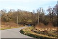
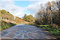
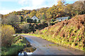
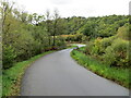
Nearby Images from Geograph Britain and Ireland:
©2017(licence)
©2012(licence)
©2012(licence)
©2020(licence)

©2006(licence)
The above images may not be of the site on this page, they are loaded from Geograph.
Please Submit an Image of this site or go out and take one for us!
Click here to see more info for this site
Nearby sites
Key: Red: member's photo, Blue: 3rd party photo, Yellow: other image, Green: no photo - please go there and take one, Grey: site destroyed
Download sites to:
KML (Google Earth)
GPX (GPS waypoints)
CSV (Garmin/Navman)
CSV (Excel)
To unlock full downloads you need to sign up as a Contributory Member. Otherwise downloads are limited to 50 sites.
Turn off the page maps and other distractions
Nearby sites listing. In the following links * = Image available
996m SSW 193° Rubha Barr Challtuinn* Cairn (NN021201)
2.7km E 97° Port Sonachan* Chambered Cairn (NN050206)
3.9km NE 47° Holy stone* Rock Art (NN0539923584)
4.0km SSW 211° Carn Dubh, Crannog (Loch Awe)* Crannog (NN00131775)
7.8km ENE 78° Cladich* Chambered Cairn (NN101223)
8.8km SSW 197° Ardchonnell* Chambered Cairn (NM99321275)
8.9km SE 133° Drimfern Chambered Cairn (NN086147)
9.1km N 351° Dun Mhuirageul* Stone Fort or Dun (NN01323008)
9.9km SSW 204° Innis Chonnel Crannog* Crannog (NM97841220)
10.1km N 351° Taynault (Lorn)* Standing Stone (Menhir) (NN01203115)
10.2km NNW 347° Nelson's monument, Taynuilt* Standing Stone (Menhir) (NN00513109)
10.9km NW 307° Clachadow* Cairn (NM93932806)
11.1km ENE 58° Sailean Rubha Dubhairt (Loch Awe) Crannog* Crannog (NN12152647)
11.4km N 355° Dun Leigh* Stone Fort or Dun (NN01813243)
11.6km WNW 282° Dun Iadain* Stone Fort or Dun (NM91122404)
12.0km NW 305° Glenamacrie Dun* Stone Fort or Dun (NM92862836)
12.3km NW 305° Clenamacrie Stone Row* Stone Row / Alignment (NM9251128550)
12.4km NW 304° Glenamacrie Farm* Cairn (NM92452854)
12.7km NW 304° Glenamachrie Cairn* Cairn (NM92132870)
12.7km WNW 282° Dalnacabaig* Cairn (NM90002429)
13.3km ESE 119° Dron Rocking Stone* Rock Art (NN137141)
13.9km SSE 147° Inveraray Castle* Standing Stone (Menhir) (NN0946809048)
14.0km WNW 302° Diarmid's Grave* Cairn (NM9077828950)
14.0km WNW 302° Clach na Carraig* Standing Stone (Menhir) (NM9076728957)
14.1km WNW 302° Strontoiller Large Cairn* Cairn (NM90732907)
View more nearby sites and additional images


 We would like to know more about this location. Please feel free to add a brief description and any relevant information in your own language.
 Wir möchten mehr über diese Stätte erfahren. Bitte zögern Sie nicht, eine kurze Beschreibung und relevante Informationen in Deutsch hinzuzufügen.
 Nous aimerions en savoir encore un peu sur les lieux. S'il vous plaît n'hesitez pas à ajouter une courte description et tous les renseignements pertinents dans votre propre langue.
 Quisieramos informarnos un poco más de las lugares. No dude en añadir una breve descripción y otros datos relevantes en su propio idioma.