


<< Text Pages >> Camborne School of Mines Geological Museum - Museum in England in Cornwall
Submitted by vicky on Saturday, 30 November 2002 Page Views: 8872
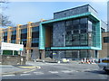
MuseumsSite Name: Camborne School of Mines Geological MuseumCountry: England
NOTE: This site is 1.27 km away from the location you searched for.
County: Cornwall Type: Museum
Nearest Town: Redruth
Map Ref: SW666416 Landranger Map Number: 203
Latitude: 50.228230N Longitude: 5.273817W
Condition:
| 5 | Perfect |
| 4 | Almost Perfect |
| 3 | Reasonable but with some damage |
| 2 | Ruined but still recognisable as an ancient site |
| 1 | Pretty much destroyed, possibly visible as crop marks |
| 0 | No data. |
| -1 | Completely destroyed |
| 5 | Superb |
| 4 | Good |
| 3 | Ordinary |
| 2 | Not Good |
| 1 | Awful |
| 0 | No data. |
| 5 | Can be driven to, probably with disabled access |
| 4 | Short walk on a footpath |
| 3 | Requiring a bit more of a walk |
| 2 | A long walk |
| 1 | In the middle of nowhere, a nightmare to find |
| 0 | No data. |
| 5 | co-ordinates taken by GPS or official recorded co-ordinates |
| 4 | co-ordinates scaled from a detailed map |
| 3 | co-ordinates scaled from a bad map |
| 2 | co-ordinates of the nearest village |
| 1 | co-ordinates of the nearest town |
| 0 | no data |
Be the first person to rate this site - see the 'Contribute!' box in the right hand menu.
Internal Links:
External Links:
I have visited· I would like to visit
LiveAndrew has visited here
Exhibition on local mines including man's use of the raw materials
Address: University of Exeter, TR15 3SE
Phone: 01209 714866
Opening Hours: Monday to Friday 10am to 4pm , Except Bank Holidays and between Christmas and New Year
Admission: Free
Visit their web site
You may be viewing yesterday's version of this page. To see the most up to date information please register for a free account.
Do not use the above information on other web sites or publications without permission of the contributor.
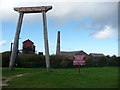
Nearby Images from Geograph Britain and Ireland:
©2010(licence)
©2010(licence)

©2017(licence)

©2008(licence)
©2023(licence)
The above images may not be of the site on this page, they are loaded from Geograph.
Please Submit an Image of this site or go out and take one for us!
Click here to see more info for this site
Nearby sites
Key: Red: member's photo, Blue: 3rd party photo, Yellow: other image, Green: no photo - please go there and take one, Grey: site destroyed
Download sites to:
KML (Google Earth)
GPX (GPS waypoints)
CSV (Garmin/Navman)
CSV (Excel)
To unlock full downloads you need to sign up as a Contributory Member. Otherwise downloads are limited to 50 sites.
Turn off the page maps and other distractions
Nearby sites listing. In the following links * = Image available
1.8km SE 141° Bosleake Stones* Modern Stone Circle etc (SW67674018)
2.1km SSE 153° Canarthen Cross* Ancient Cross (SW67453973)
2.1km N 354° Mary's Well (Illogan)* Holy Well or Sacred Spring (SW66484369)
2.1km ESE 113° Carn Brea Enclosure* Ancient Village or Settlement (SW685407)
2.1km ESE 108° Carn Brea Well* Holy Well or Sacred Spring (SW68584085)
2.2km WSW 238° St Meriasek's Well* Holy Well or Sacred Spring (SW6464640480)
2.3km ESE 111° Menhir Carn Brea (Redruth)* Standing Stone (Menhir) (SW687407)
2.4km SW 228° Camborne Cross* Ancient Cross (SW64704005)
2.5km E 94° St Euny's Well (Carn Brea)* Holy Well or Sacred Spring (SW691413)
2.5km SW 227° Killivose Cross* Ancient Cross (SW64683995)
2.6km SW 232° Maen Cadoar* Standing Stone (Menhir) (SW645401)
2.6km SW 230° St Martin and St Meriadoc Cross Ancient Cross (SW64524003)
2.6km SW 230° St Ia's Cross* Ancient Cross (SW64504002)
3.1km NW 310° Tehidy round* Ancient Village or Settlement (SW643437)
3.2km E 81° St Rumon's Cross* Ancient Cross (SW69804195)
3.3km SE 126° Carnkie tumuli* Barrow Cemetery (SW692395)
3.4km S 191° St Ia's Well (Troon)* Holy Well or Sacred Spring (SW658383)
3.4km N 356° Nance Hill Round* Ancient Village or Settlement (SW665450)
3.6km SSW 204° The Rocks* Rock Outcrop (SW650384)
3.9km NW 305° Crane Castle* Promontory Fort / Cliff Castle (SW635440)
4.0km SSE 161° Vincent's Well Holy Well or Sacred Spring (SW677378)
4.0km NNW 341° Portreath Submerged Forest* Natural Stone / Erratic / Other Natural Feature (SW65434544)
4.1km SSW 199° Treslothan Holy Well* Holy Well or Sacred Spring (SW651378)
4.1km SSW 199° Treslothan Cross* Ancient Cross (SW65073781)
4.1km SE 137° Gregwartha Tumuli* Barrow Cemetery (SW693385)
View more nearby sites and additional images


 We would like to know more about this location. Please feel free to add a brief description and any relevant information in your own language.
 Wir möchten mehr über diese Stätte erfahren. Bitte zögern Sie nicht, eine kurze Beschreibung und relevante Informationen in Deutsch hinzuzufügen.
 Nous aimerions en savoir encore un peu sur les lieux. S'il vous plaît n'hesitez pas à ajouter une courte description et tous les renseignements pertinents dans votre propre langue.
 Quisieramos informarnos un poco más de las lugares. No dude en añadir una breve descripción y otros datos relevantes en su propio idioma.