


<< Our Photo Pages >> Canarthen Cross - Ancient Cross in England in Cornwall
Submitted by Bladup on Sunday, 05 March 2023 Page Views: 277
Early Medieval (Dark Age)Site Name: Canarthen CrossCountry: England County: Cornwall Type: Ancient Cross
Map Ref: SW67453973
Latitude: 50.211775N Longitude: 5.260774W
Condition:
| 5 | Perfect |
| 4 | Almost Perfect |
| 3 | Reasonable but with some damage |
| 2 | Ruined but still recognisable as an ancient site |
| 1 | Pretty much destroyed, possibly visible as crop marks |
| 0 | No data. |
| -1 | Completely destroyed |
| 5 | Superb |
| 4 | Good |
| 3 | Ordinary |
| 2 | Not Good |
| 1 | Awful |
| 0 | No data. |
| 5 | Can be driven to, probably with disabled access |
| 4 | Short walk on a footpath |
| 3 | Requiring a bit more of a walk |
| 2 | A long walk |
| 1 | In the middle of nowhere, a nightmare to find |
| 0 | No data. |
| 5 | co-ordinates taken by GPS or official recorded co-ordinates |
| 4 | co-ordinates scaled from a detailed map |
| 3 | co-ordinates scaled from a bad map |
| 2 | co-ordinates of the nearest village |
| 1 | co-ordinates of the nearest town |
| 0 | no data |
Internal Links:
External Links:
")
You may be viewing yesterday's version of this page. To see the most up to date information please register for a free account.
Do not use the above information on other web sites or publications without permission of the contributor.
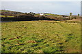
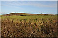
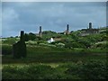
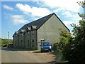
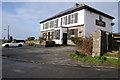
Nearby Images from Geograph Britain and Ireland:
©2014(licence)
©2014(licence)
©2005(licence)
©2023(licence)
©2014(licence)
The above images may not be of the site on this page, they are loaded from Geograph.
Please Submit an Image of this site or go out and take one for us!
Click here to see more info for this site
Nearby sites
Key: Red: member's photo, Blue: 3rd party photo, Yellow: other image, Green: no photo - please go there and take one, Grey: site destroyed
Download sites to:
KML (Google Earth)
GPX (GPS waypoints)
CSV (Garmin/Navman)
CSV (Excel)
To unlock full downloads you need to sign up as a Contributory Member. Otherwise downloads are limited to 50 sites.
Turn off the page maps and other distractions
Nearby sites listing. In the following links * = Image available
500m NNE 23° Bosleake Stones* Modern Stone Circle etc (SW67674018)
1.4km NE 45° Carn Brea Enclosure* Ancient Village or Settlement (SW685407)
1.6km NE 50° Menhir Carn Brea (Redruth)* Standing Stone (Menhir) (SW687407)
1.6km NE 43° Carn Brea Well* Holy Well or Sacred Spring (SW68584085)
1.8km E 95° Carnkie tumuli* Barrow Cemetery (SW692395)
1.9km S 170° Vincent's Well Holy Well or Sacred Spring (SW677378)
2.1km NNW 333° Camborne School of Mines Geological Museum Museum (SW666416)
2.2km SW 227° St Ia's Well (Troon)* Holy Well or Sacred Spring (SW658383)
2.2km ESE 121° Gregwartha Tumuli* Barrow Cemetery (SW693385)
2.3km NE 44° St Euny's Well (Carn Brea)* Holy Well or Sacred Spring (SW691413)
2.8km W 274° Camborne Cross* Ancient Cross (SW64704005)
2.8km W 272° Killivose Cross* Ancient Cross (SW64683995)
2.8km WSW 239° The Rocks* Rock Outcrop (SW650384)
2.9km WNW 283° St Meriasek's Well* Holy Well or Sacred Spring (SW6464640480)
2.9km W 273° St Martin and St Meriadoc Cross Ancient Cross (SW64524003)
3.0km W 273° St Ia's Cross* Ancient Cross (SW64504002)
3.0km W 275° Maen Cadoar* Standing Stone (Menhir) (SW645401)
3.0km SW 228° Treslothan Holy Well* Holy Well or Sacred Spring (SW651378)
3.1km SW 229° Treslothan Cross* Ancient Cross (SW65073781)
3.1km S 180° Hangman's Barrow* Cairn (SW67333665)
3.2km NE 44° St Rumon's Cross* Ancient Cross (SW69804195)
3.3km SSE 163° Wendron North* Stone Circle (SW68293656)
3.3km SSE 162° Wendron South* Stone Circle (SW68313654)
3.4km SW 219° Hr Carwynnen* Stone Circle (SW652372)
3.5km SW 221° Carwynnen Quoit* Portal Tomb (SW65013721)
View more nearby sites and additional images


 We would like to know more about this location. Please feel free to add a brief description and any relevant information in your own language.
 Wir möchten mehr über diese Stätte erfahren. Bitte zögern Sie nicht, eine kurze Beschreibung und relevante Informationen in Deutsch hinzuzufügen.
 Nous aimerions en savoir encore un peu sur les lieux. S'il vous plaît n'hesitez pas à ajouter une courte description et tous les renseignements pertinents dans votre propre langue.
 Quisieramos informarnos un poco más de las lugares. No dude en añadir una breve descripción y otros datos relevantes en su propio idioma.