


<< Our Photo Pages >> Carn Dubh, Crannog (Loch Awe) - Crannog in Scotland in Argyll
Submitted by crannog on Tuesday, 07 February 2012 Page Views: 6300
Iron Age and Later PrehistorySite Name: Carn Dubh, Crannog (Loch Awe)Country: Scotland
NOTE: This site is 1.354 km away from the location you searched for.
County: Argyll Type: Crannog
Nearest Village: Inverinan
Map Ref: NN00131775
Latitude: 56.309894N Longitude: 5.232754W
Condition:
| 5 | Perfect |
| 4 | Almost Perfect |
| 3 | Reasonable but with some damage |
| 2 | Ruined but still recognisable as an ancient site |
| 1 | Pretty much destroyed, possibly visible as crop marks |
| 0 | No data. |
| -1 | Completely destroyed |
| 5 | Superb |
| 4 | Good |
| 3 | Ordinary |
| 2 | Not Good |
| 1 | Awful |
| 0 | No data. |
| 5 | Can be driven to, probably with disabled access |
| 4 | Short walk on a footpath |
| 3 | Requiring a bit more of a walk |
| 2 | A long walk |
| 1 | In the middle of nowhere, a nightmare to find |
| 0 | No data. |
| 5 | co-ordinates taken by GPS or official recorded co-ordinates |
| 4 | co-ordinates scaled from a detailed map |
| 3 | co-ordinates scaled from a bad map |
| 2 | co-ordinates of the nearest village |
| 1 | co-ordinates of the nearest town |
| 0 | no data |
Internal Links:
External Links:
I have visited· I would like to visit
church-grim would like to visit
 (PID:86502)")
It is wholly artificial in that it does not incorporate natural glacial mounds, ridges of bedrock or a natural island surface as a foundation. The elevation of this crannog suggests that there may have been later re-building. Timbers in large quantities were visible and a sharpening stone was found.
You may be viewing yesterday's version of this page. To see the most up to date information please register for a free account.
 (PID:86504)")
Do not use the above information on other web sites or publications without permission of the contributor.
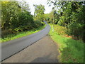
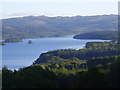
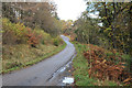
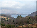
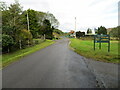
Nearby Images from Geograph Britain and Ireland:
©2020(licence)
©2008(licence)
©2012(licence)
©2021(licence)
©2020(licence)
The above images may not be of the site on this page, they are loaded from Geograph.
Please Submit an Image of this site or go out and take one for us!
Click here to see more info for this site
Nearby sites
Key: Red: member's photo, Blue: 3rd party photo, Yellow: other image, Green: no photo - please go there and take one, Grey: site destroyed
Download sites to:
KML (Google Earth)
GPX (GPS waypoints)
CSV (Garmin/Navman)
CSV (Excel)
To unlock full downloads you need to sign up as a Contributory Member. Otherwise downloads are limited to 50 sites.
Turn off the page maps and other distractions
Nearby sites listing. In the following links * = Image available
3.1km NE 37° Rubha Barr Challtuinn* Cairn (NN021201)
4.0km NNE 31° Auchachenna* Chambered Cairn (NN02372106)
5.1km S 186° Ardchonnell* Chambered Cairn (NM99321275)
5.6km ENE 57° Port Sonachan* Chambered Cairn (NN050206)
6.0km SSW 200° Innis Chonnel Crannog* Crannog (NM97841220)
7.8km NE 39° Holy stone* Rock Art (NN0539923584)
9.0km ESE 107° Drimfern Chambered Cairn (NN086147)
10.9km ENE 63° Cladich* Chambered Cairn (NN101223)
11.0km WNW 302° Dun Iadain* Stone Fort or Dun (NM91122404)
11.8km SSW 210° Rubna na Fidhle* Class III Pictish Cross Slab (NM9377607789)
12.0km NNW 326° Clachadow* Cairn (NM93932806)
12.0km WNW 300° Dalnacabaig* Cairn (NM90002429)
12.4km N 3° Dun Mhuirageul* Stone Fort or Dun (NN01323008)
12.5km WSW 253° Dun Toiseach Stone Fort or Dun (NM880147)
12.7km SE 130° Inveraray Castle* Standing Stone (Menhir) (NN0946809048)
12.8km NW 323° Glenamacrie Dun* Stone Fort or Dun (NM92862836)
13.2km NW 322° Clenamacrie Stone Row* Stone Row / Alignment (NM9251128550)
13.2km NW 322° Glenamacrie Farm* Cairn (NM92452854)
13.3km N 359° Nelson's monument, Taynuilt* Standing Stone (Menhir) (NN00513109)
13.4km SSE 150° Achnagoul 2* Chambered Cairn (NN062058)
13.4km N 2° Taynault (Lorn)* Standing Stone (Menhir) (NN01203115)
13.5km SSE 151° Achnagoul 1* Chambered Cairn (NN061056)
13.5km NW 321° Glenamachrie Cairn* Cairn (NM92132870)
13.9km W 279° Lagganbeg* Cairn (NM86492046)
13.9km WNW 299° Kilmore House* Cairn (NM88292515)
View more nearby sites and additional images


 We would like to know more about this location. Please feel free to add a brief description and any relevant information in your own language.
 Wir möchten mehr über diese Stätte erfahren. Bitte zögern Sie nicht, eine kurze Beschreibung und relevante Informationen in Deutsch hinzuzufügen.
 Nous aimerions en savoir encore un peu sur les lieux. S'il vous plaît n'hesitez pas à ajouter une courte description et tous les renseignements pertinents dans votre propre langue.
 Quisieramos informarnos un poco más de las lugares. No dude en añadir una breve descripción y otros datos relevantes en su propio idioma.