


<< Text Pages >> Inverpolly - Stone Fort or Dun in Scotland in Highlands
Submitted by Andy B on Thursday, 02 September 2010 Page Views: 4138
Multi-periodSite Name: InverpollyCountry: Scotland
NOTE: This site is 6.368 km away from the location you searched for.
County: Highlands Type: Stone Fort or Dun
Map Ref: NC06611551
Latitude: 58.086269N Longitude: 5.282011W
Condition:
| 5 | Perfect |
| 4 | Almost Perfect |
| 3 | Reasonable but with some damage |
| 2 | Ruined but still recognisable as an ancient site |
| 1 | Pretty much destroyed, possibly visible as crop marks |
| 0 | No data. |
| -1 | Completely destroyed |
| 5 | Superb |
| 4 | Good |
| 3 | Ordinary |
| 2 | Not Good |
| 1 | Awful |
| 0 | No data. |
| 5 | Can be driven to, probably with disabled access |
| 4 | Short walk on a footpath |
| 3 | Requiring a bit more of a walk |
| 2 | A long walk |
| 1 | In the middle of nowhere, a nightmare to find |
| 0 | No data. |
| 5 | co-ordinates taken by GPS or official recorded co-ordinates |
| 4 | co-ordinates scaled from a detailed map |
| 3 | co-ordinates scaled from a bad map |
| 2 | co-ordinates of the nearest village |
| 1 | co-ordinates of the nearest town |
| 0 | no data |
Internal Links:
External Links:
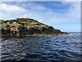
A vitrified dun, with annexe and outwork, at NC 0661 1551. The circular dun occupies the summit of a knoll, and measures c. 12.5m in diameter within a heavily vitrified wall which must have been at least 5.0m thick. A slight dip in the bank of debris in the SE is suggestive of an entrance but is probably misleading as the entrance would be expected more to the S.
Immediately outside the dun at a lower level are the remains of another heavily vitrified structure. Insufficient is visible, however, to establish its true relationship with the dun, though it seemslikely that it is a contemporary annexe rather than an earlier work. There is no defnite sign of an entrance.
Blocking the approach from the S is an outwork comprising a wall of small stones reduced almost to its foundation. At one point is a small mass of vitrifaction suggesting that this too was timber-laced and at least partly vitrified. An entrance is denoted by a gap in the rubble.
More, with photos of the vitrification at Scotland's Places
You may be viewing yesterday's version of this page. To see the most up to date information please register for a free account.
Do not use the above information on other web sites or publications without permission of the contributor.
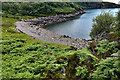
Nearby Images from Geograph Britain and Ireland:
©2019(licence)
©2018(licence)
©2006(licence)
©2019(licence)
©2019(licence)
The above images may not be of the site on this page, they are loaded from Geograph.
Please Submit an Image of this site or go out and take one for us!
Click here to see more info for this site
Nearby sites
Key: Red: member's photo, Blue: 3rd party photo, Yellow: other image, Green: no photo - please go there and take one, Grey: site destroyed
Download sites to:
KML (Google Earth)
GPX (GPS waypoints)
CSV (Garmin/Navman)
CSV (Excel)
To unlock full downloads you need to sign up as a Contributory Member. Otherwise downloads are limited to 50 sites.
Turn off the page maps and other distractions
Nearby sites listing. In the following links * = Image available
5.2km WSW 248° Brae of Achnahaird Stone Fort or Dun (NC01701380)
9.4km SSW 200° Achlochan Broch* Broch or Nuraghe (NC029069)
12.6km NNW 344° Clachtoll Stone Circle* Stone Circle (NC037278)
12.7km NNW 344° Clachtoll Broch* Broch or Nuraghe (NC03652785)
13.4km NE 42° Loch Assynt Crannog (NC1603225018)
15.4km SSE 160° Dun Canna* Stone Fort or Dun (NC11160080)
15.6km NNW 346° Loch Na Claise Crannog (NC03543082)
16.0km E 100° Glacbain* Cairn (NC2231112011)
16.8km SE 141° An Dun, Strath Canaird Stone Fort or Dun (NC16530196)
16.8km SSE 167° Isle Martin Cross Stone* Ancient Cross (NH096989)
16.9km E 95° Cam Loch B Chambered Cairn (NC23431314)
17.0km E 95° Cam Loch A Cairn (NC23501312)
17.5km E 98° Ledmore* Chambered Cairn (NC23821215)
18.3km E 92° Ledbeg River* Chambered Cairn (NC24891411)
19.3km ENE 62° Ardvreck* Chambered Cairn (NC24142371)
19.5km ENE 56° Allt Sgiathaig* Chambered Cairn (NC23412552)
19.5km E 99° Loch Borralan Crannog* Crannog (NC25741138)
19.8km E 100° Loch Borralan West* Chambered Cairn (NC2603811142)
20.0km E 100° Loch Borralan East* Chambered Cairn (NC26241118)
20.2km E 83° Allt nan Uamh Bone Caves* Cave or Rock Shelter (NC268170)
20.3km E 100° Altnacealgach* Chambered Cairn (NC2652811033)
20.4km ENE 69° Carrachan Dubh Chambered Cairn (NC26102176)
20.5km NNE 27° An Dun (Loch Ardbhair)* Broch or Nuraghe (NC16893324)
23.9km NE 36° Kylestrome Broch* Broch or Nuraghe (NC217341)
24.0km S 174° Beinn Ghobhlach Standing Stone* Standing Stone (Menhir) (NH080915)
View more nearby sites and additional images


 We would like to know more about this location. Please feel free to add a brief description and any relevant information in your own language.
 Wir möchten mehr über diese Stätte erfahren. Bitte zögern Sie nicht, eine kurze Beschreibung und relevante Informationen in Deutsch hinzuzufügen.
 Nous aimerions en savoir encore un peu sur les lieux. S'il vous plaît n'hesitez pas à ajouter une courte description et tous les renseignements pertinents dans votre propre langue.
 Quisieramos informarnos un poco más de las lugares. No dude en añadir una breve descripción y otros datos relevantes en su propio idioma.