


<< Our Photo Pages >> Park Shady Spring - Holy Well or Sacred Spring in England in Cornwall
Submitted by cromagnonman on Saturday, 06 November 2021 Page Views: 1278
Springs and Holy WellsSite Name: Park Shady Spring Alternative Name: Mount HawkeHoly WellCountry: England
NOTE: This site is 1.592 km away from the location you searched for.
County: Cornwall Type: Holy Well or Sacred Spring
Nearest Town: Porthtowan Nearest Village: Mount Hawke
Map Ref: SW71154790
Latitude: 50.286579N Longitude: 5.213938W
Condition:
| 5 | Perfect |
| 4 | Almost Perfect |
| 3 | Reasonable but with some damage |
| 2 | Ruined but still recognisable as an ancient site |
| 1 | Pretty much destroyed, possibly visible as crop marks |
| 0 | No data. |
| -1 | Completely destroyed |
| 5 | Superb |
| 4 | Good |
| 3 | Ordinary |
| 2 | Not Good |
| 1 | Awful |
| 0 | No data. |
| 5 | Can be driven to, probably with disabled access |
| 4 | Short walk on a footpath |
| 3 | Requiring a bit more of a walk |
| 2 | A long walk |
| 1 | In the middle of nowhere, a nightmare to find |
| 0 | No data. |
| 5 | co-ordinates taken by GPS or official recorded co-ordinates |
| 4 | co-ordinates scaled from a detailed map |
| 3 | co-ordinates scaled from a bad map |
| 2 | co-ordinates of the nearest village |
| 1 | co-ordinates of the nearest town |
| 0 | no data |
Internal Links:
External Links:
")
I remember often walking here as a youngster in the 1980s. There were no such things here then and I thought it to be a mine adit. I would welcome anyone who knows anything about it to add their comments here.
You may be viewing yesterday's version of this page. To see the most up to date information please register for a free account.
Do not use the above information on other web sites or publications without permission of the contributor.
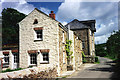
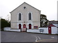
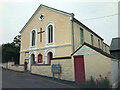
Nearby Images from Geograph Britain and Ireland:
©2005(licence)
©2023(licence)
©2012(licence)
©2023(licence)
©2012(licence)
The above images may not be of the site on this page, they are loaded from Geograph.
Please Submit an Image of this site or go out and take one for us!
Click here to see more info for this site
Nearby sites
Key: Red: member's photo, Blue: 3rd party photo, Yellow: other image, Green: no photo - please go there and take one, Grey: site destroyed
Download sites to:
KML (Google Earth)
GPX (GPS waypoints)
CSV (Garmin/Navman)
CSV (Excel)
To unlock full downloads you need to sign up as a Contributory Member. Otherwise downloads are limited to 50 sites.
Turn off the page maps and other distractions
Nearby sites listing. In the following links * = Image available
1.1km W 273° Trevissick round* Ancient Village or Settlement (SW701480)
1.3km SE 143° Coosewartha round Ancient Village or Settlement (SW719468)
1.7km N 6° Bolster Bank* Misc. Earthwork (SW714496)
2.2km NW 321° The Giant's Footprint (Cornwall)* Natural Stone / Erratic / Other Natural Feature (SW698497)
2.4km N 354° St Agnes Beacon* Barrow Cemetery (SW710503)
2.5km ESE 111° Two Burrows Round Barrow* Round Barrow(s) (SW735469)
2.9km NNW 330° Tubby´s Head* Promontory Fort / Cliff Castle (SW698505)
3.0km NNW 337° New Downs* Stone Circle (SW701507)
3.0km NNE 14° St Agnes Cornish Cross* Ancient Cross (SW720508)
4.6km WSW 243° Nancekuke Carving (Portreath) Rock Art (SW670460)
5.0km E 84° Kenwyn Four Burrows* Barrow Cemetery (SW762482)
5.5km SW 236° Nance Hill Round* Ancient Village or Settlement (SW665450)
6.0km ESE 119° Saveock Water Archaeology Modern Stone Circle etc (SW76324476)
6.1km S 190° St Rumon's Cross* Ancient Cross (SW69804195)
6.2km WSW 244° Portreath Submerged Forest* Natural Stone / Erratic / Other Natural Feature (SW65434544)
6.3km SW 225° Mary's Well (Illogan)* Holy Well or Sacred Spring (SW66484369)
6.8km WSW 246° Tregea Hill* Promontory Fort / Cliff Castle (SW648454)
6.9km SSW 195° St Euny's Well (Carn Brea)* Holy Well or Sacred Spring (SW691413)
7.3km S 175° Figgy Dowdy's Well* Holy Well or Sacred Spring (SW7146740637)
7.3km E 101° Bosvisack Round* Hillfort (SW78254624)
7.5km SSW 198° Carn Brea Well* Holy Well or Sacred Spring (SW68584085)
7.6km SSW 196° Menhir Carn Brea (Redruth)* Standing Stone (Menhir) (SW687407)
7.7km SSW 198° Carn Brea Enclosure* Ancient Village or Settlement (SW685407)
7.8km SSW 213° Camborne School of Mines Geological Museum Museum (SW666416)
7.8km NE 54° Caer Dane* Ancient Village or Settlement (SW777522)
View more nearby sites and additional images


 We would like to know more about this location. Please feel free to add a brief description and any relevant information in your own language.
 Wir möchten mehr über diese Stätte erfahren. Bitte zögern Sie nicht, eine kurze Beschreibung und relevante Informationen in Deutsch hinzuzufügen.
 Nous aimerions en savoir encore un peu sur les lieux. S'il vous plaît n'hesitez pas à ajouter une courte description et tous les renseignements pertinents dans votre propre langue.
 Quisieramos informarnos un poco más de las lugares. No dude en añadir una breve descripción y otros datos relevantes en su propio idioma.