 with our Megalithic Portal iPhone app")


<< Our Photo Pages >> Carleon Stone Circle - Stone Circle in England in Cornwall
Submitted by dooclay on Monday, 12 June 2023 Page Views: 325
Date UncertainSite Name: Carleon Stone Circle Alternative Name: Ruan Minor CircleCountry: England County: Cornwall Type: Stone Circle
Nearest Village: Ruan Minor
Map Ref: SW72551535
Latitude: 49.994832N Longitude: 5.174891W
Condition:
| 5 | Perfect |
| 4 | Almost Perfect |
| 3 | Reasonable but with some damage |
| 2 | Ruined but still recognisable as an ancient site |
| 1 | Pretty much destroyed, possibly visible as crop marks |
| 0 | No data. |
| -1 | Completely destroyed |
| 5 | Superb |
| 4 | Good |
| 3 | Ordinary |
| 2 | Not Good |
| 1 | Awful |
| 0 | No data. |
| 5 | Can be driven to, probably with disabled access |
| 4 | Short walk on a footpath |
| 3 | Requiring a bit more of a walk |
| 2 | A long walk |
| 1 | In the middle of nowhere, a nightmare to find |
| 0 | No data. |
| 5 | co-ordinates taken by GPS or official recorded co-ordinates |
| 4 | co-ordinates scaled from a detailed map |
| 3 | co-ordinates scaled from a bad map |
| 2 | co-ordinates of the nearest village |
| 1 | co-ordinates of the nearest town |
| 0 | no data |
Internal Links:
External Links:
")
A possible stone circle consisting of twelve large serpentine boulders was recorded at Carleon Farm, Ruan Minor, by George Smith in 1980.
The stone circle might have originated in the Early Bronze Age, but it is known that some of the stones were set in place by a JCB. It is now not certain which stones are original or if, in fact, a circle did exist here before the area was cleared of scrub some 10 years earlier (ie in the late 60s/early 1970s). The circle is in good condition and measures 42m north-south and 49m east-west.
The HER concludes: The site needs further investigation.
You may be viewing yesterday's version of this page. To see the most up to date information please register for a free account.
")
")
")
Do not use the above information on other web sites or publications without permission of the contributor.
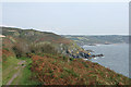
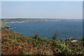
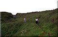
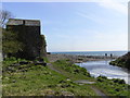
Nearby Images from Geograph Britain and Ireland:
©2008(licence)
©2008(licence)
©2010(licence)
©2009(licence)
©2005(licence)
The above images may not be of the site on this page, they are loaded from Geograph.
Please Submit an Image of this site or go out and take one for us!
Click here to see more info for this site
Nearby sites
Key: Red: member's photo, Blue: 3rd party photo, Yellow: other image, Green: no photo - please go there and take one, Grey: site destroyed
Download sites to:
KML (Google Earth)
GPX (GPS waypoints)
CSV (Garmin/Navman)
CSV (Excel)
To unlock full downloads you need to sign up as a Contributory Member. Otherwise downloads are limited to 50 sites.
Turn off the page maps and other distractions
Nearby sites listing. In the following links * = Image available
940m NW 316° Treal Barrows* Barrow Cemetery (SW71921605)
1.2km SW 234° St Ruan's Well (Cadgwith)* Holy Well or Sacred Spring (SW7151714671)
2.5km W 275° Moyle's Burrow* Round Barrow(s) (SW70051569)
2.6km NNE 13° Goonhilly Downs Barrows* Barrow Cemetery (SW73261786)
2.8km NE 56° Poldowrian Round House* Ancient Village or Settlement (SW749168)
3.0km SSW 206° Landewednack Cross* Ancient Cross (SW71111268)
3.0km WNW 286° St Helena Barrow Round Barrow(s) (SW69661632)
3.1km WNW 287° Hyrven* Standing Stone (Menhir) (SW696164)
3.2km ENE 66° Carrick Luz* Promontory Fort / Cliff Castle (SW755165)
3.3km SSW 211° The Lizard Cornish Cross* Ancient Cross (SW707126)
3.4km WNW 298° Hayle Kimbro Pool Barrow* Round Barrow(s) (SW69591711)
3.6km WNW 301° Ponson Joppa Barrow Round Barrow(s) (SW69531736)
3.7km WSW 257° Kynance Downs Round Barrow(s) (SW68951468)
4.0km WNW 303° North Predannack Downs Barrow* Round Barrow(s) (SW69281767)
4.1km N 0° Croft Pascoe Forrest Barrows* Barrow Cemetery (SW7273819434)
4.1km NW 312° Penhale Barrow 2* Round Barrow(s) (SW69601821)
4.1km WSW 247° Carngoon Bank* Ancient Village or Settlement (SW687139)
4.2km NW 310° Penhale Barrow 3* Round Barrow(s) (SW69421822)
4.2km NW 312° Penhale Enclosure Misc. Earthwork (SW69511833)
4.3km NW 307° Penhale Barrow 1* Round Barrow(s) (SW69231806)
4.3km NNW 341° Goonhilly Downs Kerb Cairn* Barrow Cemetery (SW71331951)
4.5km NNW 336° Carn Maer Tumuli* Barrow Cemetery (SW70861954)
4.7km WSW 244° Kynance Cove Hut Circle* Ancient Village or Settlement (SW68261351)
4.9km ENE 78° Dynas Cove* Promontory Fort / Cliff Castle (SW774162)
5.3km N 349° Bochym Tumuli* Barrow Cemetery (SW71762056)
View more nearby sites and additional images


 We would like to know more about this location. Please feel free to add a brief description and any relevant information in your own language.
 Wir möchten mehr über diese Stätte erfahren. Bitte zögern Sie nicht, eine kurze Beschreibung und relevante Informationen in Deutsch hinzuzufügen.
 Nous aimerions en savoir encore un peu sur les lieux. S'il vous plaît n'hesitez pas à ajouter une courte description et tous les renseignements pertinents dans votre propre langue.
 Quisieramos informarnos un poco más de las lugares. No dude en añadir una breve descripción y otros datos relevantes en su propio idioma.