 with our Megalithic Portal iPhone app")


<< Our Photo Pages >> St Cairrell's Well - Holy Well or Sacred Spring in Scotland in Argyll
Submitted by ericjohn7 on Monday, 29 March 2004 Page Views: 9068
Springs and Holy WellsSite Name: St Cairrell's WellCountry: Scotland
NOTE: This site is 7.473 km away from the location you searched for.
County: Argyll Type: Holy Well or Sacred Spring
Nearest Village: Creagan
Map Ref: NM980450 Landranger Map Number: 49
Latitude: 56.553406N Longitude: 5.288176W
Condition:
| 5 | Perfect |
| 4 | Almost Perfect |
| 3 | Reasonable but with some damage |
| 2 | Ruined but still recognisable as an ancient site |
| 1 | Pretty much destroyed, possibly visible as crop marks |
| 0 | No data. |
| -1 | Completely destroyed |
| 5 | Superb |
| 4 | Good |
| 3 | Ordinary |
| 2 | Not Good |
| 1 | Awful |
| 0 | No data. |
| 5 | Can be driven to, probably with disabled access |
| 4 | Short walk on a footpath |
| 3 | Requiring a bit more of a walk |
| 2 | A long walk |
| 1 | In the middle of nowhere, a nightmare to find |
| 0 | No data. |
| 5 | co-ordinates taken by GPS or official recorded co-ordinates |
| 4 | co-ordinates scaled from a detailed map |
| 3 | co-ordinates scaled from a bad map |
| 2 | co-ordinates of the nearest village |
| 1 | co-ordinates of the nearest town |
| 0 | no data |
Internal Links:
External Links:
")
Interior of well has a stone shelf with a selection of white pebbles placed on it,and a tin mug to sample the water.
You may be viewing yesterday's version of this page. To see the most up to date information please register for a free account.
Do not use the above information on other web sites or publications without permission of the contributor.
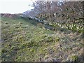
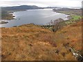
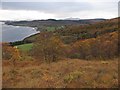
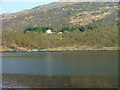
Nearby Images from Geograph Britain and Ireland:
©2007(licence)
©2010(licence)
©2010(licence)
©2011(licence)
©2019(licence)
The above images may not be of the site on this page, they are loaded from Geograph.
Please Submit an Image of this site or go out and take one for us!
Click here to see more info for this site
Nearby sites
Key: Red: member's photo, Blue: 3rd party photo, Yellow: other image, Green: no photo - please go there and take one, Grey: site destroyed
Download sites to:
KML (Google Earth)
GPX (GPS waypoints)
CSV (Garmin/Navman)
CSV (Excel)
To unlock full downloads you need to sign up as a Contributory Member. Otherwise downloads are limited to 50 sites.
Turn off the page maps and other distractions
Nearby sites listing. In the following links * = Image available
3.3km SSW 207° Barcaldine* Standing Stones (NM96374213)
5.5km SW 217° Achacha standing stone* Standing Stone (Menhir) (NM94444075)
5.6km SW 218° Achacha Cairn* Cairn (NM94364076)
5.8km WNW 290° Cairnbane (Portnacroish) Chambered Cairn (NM926473)
8.3km WSW 249° Eriska Crannog* Crannog (NM90114239)
8.4km SW 232° Castle Farm standing stone* Standing Stone (Menhir) (NM911402)
8.4km SW 233° Castle Farm cairns* Cairn (NM91014029)
8.6km SW 228° Culcharron cairn* Cairn (NM913396)
8.8km WSW 239° Achnamoine Cairn* Cairn (NM90184082)
8.9km WSW 241° Achnamoine 2* Cairn (NM89974104)
9.1km WSW 244° Balure Cairns* Cairn (NM89604145)
9.2km SSW 199° Achnaba E* Cairn (NM94593639)
9.4km SSW 199° Achnaba B* Cairn (NM94533626)
9.4km SSW 200° Achnaba D* Cairn (NM94283631)
9.5km SSW 199° Achnaba A* Cairn (NM94453616)
9.5km SSW 201° Achnaba C* Cairn (NM94093630)
9.6km N 1° Achara Standing Stone* Standing Stone (Menhir) (NM98665455)
9.7km SE 131° Muirheadstone* Natural Stone / Erratic / Other Natural Feature (NN050383)
9.7km SW 234° Kintaline Mill Farm Kist* Cist (NM89793971)
9.8km SW 226° Benderloch Stone Circle* Stone Circle (NM90613853)
10.0km SSW 208° Achnacreebeag* Chambered Cairn (NM92963639)
10.1km S 182° Ardchattan Priory* Sculptured Stone (NM971349)
10.2km SW 226° Dun Mac Sniachan* Vitrified Fort (NM90323822)
10.4km SW 225° Benderloch Standing Stone* Standing Stone (Menhir) (NM903380)
10.4km SSW 211° Achnacree Cairn* Round Cairn (NM922363)
View more nearby sites and additional images


 We would like to know more about this location. Please feel free to add a brief description and any relevant information in your own language.
 Wir möchten mehr über diese Stätte erfahren. Bitte zögern Sie nicht, eine kurze Beschreibung und relevante Informationen in Deutsch hinzuzufügen.
 Nous aimerions en savoir encore un peu sur les lieux. S'il vous plaît n'hesitez pas à ajouter une courte description et tous les renseignements pertinents dans votre propre langue.
 Quisieramos informarnos un poco más de las lugares. No dude en añadir una breve descripción y otros datos relevantes en su propio idioma.