

<< Image Pages >> Eilean Buidhe - Stone Fort or Dun in Scotland in Isle of Bute
Submitted by durhamnature on Monday, 17 September 2012 Page Views: 3415
Multi-periodSite Name: Eilean BuidheCountry: Scotland County: Isle of Bute Type: Stone Fort or Dun
Map Ref: NS01867532
Latitude: 55.929999N Longitude: 5.173315W
Condition:
| 5 | Perfect |
| 4 | Almost Perfect |
| 3 | Reasonable but with some damage |
| 2 | Ruined but still recognisable as an ancient site |
| 1 | Pretty much destroyed, possibly visible as crop marks |
| 0 | No data. |
| -1 | Completely destroyed |
| 5 | Superb |
| 4 | Good |
| 3 | Ordinary |
| 2 | Not Good |
| 1 | Awful |
| 0 | No data. |
| 5 | Can be driven to, probably with disabled access |
| 4 | Short walk on a footpath |
| 3 | Requiring a bit more of a walk |
| 2 | A long walk |
| 1 | In the middle of nowhere, a nightmare to find |
| 0 | No data. |
| 5 | co-ordinates taken by GPS or official recorded co-ordinates |
| 4 | co-ordinates scaled from a detailed map |
| 3 | co-ordinates scaled from a bad map |
| 2 | co-ordinates of the nearest village |
| 1 | co-ordinates of the nearest town |
| 0 | no data |
Internal Links:
External Links:
")
Canmore site 40458
A vitrified dun situated at the south-west end of Eilean Buidhe, (“Little Yellow Island”), one of the Burnt Isles at the north tip of the Kyle of Bute, and 350m south of Caol Ruadh. Approximately circular in plan, the dun measures about 19.5m in diameter within a fallen wall some 6m in thickness and a maximum height of 1.5m on the east side. It was excavated by J H Maxwell in 1936 and, as the site is now heavily overgrown, this account is largely based upon his published report. Two stretches of inner facing-stones were discovered on the north and on the west, and investigation of the core of the wall revealed large quantities of vitrified material forming a band up to 1.5m thick. The entrance probably lay within the gap in the wall on the NNE. Excavations in the interior uncovered a layer of charcoal, which extended beneath the inner face of the wall, as well as areas of rough paving, but no traces of internal structures were identified. A small hollow or cistern 'about mid-way between the centre of the fort and the south point', first noted in 1822 (Trans Royal Soc of Edinburgh 1824), was emptied of water and cleared of silt, as it had been in 1822, but no relics were found.
Text summarised from Canmore and other sources.
You may be viewing yesterday's version of this page. To see the most up to date information please register for a free account.
Do not use the above information on other web sites or publications without permission of the contributor.
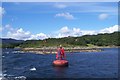
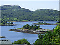
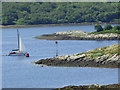
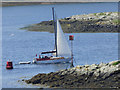
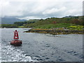
Nearby Images from Geograph Britain and Ireland:
©2011(licence)
©2018(licence)
©2018(licence)
©2018(licence)
©2012(licence)
The above images may not be of the site on this page, they are loaded from Geograph.
Please Submit an Image of this site or go out and take one for us!
Click here to see more info for this site
Nearby sites
Key: Red: member's photo, Blue: 3rd party photo, Yellow: other image, Green: no photo - please go there and take one, Grey: site destroyed
Download sites to:
KML (Google Earth)
GPX (GPS waypoints)
CSV (Garmin/Navman)
CSV (Excel)
To unlock full downloads you need to sign up as a Contributory Member. Otherwise downloads are limited to 50 sites.
Turn off the page maps and other distractions
Nearby sites listing. In the following links * = Image available
4.7km SSW 208° Aultmore Burn Fort* Hillfort (NR9946871279)
5.2km SSW 202° Glenvoidean* Chambered Cairn (NR9970870570)
5.5km NNW 347° Meckan's Grave (Loch Riddon)* Cist (NS00858070)
5.5km SSW 203° St Michael's Grave* Chambered Cairn (NR9947070314)
6.1km SW 227° Kames* Standing Stones (NR97177137)
6.1km S 189° Carnbaan* Chambered Cairn (NS0063269316)
6.9km NNW 347° Auchnagarran* Standing Stone (Menhir) (NS00648215)
7.1km S 186° Glecknabae* Chambered Cairn (NS0074568263)
7.2km NNW 345° Barmore Fort* Hillfort (NS00258237)
8.5km SSE 159° St Colmac's Cross Standing Stone (Menhir) (NS0452167263)
8.7km SSE 157° Colmac Bridge* Standing Stone (Menhir) (NS0491367160)
8.9km SSE 161° St Colmac Cottages Stone Circle* Stone Circle (NS044668)
9.1km SSE 154° Acholter* Standing Stone (Menhir) (NS0546466961)
9.1km NNW 347° Lephinkill* Chambered Cairn (NS00278432)
9.1km NNW 343° Glendaruel Churchyard* Sculptured Stone (NR9951984165)
9.5km SW 220° Colachla* Stone Fort or Dun (NR95456832)
9.5km WNW 296° Lindsaig* Rock Art (NR93477991)
9.5km SSE 164° St Colmac's A Stone Circle (NS040660)
9.7km W 270° Inveryne Rock Art* Rock Art (NR92177578)
9.8km W 260° Ardmarnoch 4* Rock Art (NR921740)
9.9km W 260° Auchalick Wood* Hillfort (NR92007407)
9.9km W 260° Ardmarnoch 3 Rock Art (NR91987401)
10.0km NNE 20° Balliemore (Craigendive)* Standing Stones (NS0565084540)
10.0km N 350° Ardachearanbeg Chambered Cairn (NS005852)
10.0km WNW 291° Fearnoch Cairn* Cairn (NR9268879398)
View more nearby sites and additional images


 We would like to know more about this location. Please feel free to add a brief description and any relevant information in your own language.
 Wir möchten mehr über diese Stätte erfahren. Bitte zögern Sie nicht, eine kurze Beschreibung und relevante Informationen in Deutsch hinzuzufügen.
 Nous aimerions en savoir encore un peu sur les lieux. S'il vous plaît n'hesitez pas à ajouter une courte description et tous les renseignements pertinents dans votre propre langue.
 Quisieramos informarnos un poco más de las lugares. No dude en añadir una breve descripción y otros datos relevantes en su propio idioma.