

<< Text Pages >> Corrie possible Four-Poster - Stone Circle in Scotland in Isle of Arran
Submitted by Andy B on Thursday, 18 August 2016 Page Views: 1401
Neolithic and Bronze AgeSite Name: Corrie possible Four-PosterCountry: Scotland
NOTE: This site is 1.105 km away from the location you searched for.
County: Isle of Arran Type: Stone Circle
Map Ref: NS01404334
Latitude: 55.642909N Longitude: 5.157352W
Condition:
| 5 | Perfect |
| 4 | Almost Perfect |
| 3 | Reasonable but with some damage |
| 2 | Ruined but still recognisable as an ancient site |
| 1 | Pretty much destroyed, possibly visible as crop marks |
| 0 | No data. |
| -1 | Completely destroyed |
| 5 | Superb |
| 4 | Good |
| 3 | Ordinary |
| 2 | Not Good |
| 1 | Awful |
| 0 | No data. |
| 5 | Can be driven to, probably with disabled access |
| 4 | Short walk on a footpath |
| 3 | Requiring a bit more of a walk |
| 2 | A long walk |
| 1 | In the middle of nowhere, a nightmare to find |
| 0 | No data. |
| 5 | co-ordinates taken by GPS or official recorded co-ordinates |
| 4 | co-ordinates scaled from a detailed map |
| 3 | co-ordinates scaled from a bad map |
| 2 | co-ordinates of the nearest village |
| 1 | co-ordinates of the nearest town |
| 0 | no data |
Be the first person to rate this site - see the 'Contribute!' box in the right hand menu.
Internal Links:
External Links:
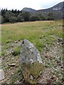
Possible 'four-poster' (unverified). A setting of four stones c.2m apart on edge of embankment overlooking stream to S
Source: WoSAS
You may be viewing yesterday's version of this page. To see the most up to date information please register for a free account.
Do not use the above information on other web sites or publications without permission of the contributor.
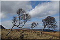
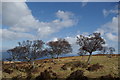
Nearby Images from Geograph Britain and Ireland:
©2012(licence)
©2012(licence)
©2012(licence)
©2009(licence)
©2009(licence)
The above images may not be of the site on this page, they are loaded from Geograph.
Please Submit an Image of this site or go out and take one for us!
Click here to see more info for this site
Nearby sites
Key: Red: member's photo, Blue: 3rd party photo, Yellow: other image, Green: no photo - please go there and take one, Grey: site destroyed
Download sites to:
KML (Google Earth)
GPX (GPS waypoints)
CSV (Garmin/Navman)
CSV (Excel)
To unlock full downloads you need to sign up as a Contributory Member. Otherwise downloads are limited to 50 sites.
Turn off the page maps and other distractions
Nearby sites listing. In the following links * = Image available
1.5km N 9° Sannox Chambered Cairn Chambered Cairn (NS017448)
1.6km NNW 345° South Sannox* Stone Circle (NS0106044907)
2.2km N 0° Sannox Cist* Cist (NS015455)
2.2km N 4° Sannox Bay Standing Stone* Standing Stone (Menhir) (NS01644558)
2.4km N 358° Mid Sannox Standing Stone* Standing Stone (Menhir) (NS0143345782)
3.2km N 358° North Sannox Chambered Cairn* Chambered Cairn (NS01424659)
3.4km N 353° North Sannox Farm* Chambered Cairn (NS01114676)
4.0km NNW 337° Allt Carn Bhain Chambered Cairn (NR99994707)
4.6km SSE 161° Merkland Cist Cist (NS02693896)
5.2km NW 324° Allt Lon Na Cuilc Marker Stone (NR98524766)
5.4km S 176° Replica Bronze Age Round House at Brodick Castle Modern Stone Circle etc (NS015379)
5.9km S 185° Glen Shiel* Stone Row / Alignment (NS0061337447)
6.5km S 190° Glen Shirag Stone Circle (NS000370)
6.7km S 181° Stronach Standing Stone* Standing Stone (Menhir) (NS0100236608)
7.1km S 186° Stronach Ridge Rock Art* Rock Art (NS00303636)
7.5km S 183° Auchrannie, Glen Cloy* Souterrain (Fogou, Earth House) (NS007359)
7.7km SSW 195° Glen Shurig (Kilbride) Stone Circle (NR9936)
7.8km S 174° Mayish* Standing Stone (Menhir) (NS01813551)
8.7km S 183° Glenrickard* Chambered Cairn (NS00513466)
9.9km S 175° Lamlash* Stone Circle (NS0188233419)
10.2km S 170° Dunan Mor* Chambered Cairn (NS027332)
10.4km S 170° Dunan Beag* Chambered Cairn (NS0270932974)
10.5km NW 311° Lochranza Golf Course Standing Stone* Standing Stone (Menhir) (NR93795058)
10.6km S 169° North Blairmore* Standing Stone (Menhir) (NS0293432791)
10.8km WNW 298° Madadh Lounie Standing Stones (NR921488)
View more nearby sites and additional images


 We would like to know more about this location. Please feel free to add a brief description and any relevant information in your own language.
 Wir möchten mehr über diese Stätte erfahren. Bitte zögern Sie nicht, eine kurze Beschreibung und relevante Informationen in Deutsch hinzuzufügen.
 Nous aimerions en savoir encore un peu sur les lieux. S'il vous plaît n'hesitez pas à ajouter une courte description et tous les renseignements pertinents dans votre propre langue.
 Quisieramos informarnos un poco más de las lugares. No dude en añadir una breve descripción y otros datos relevantes en su propio idioma.