


<< Our Photo Pages >> Twelve barrows - Barrow Cemetery in England in Cornwall
Submitted by Bladup on Monday, 21 April 2014 Page Views: 1847
Neolithic and Bronze AgeSite Name: Twelve barrowsCountry: England
NOTE: This site is 0.141 km away from the location you searched for.
County: Cornwall Type: Barrow Cemetery
Map Ref: SW794554
Latitude: 50.357072N Longitude: 5.102694W
Condition:
| 5 | Perfect |
| 4 | Almost Perfect |
| 3 | Reasonable but with some damage |
| 2 | Ruined but still recognisable as an ancient site |
| 1 | Pretty much destroyed, possibly visible as crop marks |
| 0 | No data. |
| -1 | Completely destroyed |
| 5 | Superb |
| 4 | Good |
| 3 | Ordinary |
| 2 | Not Good |
| 1 | Awful |
| 0 | No data. |
| 5 | Can be driven to, probably with disabled access |
| 4 | Short walk on a footpath |
| 3 | Requiring a bit more of a walk |
| 2 | A long walk |
| 1 | In the middle of nowhere, a nightmare to find |
| 0 | No data. |
| 5 | co-ordinates taken by GPS or official recorded co-ordinates |
| 4 | co-ordinates scaled from a detailed map |
| 3 | co-ordinates scaled from a bad map |
| 2 | co-ordinates of the nearest village |
| 1 | co-ordinates of the nearest town |
| 0 | no data |
Internal Links:
External Links:
")
Pastscape entry
You may be viewing yesterday's version of this page. To see the most up to date information please register for a free account.
Do not use the above information on other web sites or publications without permission of the contributor.
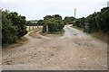
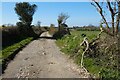
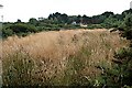
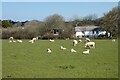
Nearby Images from Geograph Britain and Ireland:
©2006(licence)
©2022(licence)
©2006(licence)
©2022(licence)
©2013(licence)
The above images may not be of the site on this page, they are loaded from Geograph.
Please Submit an Image of this site or go out and take one for us!
Click here to see more info for this site
Nearby sites
Key: Red: member's photo, Blue: 3rd party photo, Yellow: other image, Green: no photo - please go there and take one, Grey: site destroyed
Download sites to:
KML (Google Earth)
GPX (GPS waypoints)
CSV (Garmin/Navman)
CSV (Excel)
To unlock full downloads you need to sign up as a Contributory Member. Otherwise downloads are limited to 50 sites.
Turn off the page maps and other distractions
Nearby sites listing. In the following links * = Image available
1.7km WSW 237° Piran's Round* Ancient Village or Settlement (SW779545)
2.0km N 3° Cubert Round* Ancient Village or Settlement (SW796574)
2.4km WNW 293° St Piran's Cross* Ancient Cross (SW7722156450)
2.5km NNW 339° Cubert.* Early Christian Sculptured Stone (SW786578)
2.8km WNW 289° St. Piran's Lost Oratory* Early Christian Sculptured Stone (SW768564)
3.1km SSW 200° Caer Kief* Ancient Village or Settlement (SW782525)
3.6km SSW 206° Caer Dane* Ancient Village or Settlement (SW777522)
4.0km NNW 327° Trevornick Farm* Holy Well or Sacred Spring (SW7733958890)
4.2km NNW 339° Cubert Common Tumulus* Round Barrow(s) (SW78055943)
4.3km NW 304° Ligger Point Barrows* Barrow Cemetery (SW759580)
5.0km N 352° Crantock* Holy Well or Sacred Spring (SW789604)
5.2km NW 313° Penhale Point Cliff Castle* Promontory Fort / Cliff Castle (SW758591)
5.2km NNE 15° Treringey Round* Ancient Village or Settlement (SW810604)
5.3km N 352° St Ambrusca's Well* Holy Well or Sacred Spring (SW789607)
5.4km NNW 327° Holywell Bay* Holy Well or Sacred Spring (SW76636002)
5.4km ESE 104° Warren's Barrow* Barrow Cemetery (SW846539)
6.1km NNW 329° Kelsey Head* Promontory Fort / Cliff Castle (SW765608)
6.3km NNW 346° East Pentire Barrow* Round Barrow(s) (SW781616)
7.2km ENE 66° Dairyland Farm World* Modern Stone Circle etc (SW861580)
7.2km NNE 18° Barrowfields* Barrow Cemetery (SW819622)
7.5km SSE 150° Bishops Wood Fort* Hillfort (SW82914873)
7.9km SSW 202° Kenwyn Four Burrows* Barrow Cemetery (SW762482)
8.3km NNE 19° Trevelgue* Barrow Cemetery (SW825631)
8.3km NNE 19° Trevelgue Head* Promontory Fort / Cliff Castle (SW82506310)
8.4km NE 37° Rialton Manor* Holy Well or Sacred Spring (SW847619)
View more nearby sites and additional images


 We would like to know more about this location. Please feel free to add a brief description and any relevant information in your own language.
 Wir möchten mehr über diese Stätte erfahren. Bitte zögern Sie nicht, eine kurze Beschreibung und relevante Informationen in Deutsch hinzuzufügen.
 Nous aimerions en savoir encore un peu sur les lieux. S'il vous plaît n'hesitez pas à ajouter une courte description et tous les renseignements pertinents dans votre propre langue.
 Quisieramos informarnos un poco más de las lugares. No dude en añadir una breve descripción y otros datos relevantes en su propio idioma.