

<< Text Pages >> Dolmen of Mian - Burial Chamber or Dolmen in Spain in Asturias
Submitted by alchemille on Monday, 29 April 2013 Page Views: 2703
Neolithic and Bronze AgeSite Name: Dolmen of Mian Alternative Name: dolmen de MianCountry: Spain
NOTE: This site is 6.388 km away from the location you searched for.
Region: Asturias Type: Burial Chamber or Dolmen
Nearest Town: Mian
Latitude: 43.266667N Longitude: 5.133333W
Condition:
| 5 | Perfect |
| 4 | Almost Perfect |
| 3 | Reasonable but with some damage |
| 2 | Ruined but still recognisable as an ancient site |
| 1 | Pretty much destroyed, possibly visible as crop marks |
| 0 | No data. |
| -1 | Completely destroyed |
| 5 | Superb |
| 4 | Good |
| 3 | Ordinary |
| 2 | Not Good |
| 1 | Awful |
| 0 | No data. |
| 5 | Can be driven to, probably with disabled access |
| 4 | Short walk on a footpath |
| 3 | Requiring a bit more of a walk |
| 2 | A long walk |
| 1 | In the middle of nowhere, a nightmare to find |
| 0 | No data. |
| 5 | co-ordinates taken by GPS or official recorded co-ordinates |
| 4 | co-ordinates scaled from a detailed map |
| 3 | co-ordinates scaled from a bad map |
| 2 | co-ordinates of the nearest village |
| 1 | co-ordinates of the nearest town |
| 0 | no data |
Internal Links:
External Links:
Burial Chamber (Dolmen) in Asturias
Dolmen de Mian. Amieva. The Dolmen was found in the parish of Mian, near the town council of Amieva, in the eastern part of the autonomous region of Asturias. It was found in the second half of the XIX century near the church of Saint Mary's. Under the dolmen there were found two polished axes, today in the Provincial Archaeological Museum of Oviedo. Nothing else survived.
You may be viewing yesterday's version of this page. To see the most up to date information please register for a free account.
Do not use the above information on other web sites or publications without permission of the contributor.
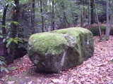
Nearby Images from Flickr

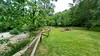
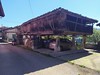
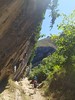
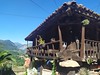

The above images may not be of the site on this page, but were taken nearby. They are loaded from Flickr so please click on them for image credits.
Click here to see more info for this site
Nearby sites
Click here to view sites on an interactive map of the areaKey: Red: member's photo, Blue: 3rd party photo, Yellow: other image, Green: no photo - please go there and take one, Grey: site destroyed
Download sites to:
KML (Google Earth)
GPX (GPS waypoints)
CSV (Garmin/Navman)
CSV (Excel)
To unlock full downloads you need to sign up as a Contributory Member. Otherwise downloads are limited to 50 sites.
Turn off the page maps and other distractions
Nearby sites listing. In the following links * = Image available
8.2km NNE 18° Cueva de la Güelga Cave or Rock Shelter
8.5km SW 214° El Castiellu (Tarañes) Castro or Chafurdão
9.0km NNE 18° Cueva de La Peña La Morca Cave or Rock Shelter
9.3km N 8° El Cuetu (El Llanu) Castro or Chafurdão
9.6km N 1° Dolmen de Santa Cruz de Cangas de Onís* Burial Chamber or Dolmen
10.0km NE 37° Dolmen de Abamia en Corao Burial Chamber or Dolmen
10.4km N 1° Cueva de los Azules Cave or Rock Shelter
10.5km NNE 15° Cueva del Buxu* Cave or Rock Shelter
14.6km NNW 339° El Picu Mancobiu Castro or Chafurdão
19.3km WSW 238° Colláu Castiellu Castro or Chafurdão
20.6km NW 310° Cueva del Sidrón* Cave or Rock Shelter
20.9km ENE 76° Abrigos de Berodia Cave or Rock Shelter
21.1km N 5° Cueva de Les Pedroses Cave or Rock Shelter
21.4km NNW 347° Picu el Castru (Prau) Castro or Chafurdão
21.4km NNE 18° Cueva de San Antonio Cave or Rock Shelter
21.7km ENE 75° Cueva de La Covaciella Cave or Rock Shelter
22.0km NNE 13° Cueva de La Lloseta Cave or Rock Shelter
22.2km NNE 14° Cuevona de Ardines Cave or Rock Shelter
22.2km ENE 77° Cueva de El Bosque Cave or Rock Shelter
22.2km NNE 14° Cueva de Tito Bustillo* Cave or Rock Shelter
22.5km S 181° La Uña menhir* Standing Stone (Menhir)
22.7km ENE 73° Abrigo de Soberaos Cave or Rock Shelter
24.5km E 85° Cueva del Bosque del Táranu Cave or Rock Shelter
24.7km ENE 78° Cueva de La Peña del Alba Cave or Rock Shelter
24.9km ENE 78° Abrigo de Falo Cave or Rock Shelter
View more nearby sites and additional images


 We would like to know more about this location. Please feel free to add a brief description and any relevant information in your own language.
 Wir möchten mehr über diese Stätte erfahren. Bitte zögern Sie nicht, eine kurze Beschreibung und relevante Informationen in Deutsch hinzuzufügen.
 Nous aimerions en savoir encore un peu sur les lieux. S'il vous plaît n'hesitez pas à ajouter une courte description et tous les renseignements pertinents dans votre propre langue.
 Quisieramos informarnos un poco más de las lugares. No dude en añadir una breve descripción y otros datos relevantes en su propio idioma.