 with our Megalithic Portal iPhone app")


<< Our Photo Pages >> Sailean Rubha Dubhairt (Loch Awe) Crannog - Crannog in Scotland in Argyll
Submitted by crannog on Friday, 27 January 2012 Page Views: 4198
Iron Age and Later PrehistorySite Name: Sailean Rubha Dubhairt (Loch Awe) Crannog Alternative Name: Loch Awe crannogCountry: Scotland
NOTE: This site is 1.023 km away from the location you searched for.
County: Argyll Type: Crannog
Nearest Town: Dalmally Nearest Village: Cladich
Map Ref: NN12152647
Latitude: 56.393041N Longitude: 5.044987W
Condition:
| 5 | Perfect |
| 4 | Almost Perfect |
| 3 | Reasonable but with some damage |
| 2 | Ruined but still recognisable as an ancient site |
| 1 | Pretty much destroyed, possibly visible as crop marks |
| 0 | No data. |
| -1 | Completely destroyed |
| 5 | Superb |
| 4 | Good |
| 3 | Ordinary |
| 2 | Not Good |
| 1 | Awful |
| 0 | No data. |
| 5 | Can be driven to, probably with disabled access |
| 4 | Short walk on a footpath |
| 3 | Requiring a bit more of a walk |
| 2 | A long walk |
| 1 | In the middle of nowhere, a nightmare to find |
| 0 | No data. |
| 5 | co-ordinates taken by GPS or official recorded co-ordinates |
| 4 | co-ordinates scaled from a detailed map |
| 3 | co-ordinates scaled from a bad map |
| 2 | co-ordinates of the nearest village |
| 1 | co-ordinates of the nearest town |
| 0 | no data |
Internal Links:
External Links:
 Crannog (PID:86334)")
T D McArdle and C M McArdle 1972; RCAHMS 1975.
You may be viewing yesterday's version of this page. To see the most up to date information please register for a free account.
 Crannog (PID:86361)")
 Crannog (PID:86335)")
Do not use the above information on other web sites or publications without permission of the contributor.
davidmorgan has found this location on Google Street View:
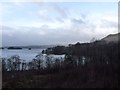
Nearby Images from Geograph Britain and Ireland:
©2022(licence)
©2009(licence)
©2006(licence)
©2012(licence)
©2006(licence)
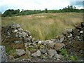
The above images may not be of the site on this page, they are loaded from Geograph.
Please Submit an Image of this site or go out and take one for us!
Click here to see more info for this site
Nearby sites
Key: Red: member's photo, Blue: 3rd party photo, Yellow: other image, Green: no photo - please go there and take one, Grey: site destroyed
Download sites to:
KML (Google Earth)
GPX (GPS waypoints)
CSV (Garmin/Navman)
CSV (Excel)
To unlock full downloads you need to sign up as a Contributory Member. Otherwise downloads are limited to 50 sites.
Turn off the page maps and other distractions
Nearby sites listing. In the following links * = Image available
4.6km SSW 204° Cladich* Chambered Cairn (NN101223)
4.6km ENE 75° St Conan's Well* Holy Well or Sacred Spring (NN167275)
7.3km WSW 244° Holy stone* Rock Art (NN0539923584)
9.2km SW 228° Port Sonachan* Chambered Cairn (NN050206)
11.1km WSW 238° Auchachenna* Chambered Cairn (NN02372106)
11.4km WNW 286° Dun Mhuirageul* Stone Fort or Dun (NN01323008)
11.9km SW 235° Rubha Barr Challtuinn* Cairn (NN021201)
11.9km WNW 291° Taynault (Lorn)* Standing Stone (Menhir) (NN01203115)
11.9km WNW 297° Dun Leigh* Stone Fort or Dun (NN01813243)
12.3km SSW 194° Drimfern Chambered Cairn (NN086147)
12.4km S 170° Dron Rocking Stone* Rock Art (NN137141)
12.5km WNW 289° Nelson's monument, Taynuilt* Standing Stone (Menhir) (NN00513109)
13.8km NNW 326° Muirheadstone* Natural Stone / Erratic / Other Natural Feature (NN050383)
14.8km SW 231° Carn Dubh, Crannog (Loch Awe)* Crannog (NN00131775)
17.1km WNW 294° Dun Chathach (Connel) Hillfort (NM96743401)
17.2km WNW 297° Ardchattan Priory* Sculptured Stone (NM971349)
17.6km S 186° Inveraray Castle* Standing Stone (Menhir) (NN0946809048)
18.2km W 272° Clachadow* Cairn (NM93932806)
18.7km SSE 167° Ardno* Cairn (NN15680808)
18.7km SW 220° Ardchonnell* Chambered Cairn (NM99321275)
19.3km W 273° Glenamacrie Dun* Stone Fort or Dun (NM92862836)
19.7km W 274° Clenamacrie Stone Row* Stone Row / Alignment (NM9251128550)
19.7km W 273° Glenamacrie Farm* Cairn (NM92452854)
20.1km W 274° Glenamachrie Cairn* Cairn (NM92132870)
20.1km WNW 297° Achnaba B* Cairn (NM94533626)
View more nearby sites and additional images


 We would like to know more about this location. Please feel free to add a brief description and any relevant information in your own language.
 Wir möchten mehr über diese Stätte erfahren. Bitte zögern Sie nicht, eine kurze Beschreibung und relevante Informationen in Deutsch hinzuzufügen.
 Nous aimerions en savoir encore un peu sur les lieux. S'il vous plaît n'hesitez pas à ajouter une courte description et tous les renseignements pertinents dans votre propre langue.
 Quisieramos informarnos un poco más de las lugares. No dude en añadir una breve descripción y otros datos relevantes en su propio idioma.