


<< Image Pages >> Mountstuart - Cist in Scotland in Isle of Bute
Submitted by durhamnature on Monday, 17 September 2012 Page Views: 3009
Neolithic and Bronze AgeSite Name: MountstuartCountry: Scotland
NOTE: This site is 0.339 km away from the location you searched for.
County: Isle of Bute Type: Cist
Map Ref: NS1048360922
Latitude: 55.804292N Longitude: 5.025435W
Condition:
| 5 | Perfect |
| 4 | Almost Perfect |
| 3 | Reasonable but with some damage |
| 2 | Ruined but still recognisable as an ancient site |
| 1 | Pretty much destroyed, possibly visible as crop marks |
| 0 | No data. |
| -1 | Completely destroyed |
| 5 | Superb |
| 4 | Good |
| 3 | Ordinary |
| 2 | Not Good |
| 1 | Awful |
| 0 | No data. |
| 5 | Can be driven to, probably with disabled access |
| 4 | Short walk on a footpath |
| 3 | Requiring a bit more of a walk |
| 2 | A long walk |
| 1 | In the middle of nowhere, a nightmare to find |
| 0 | No data. |
| 5 | co-ordinates taken by GPS or official recorded co-ordinates |
| 4 | co-ordinates scaled from a detailed map |
| 3 | co-ordinates scaled from a bad map |
| 2 | co-ordinates of the nearest village |
| 1 | co-ordinates of the nearest town |
| 0 | no data |
Internal Links:
External Links:
")
Mountstuart
Canmore site 40722
A cist, 120cm x 60cm x 48cm wide was found on 23rd March 1887, close beside the West Lodge, Mountstuart, above Kerrycroy Burn. In his letter describing the find, the Marquess of Bute says the cover-stone was found about 50cm below the surface of a mound hitherto thought natural, but which he now thought must be the remains of a tumulus. The cist contained a crouched burial with a possibly trepanned skull, a jet necklace and a food vessel (type C2), and what had possibly been a bronze ring and pin.
The finds were donated to the National Museum of Antiquities of Scotland in 1888.
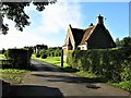
The cist was rediscovered as a result of information from Mr Billy Shields (Countryside Ranger), and it lies under a rhododendron bush on the E side of the estate road opposite Heather Lodge. The exposed capstone comprises a red sandstone slab that measures 1.5m by 1m and at least 17cm in thickness, and lies flush with the ground.
Text summarised from Canmore and other sources.
You may be viewing yesterday's version of this page. To see the most up to date information please register for a free account.
")
")
")
Do not use the above information on other web sites or publications without permission of the contributor.
Nearby Images from Geograph Britain and Ireland:
©2013(licence)
©2006(licence)
©2013(licence)
©2011(licence)
©2018(licence)
The above images may not be of the site on this page, they are loaded from Geograph.
Please Submit an Image of this site or go out and take one for us!
Click here to see more info for this site
Nearby sites
Key: Red: member's photo, Blue: 3rd party photo, Yellow: other image, Green: no photo - please go there and take one, Grey: site destroyed
Download sites to:
KML (Google Earth)
GPX (GPS waypoints)
CSV (Garmin/Navman)
CSV (Excel)
To unlock full downloads you need to sign up as a Contributory Member. Otherwise downloads are limited to 50 sites.
Turn off the page maps and other distractions
Nearby sites listing. In the following links * = Image available
3.2km NW 321° Townhead Neolithic Settlement Ancient Village or Settlement (NS086635)
3.4km NW 325° St Mary's Well (Rothsay)* Holy Well or Sacred Spring (NS0866763750)
3.9km W 280° Loch Dhu Crannog* Crannog (NS06646176)
3.9km WSW 248° Ambrisbeg Hill Cairn* Cairn (NS0677459579)
4.1km NW 310° Craigberoch* Standing Stone (Menhir) (NS0745263652)
4.3km W 263° Bicker's Houses* Chambered Cairn (NS062606)
4.6km WSW 247° Loch Quien Crannog* Crannog (NS06185929)
5.0km WSW 242° Scalpsie Barrow* Round Cairn (NS05955873)
5.4km SSW 192° Blackpark* Stone Circle (NS0916455666)
5.5km WSW 243° Scalpsie Dun* Stone Fort or Dun (NS05485866)
5.9km SSW 197° Stravanan Bay* Stone Row / Alignment (NS0846555361)
6.6km NW 318° Dun Burgidale* Stone Fort or Dun (NS0627766051)
6.8km W 274° St. Ninian's Bay* Standing Stones (NS037617)
7.4km ESE 120° Glaid Stone* Natural Stone / Erratic / Other Natural Feature (NS16765700)
7.5km S 185° St Blane's Well* Ancient Cross (NS0944253442)
7.6km S 185° St Blane's Chapel (Isle of Bute)* Ancient Cross (NS0949853405)
7.6km S 186° St Blane's Broch* Broch or Nuraghe (NS094534)
7.6km WNW 292° Castle Cree* Hillfort (NS0356464133)
7.8km NW 318° Acholter* Standing Stone (Menhir) (NS0546466961)
7.9km E 101° Tomont End Cairns, Isle of Great Cumbrae* Cairn (NS182591)
7.9km SSW 191° Dunagoil* Burial Chamber or Dolmen (NS08595322)
8.0km SSW 192° Dunagoil hillfort* Vitrified Fort (NS0847953127)
8.2km NW 306° St Colmac's A Stone Circle (NS040660)
8.3km NW 316° Colmac Bridge* Standing Stone (Menhir) (NS0491367160)
8.4km ESE 120° Gouklan Stone Standing Stone (Menhir) (NS17615641)
View more nearby sites and additional images


 We would like to know more about this location. Please feel free to add a brief description and any relevant information in your own language.
 Wir möchten mehr über diese Stätte erfahren. Bitte zögern Sie nicht, eine kurze Beschreibung und relevante Informationen in Deutsch hinzuzufügen.
 Nous aimerions en savoir encore un peu sur les lieux. S'il vous plaît n'hesitez pas à ajouter une courte description et tous les renseignements pertinents dans votre propre langue.
 Quisieramos informarnos un poco más de las lugares. No dude en añadir una breve descripción y otros datos relevantes en su propio idioma.