


<< Our Photo Pages >> Cill Donnain - Early Christian Sculptured Stone in Scotland in Highlands
Submitted by uisdean on Saturday, 21 April 2007 Page Views: 5829
Date UncertainSite Name: Cill DonnainCountry: Scotland
NOTE: This site is 12.404 km away from the location you searched for.
County: Highlands Type: Early Christian Sculptured Stone
Nearest Village: Invergarry
Map Ref: NH26580276
Latitude: 57.083076N Longitude: 4.863163W
Condition:
| 5 | Perfect |
| 4 | Almost Perfect |
| 3 | Reasonable but with some damage |
| 2 | Ruined but still recognisable as an ancient site |
| 1 | Pretty much destroyed, possibly visible as crop marks |
| 0 | No data. |
| -1 | Completely destroyed |
| 5 | Superb |
| 4 | Good |
| 3 | Ordinary |
| 2 | Not Good |
| 1 | Awful |
| 0 | No data. |
| 5 | Can be driven to, probably with disabled access |
| 4 | Short walk on a footpath |
| 3 | Requiring a bit more of a walk |
| 2 | A long walk |
| 1 | In the middle of nowhere, a nightmare to find |
| 0 | No data. |
| 5 | co-ordinates taken by GPS or official recorded co-ordinates |
| 4 | co-ordinates scaled from a detailed map |
| 3 | co-ordinates scaled from a bad map |
| 2 | co-ordinates of the nearest village |
| 1 | co-ordinates of the nearest town |
| 0 | no data |
Internal Links:
External Links:
")
St Donnan was a contemporary and friend of S. Columba and led a mission to Northern Scotland. He was martyred in his Church at Eigg, on the 17th April, 617 A.D. Tradition says that the day was being observed as Easter Sunday. (See "St Donnan the Great, and his muinntir." Rev Archibald Black Scott, DD. Published in the Transactions of the Scottish Ecclesiological Society, vol i, part iii. Aberdeen. 1906.)
You may be viewing yesterday's version of this page. To see the most up to date information please register for a free account.
")
")
Do not use the above information on other web sites or publications without permission of the contributor.
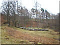
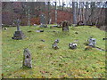
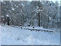
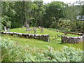
Nearby Images from Geograph Britain and Ireland:
©2009(licence)
©2007(licence)
©2009(licence)
©2009(licence)
©2009(licence)
The above images may not be of the site on this page, they are loaded from Geograph.
Please Submit an Image of this site or go out and take one for us!
Click here to see more info for this site
Nearby sites
Key: Red: member's photo, Blue: 3rd party photo, Yellow: other image, Green: no photo - please go there and take one, Grey: site destroyed
Download sites to:
KML (Google Earth)
GPX (GPS waypoints)
CSV (Garmin/Navman)
CSV (Excel)
To unlock full downloads you need to sign up as a Contributory Member. Otherwise downloads are limited to 50 sites.
Turn off the page maps and other distractions
Nearby sites listing. In the following links * = Image available
5.3km SE 131° Well of the Heads* Holy Well or Sacred Spring (NN3047399140)
14.0km NE 56° Cherry Island* Crannog (NH385102)
18.3km SSE 168° Glen Roy Chalice Stone* Rock Art (NN295847)
21.9km S 184° Killichonate Well* Holy Well or Sacred Spring (NN241810)
26.6km NE 43° Boulder near Creag Dhearg Natural Stone / Erratic / Other Natural Feature (NH456215)
28.8km N 9° Comar Wood* Stone Fort or Dun (NH3250931008)
29.4km NNE 19° Mony's Stone* Standing Stone (Menhir) (NH3751530072)
29.9km NNE 21° Corrimony* Clava Cairn (NH38303029)
30.0km NNE 21° Corrimony mound Artificial Mound (NH38383038)
30.7km NNE 21° Curadan's Well* Holy Well or Sacred Spring (NH38753102)
31.1km NNE 23° Buntait Cup Marked Stone* Rock Art (NH39793102)
31.7km NNW 327° Glen Cannich hut circles Ancient Village or Settlement (NH104301)
32.5km SSW 204° Samuel's Stone* Natural Stone / Erratic / Other Natural Feature (NN122735)
33.0km ESE 105° Dun da Lamh* Stone Fort or Dun (NN582929)
33.2km SSW 207° West Highland Museum* Museum (NN102738)
33.6km NNE 16° St Ignatius' Well* Holy Well or Sacred Spring (NH3709934761)
33.7km SSW 202° Dun Dige* Round Barrow(s) (NN126720)
34.3km WNW 288° Sheil Bridge* Ancient Village or Settlement (NG9438215035)
35.2km WNW 300° Lienassie* Rock Art (NG968217)
35.4km SSW 201° Dun Deardail* Vitrified Fort (NN127701)
36.3km WNW 294° Cill Fhearchair* Standing Stone (Menhir) (NG93871879)
36.4km WNW 298° Croe Bridge* Rock Art (NG95162141)
36.6km NE 36° Clachmhor, Culnakirk* Rock Art (NH49443145)
36.6km NE 36° Carn Daley* Clava Cairn (NH4945431458)
36.9km WNW 297° Tigh Geal* Rock Art (NG94452120)
View more nearby sites and additional images


 We would like to know more about this location. Please feel free to add a brief description and any relevant information in your own language.
 Wir möchten mehr über diese Stätte erfahren. Bitte zögern Sie nicht, eine kurze Beschreibung und relevante Informationen in Deutsch hinzuzufügen.
 Nous aimerions en savoir encore un peu sur les lieux. S'il vous plaît n'hesitez pas à ajouter une courte description et tous les renseignements pertinents dans votre propre langue.
 Quisieramos informarnos un poco más de las lugares. No dude en añadir una breve descripción y otros datos relevantes en su propio idioma.