


<< Text Pages >> Allt Raon A'Chroisg - Broch or Nuraghe in Scotland in Highlands
Submitted by SolarMegalith on Tuesday, 15 November 2011 Page Views: 2878
Iron Age and Later PrehistorySite Name: Allt Raon A'Chroisg Alternative Name: LeckmelmCountry: Scotland
NOTE: This site is 12.053 km away from the location you searched for.
County: Highlands Type: Broch or Nuraghe
Map Ref: NH16959008
Latitude: 57.862588N Longitude: 5.087231W
Condition:
| 5 | Perfect |
| 4 | Almost Perfect |
| 3 | Reasonable but with some damage |
| 2 | Ruined but still recognisable as an ancient site |
| 1 | Pretty much destroyed, possibly visible as crop marks |
| 0 | No data. |
| -1 | Completely destroyed |
| 5 | Superb |
| 4 | Good |
| 3 | Ordinary |
| 2 | Not Good |
| 1 | Awful |
| 0 | No data. |
| 5 | Can be driven to, probably with disabled access |
| 4 | Short walk on a footpath |
| 3 | Requiring a bit more of a walk |
| 2 | A long walk |
| 1 | In the middle of nowhere, a nightmare to find |
| 0 | No data. |
| 5 | co-ordinates taken by GPS or official recorded co-ordinates |
| 4 | co-ordinates scaled from a detailed map |
| 3 | co-ordinates scaled from a bad map |
| 2 | co-ordinates of the nearest village |
| 1 | co-ordinates of the nearest town |
| 0 | no data |
Internal Links:
External Links:
Broch in Highlands
Remains of a broch preserved as a rubby knoll. 19th century reports mention visible traces of masonry.
MacKie E.W. 2007. The Roundhouses, Brochs and Wheelhouses of Atlantic Scotland c. 700 BC – AD 500. Part 2 (I). Oxford: Archaeopress (p. 763).
You may be viewing yesterday's version of this page. To see the most up to date information please register for a free account.
Do not use the above information on other web sites or publications without permission of the contributor.
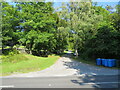
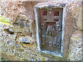
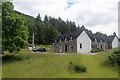
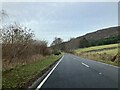
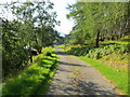
Nearby Images from Geograph Britain and Ireland:
©2021(licence)
©2022(licence)
©2014(licence)
©2023(licence)
©2021(licence)
The above images may not be of the site on this page, they are loaded from Geograph.
Please Submit an Image of this site or go out and take one for us!
Click here to see more info for this site
Nearby sites
Key: Red: member's photo, Blue: 3rd party photo, Yellow: other image, Green: no photo - please go there and take one, Grey: site destroyed
Download sites to:
KML (Google Earth)
GPX (GPS waypoints)
CSV (Garmin/Navman)
CSV (Excel)
To unlock full downloads you need to sign up as a Contributory Member. Otherwise downloads are limited to 50 sites.
Turn off the page maps and other distractions
Nearby sites listing. In the following links * = Image available
2.0km W 267° Dun An Ruigh Ruadh* Stone Fort or Dun (NH14939008)
3.0km WNW 292° Dun Lagaidh* Stone Fort or Dun (NH14239135)
6.7km SW 225° Bruthach Na Garbh Choille Ancient Village or Settlement (NH120856)
9.0km W 276° Beinn Ghobhlach Standing Stone* Standing Stone (Menhir) (NH080915)
11.5km NW 318° Isle Martin Cross Stone* Ancient Cross (NH096989)
11.9km N 355° An Dun, Strath Canaird Stone Fort or Dun (NC16530196)
12.2km NNW 329° Dun Canna* Stone Fort or Dun (NC11160080)
20.2km W 276° Stones near Mungasdale Natural Stone / Erratic / Other Natural Feature (NG9686393111)
21.9km NW 318° Achlochan Broch* Broch or Nuraghe (NC029069)
22.3km NE 34° Cnoc Chaornaidh South-east* Chambered Cairn (NC30320793)
22.4km NNE 33° Cnoc Chaornaidh Central* Cairn (NC30170818)
22.4km NNE 33° Cnoc Chaornaidh North West* Chambered Cairn (NC299084)
22.5km N 11° Glacbain* Cairn (NC2231112011)
22.9km NNE 21° Loch Borralan West* Chambered Cairn (NC2603811142)
23.0km NNE 22° Altnacealgach* Chambered Cairn (NC2652811033)
23.0km NNE 20° Loch Borralan Crannog* Crannog (NC25741138)
23.0km NNE 21° Loch Borralan East* Chambered Cairn (NC26241118)
23.1km NNE 15° Ledmore* Chambered Cairn (NC23821215)
23.9km NNE 13° Cam Loch A Cairn (NC23501312)
23.9km NNE 13° Cam Loch B Chambered Cairn (NC23431314)
25.3km NNE 16° Ledbeg River* Chambered Cairn (NC24891411)
26.5km ENE 63° Torr Chorcain Vitrified Fort (NC412009)
26.9km ENE 63° Langwell Farm Cairn (NC416011)
27.4km NNW 335° Inverpolly Stone Fort or Dun (NC06611551)
28.1km NW 325° Brae of Achnahaird Stone Fort or Dun (NC01701380)
View more nearby sites and additional images


 We would like to know more about this location. Please feel free to add a brief description and any relevant information in your own language.
 Wir möchten mehr über diese Stätte erfahren. Bitte zögern Sie nicht, eine kurze Beschreibung und relevante Informationen in Deutsch hinzuzufügen.
 Nous aimerions en savoir encore un peu sur les lieux. S'il vous plaît n'hesitez pas à ajouter une courte description et tous les renseignements pertinents dans votre propre langue.
 Quisieramos informarnos un poco más de las lugares. No dude en añadir una breve descripción y otros datos relevantes en su propio idioma.