

<< Text Pages >> St John's Well (Glenluce) - Holy Well or Sacred Spring in Scotland in Dumfries and Galloway
Submitted by Anne T on Wednesday, 13 July 2022 Page Views: 419
Springs and Holy WellsSite Name: St John's Well (Glenluce)Country: Scotland
NOTE: This site is 0.156 km away from the location you searched for.
County: Dumfries and Galloway Type: Holy Well or Sacred Spring
Nearest Town: Stranraer Nearest Village: Glenluce
Map Ref: NX19705752
Latitude: 54.879832N Longitude: 4.812006W
Condition:
| 5 | Perfect |
| 4 | Almost Perfect |
| 3 | Reasonable but with some damage |
| 2 | Ruined but still recognisable as an ancient site |
| 1 | Pretty much destroyed, possibly visible as crop marks |
| 0 | No data. |
| -1 | Completely destroyed |
| 5 | Superb |
| 4 | Good |
| 3 | Ordinary |
| 2 | Not Good |
| 1 | Awful |
| 0 | No data. |
| 5 | Can be driven to, probably with disabled access |
| 4 | Short walk on a footpath |
| 3 | Requiring a bit more of a walk |
| 2 | A long walk |
| 1 | In the middle of nowhere, a nightmare to find |
| 0 | No data. |
| 5 | co-ordinates taken by GPS or official recorded co-ordinates |
| 4 | co-ordinates scaled from a detailed map |
| 3 | co-ordinates scaled from a bad map |
| 2 | co-ordinates of the nearest village |
| 1 | co-ordinates of the nearest town |
| 0 | no data |
Be the first person to rate this site - see the 'Contribute!' box in the right hand menu.
Internal Links:
External Links:
Holy Well or Sacred Spring in Dumfries and Galloway
Canmore Site ID 61208, 'Glenluce, St John's Well' records this as a holy well.
An entry from 1968 says: "There is a well close to Old Luce Parish Church which some local people refer to as 'St John's Well', while others say it has no special name'. This was updated by R &F Morris in their 1982 publication "Scottish Healing Wells" to say "This well (unnamed) still sends its water from under an old coping stone".
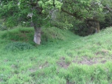
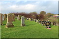
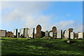
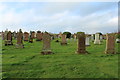
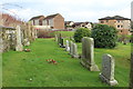
The location of the well is in the north-eastern corner of the burial ground in Glenluce, although the well (and its outflow) can't be seen on the Google Earth images (that I can make out).
Does anyone has any information about this well? Can you confirm its name and classification as a holy well? If so, do you know what its waters were used for - baptisms at the church, healing and/or restorative purposes?
Have you visited this site? Can you confirm the well still exists? Do you have any photographs you can add? Thank you.
You may be viewing yesterday's version of this page. To see the most up to date information please register for a free account.
Do not use the above information on other web sites or publications without permission of the contributor.
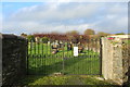
Nearby Images from Geograph Britain and Ireland:
©2017(licence)
©2017(licence)
©2017(licence)
©2017(licence)
©2017(licence)
The above images may not be of the site on this page, they are loaded from Geograph.
Please Submit an Image of this site or go out and take one for us!
Click here to see more info for this site
Nearby sites
Key: Red: member's photo, Blue: 3rd party photo, Yellow: other image, Green: no photo - please go there and take one, Grey: site destroyed
Download sites to:
KML (Google Earth)
GPX (GPS waypoints)
CSV (Garmin/Navman)
CSV (Excel)
To unlock full downloads you need to sign up as a Contributory Member. Otherwise downloads are limited to 50 sites.
Turn off the page maps and other distractions
Nearby sites listing. In the following links * = Image available
1.1km E 80° Lady Well (Glenluce) Holy Well or Sacred Spring (NX20845768)
1.6km NW 315° St Katherine's Well (Glenluce)* Holy Well or Sacred Spring (NX18605873)
2.2km ENE 69° Coffin Stone (Glenluce)* Natural Stone / Erratic / Other Natural Feature (NX2183158227)
3.1km N 358° Camrie Fell* Cairn (NX19736060)
3.1km NW 306° Airyhemming E* Cairn (NX17265943)
3.2km WNW 303° Airyhemming W* Cairn (NX17055938)
3.3km SSE 151° Chapel Well (St Fillan's) Holy Well or Sacred Spring (NX21195457)
3.4km NNW 341° Mid Gleniron Stony Mounds* Cairn (NX1869460787)
3.5km NNW 342° Mid Gleniron 3* Cairn (NX18766092)
3.5km NNW 342° Mid Gleniron 2* Chambered Cairn (NX18776093)
3.5km NNW 342° Mid Gleniron 5* Cairn (NX1871460929)
3.6km NNW 344° Mid Gleniron 4* Cairn (NX18856100)
3.6km NNE 23° Benlaight South* Cairn (NX21246078)
3.6km NNW 341° Mid Gleniron 1* Chambered Cairn (NX18676100)
3.7km NNE 30° Ballach-a-Heathry* Cairn (NX21656065)
3.7km NW 318° Craig Fell N* Cairn (NX17296039)
3.9km NNE 20° Benlaight North* Cairn (NX21196112)
4.2km ESE 118° Barnsallie Fell* Cairn (NX23355535)
4.3km SSE 162° Stairhaven Broch* Broch or Nuraghe (NX2090353351)
4.6km ESE 122° Whitefield Loch Crannog* Crannog (NX23555493)
4.7km W 267° Dunragit Cursus* Cursus (NX14975745)
4.9km W 273° Round Dounan* Hillfort (NX14835795)
4.9km W 260° Droughduil Mote* Timber Circle (NX14825687)
5.0km NNW 337° Cruise Back Fell* Hillfort (NX17946219)
5.3km NNW 337° Littlepark* Cairn (NX17836250)
View more nearby sites and additional images


 We would like to know more about this location. Please feel free to add a brief description and any relevant information in your own language.
 Wir möchten mehr über diese Stätte erfahren. Bitte zögern Sie nicht, eine kurze Beschreibung und relevante Informationen in Deutsch hinzuzufügen.
 Nous aimerions en savoir encore un peu sur les lieux. S'il vous plaît n'hesitez pas à ajouter une courte description et tous les renseignements pertinents dans votre propre langue.
 Quisieramos informarnos un poco más de las lugares. No dude en añadir una breve descripción y otros datos relevantes en su propio idioma.