


<< Our Photo Pages >> St Kew Cross - Ancient Cross in England in Cornwall
Submitted by theendlessbreeze on Tuesday, 16 May 2006 Page Views: 5047
Early Medieval (Dark Age)Site Name: St Kew CrossCountry: England
NOTE: This site is 0.158 km away from the location you searched for.
County: Cornwall Type: Ancient Cross
Nearest Town: Wadebridge Nearest Village: St Kew
Map Ref: SX021768
Latitude: 50.557369N Longitude: 4.795302W
Condition:
| 5 | Perfect |
| 4 | Almost Perfect |
| 3 | Reasonable but with some damage |
| 2 | Ruined but still recognisable as an ancient site |
| 1 | Pretty much destroyed, possibly visible as crop marks |
| 0 | No data. |
| -1 | Completely destroyed |
| 5 | Superb |
| 4 | Good |
| 3 | Ordinary |
| 2 | Not Good |
| 1 | Awful |
| 0 | No data. |
| 5 | Can be driven to, probably with disabled access |
| 4 | Short walk on a footpath |
| 3 | Requiring a bit more of a walk |
| 2 | A long walk |
| 1 | In the middle of nowhere, a nightmare to find |
| 0 | No data. |
| 5 | co-ordinates taken by GPS or official recorded co-ordinates |
| 4 | co-ordinates scaled from a detailed map |
| 3 | co-ordinates scaled from a bad map |
| 2 | co-ordinates of the nearest village |
| 1 | co-ordinates of the nearest town |
| 0 | no data |
Internal Links:
External Links:
I have visited· I would like to visit
lucasn visited - their rating: Cond: 5 Amb: 4 Access: 5
cazzyjane have visited here
")
I am unable to find any further information regarding this cross.
You may be viewing yesterday's version of this page. To see the most up to date information please register for a free account.
")
")
")
")
Do not use the above information on other web sites or publications without permission of the contributor.
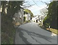
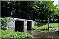
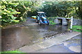
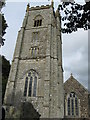
Nearby Images from Geograph Britain and Ireland:
©2013(licence)
©2011(licence)
©2015(licence)
©2010(licence)
©2010(licence)
The above images may not be of the site on this page, they are loaded from Geograph.
Please Submit an Image of this site or go out and take one for us!
Click here to see more info for this site
Nearby sites
Key: Red: member's photo, Blue: 3rd party photo, Yellow: other image, Green: no photo - please go there and take one, Grey: site destroyed
Download sites to:
KML (Google Earth)
GPX (GPS waypoints)
CSV (Garmin/Navman)
CSV (Excel)
To unlock full downloads you need to sign up as a Contributory Member. Otherwise downloads are limited to 50 sites.
Turn off the page maps and other distractions
Nearby sites listing. In the following links * = Image available
199m E 88° St Kew's Well* Holy Well or Sacred Spring (SX023768)
819m ENE 78° Trequite Cross* Ancient Cross (SX02917694)
3.2km S 182° Killibury Camp* Hillfort (SX01857365)
3.3km SSW 194° Three Hole Cross* Ancient Cross (SX01177367)
3.4km NNE 18° Tregeare Rounds* Hillfort (SX033800)
4.3km NW 311° St Endellion inscribed stone* Early Christian Sculptured Stone (SW98997972)
5.2km SE 129° Penwine Cross* Ancient Cross (SX0606473375)
5.2km SE 129° Longstone (St Mabyn)* Standing Stone (Menhir) (SX06067337)
5.2km SE 129° Longstone Cross* Ancient Cross (SX06077338)
5.3km E 85° St Tudy Barrow Round Barrow(s) (SX07407708)
5.3km E 80° Trevenning Cross* Ancient Cross (SX074775)
5.6km W 271° St Minver cross* Ancient Cross (SW965771)
5.7km NE 46° St Teath Cross* Ancient Cross (SX0637980639)
5.9km NW 315° Scarnor Point Tumuli* Barrow Cemetery (SW98058110)
5.9km ENE 76° Trevenning Early Christian Sculptured Stone (SX07937806)
6.0km ESE 123° Tregony Cross Early Christian Sculptured Stone (SX06997333)
6.2km SSE 160° Pencarrow Cross* Ancient Cross (SX040709)
6.3km ENE 69° St Michael's Well (Michaelstow)* Holy Well or Sacred Spring (SX081788)
6.3km ENE 68° Michaelstow Cross* Ancient Cross (SX081789)
6.6km ENE 78° Fentonadle* Holy Well or Sacred Spring (SX086779)
6.7km ENE 64° Helbury Castle* Hillfort (SX083795)
6.9km E 87° St Breward's Well* Holy Well or Sacred Spring (SX0906776916)
7.0km WNW 294° Lundy Hole* Natural Stone / Erratic / Other Natural Feature (SW95777985)
7.0km SSE 162° Pencarrow Rounds* Hillfort (SX03987001)
7.2km SSE 164° Prior's Cross* Ancient Cross (SX038698)
View more nearby sites and additional images


 We would like to know more about this location. Please feel free to add a brief description and any relevant information in your own language.
 Wir möchten mehr über diese Stätte erfahren. Bitte zögern Sie nicht, eine kurze Beschreibung und relevante Informationen in Deutsch hinzuzufügen.
 Nous aimerions en savoir encore un peu sur les lieux. S'il vous plaît n'hesitez pas à ajouter une courte description et tous les renseignements pertinents dans votre propre langue.
 Quisieramos informarnos un poco más de las lugares. No dude en añadir una breve descripción y otros datos relevantes en su propio idioma.