


<< Text Pages >> Garvock 1 - Rock Art in Scotland in Inverclyde
Submitted by AstroGeologist on Sunday, 26 May 2019 Page Views: 584
Rock ArtSite Name: Garvock 1 Alternative Name: Loch Thom (10)Country: Scotland County: Inverclyde Type: Rock Art
Nearest Town: Greenock Nearest Village: Inverkip
Map Ref: NS2569971200
Latitude: 55.902259N Longitude: 4.789596W
Condition:
| 5 | Perfect |
| 4 | Almost Perfect |
| 3 | Reasonable but with some damage |
| 2 | Ruined but still recognisable as an ancient site |
| 1 | Pretty much destroyed, possibly visible as crop marks |
| 0 | No data. |
| -1 | Completely destroyed |
| 5 | Superb |
| 4 | Good |
| 3 | Ordinary |
| 2 | Not Good |
| 1 | Awful |
| 0 | No data. |
| 5 | Can be driven to, probably with disabled access |
| 4 | Short walk on a footpath |
| 3 | Requiring a bit more of a walk |
| 2 | A long walk |
| 1 | In the middle of nowhere, a nightmare to find |
| 0 | No data. |
| 5 | co-ordinates taken by GPS or official recorded co-ordinates |
| 4 | co-ordinates scaled from a detailed map |
| 3 | co-ordinates scaled from a bad map |
| 2 | co-ordinates of the nearest village |
| 1 | co-ordinates of the nearest town |
| 0 | no data |
Internal Links:
External Links:
Rock Art in Inverclyde
A Cup Marked Rock on the lower slopes of Colaouse Hill in the Greenock Moors.
These Cup Marks were first documented in 1970 by "F. Newall". He recorded five Cup Marks on a 'Grey Gneiss' boulder, SE of a 'D-shaped Enclosure' on the SE bank of Loch Thom - in an area known as Garvock (This is one of two Cup Marked Rocks in the area) Located near a small Burn in the fields behind the now derelict Garvock Farm, the hillside looks across the Southern end of Loch Thom to Crawhin Hill and Cornalees.
The boulder bears five Cup Marks in the form of a Cross, with a single Cup forming the "shaft". The Cups are roughly 50mm in diameter and 12mm deep
The boulder is situated situated approximately 212m above sea level.
For more information : Canmore ID 41365
You may be viewing yesterday's version of this page. To see the most up to date information please register for a free account.
Do not use the above information on other web sites or publications without permission of the contributor.
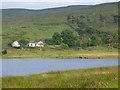
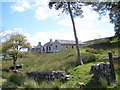
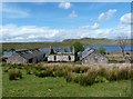
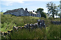
Nearby Images from Geograph Britain and Ireland:
©2009(licence)
©2011(licence)
©2017(licence)
©2012(licence)
©2013(licence)
The above images may not be of the site on this page, they are loaded from Geograph.
Please Submit an Image of this site or go out and take one for us!
Click here to see more info for this site
Nearby sites
Key: Red: member's photo, Blue: 3rd party photo, Yellow: other image, Green: no photo - please go there and take one, Grey: site destroyed
Download sites to:
KML (Google Earth)
GPX (GPS waypoints)
CSV (Garmin/Navman)
CSV (Excel)
To unlock full downloads you need to sign up as a Contributory Member. Otherwise downloads are limited to 50 sites.
Turn off the page maps and other distractions
Nearby sites listing. In the following links * = Image available
136m SSW 195° Garvock 2 Rock Art (NS2565971070)
520m NE 36° Goat Craig 7 Rock Art (NS26027161)
585m NE 34° Goat Craig 6 Rock Art (NS2605071670)
591m NE 35° Goat Craig 5 Rock Art (NS26067167)
592m NE 35° Goat Craig 8 Rock Art (NS2605971671)
593m NE 34° Goat Craig 3 Rock Art (NS26057168)
599m NE 35° Goat Craig 4 Rock Art (NS26067168)
600m NE 35° Goat Craig 9 Rock Art (NS2606271679)
648m NW 315° Crawhin Hill 1 Rock Art (NS2526071679)
694m ENE 63° Goat Craigs Cairn (Loch Thom) Cairn (NS2633371487)
702m SW 236° Crawhin Hill 2 Rock Art (NS25107083)
781m NE 48° Goat Craig 2 Rock Art (NS2630071701)
781m NE 45° Goat Craig 1 Rock Art (NS2627271734)
853m SE 126° Colaouse Hill Cup Marks Rock Art (NS26377067)
1.5km SE 125° Ouse Hill Cairn Cairn (NS2687770318)
1.6km NE 43° Gall Moss 2 Rock Art (NS2680972308)
1.7km ENE 57° Gall Moss 1 Rock Art (NS2720072101)
1.8km S 177° Garvock Hill Cairn B Cairn (NS2573369442)
1.8km SSE 165° Garvock Hill Cairn A Cairn (NS2609969405)
1.9km ENE 73° Darneme 3 Rock Art (NS27517166)
1.9km ENE 74° Darneme 2 Rock Art (NS2753471644)
1.9km NE 42° Gall Moss 3 Rock Art (NS2703472547)
1.9km S 177° Garvock Hill Cairn C Cairn (NS2571769290)
1.9km ENE 74° Darneme 1 Rock Art (NS27597166)
2.1km E 83° Gryffe Cairn B Cairn (NS2780071359)
View more nearby sites and additional images


 We would like to know more about this location. Please feel free to add a brief description and any relevant information in your own language.
 Wir möchten mehr über diese Stätte erfahren. Bitte zögern Sie nicht, eine kurze Beschreibung und relevante Informationen in Deutsch hinzuzufügen.
 Nous aimerions en savoir encore un peu sur les lieux. S'il vous plaît n'hesitez pas à ajouter une courte description et tous les renseignements pertinents dans votre propre langue.
 Quisieramos informarnos un poco más de las lugares. No dude en añadir una breve descripción y otros datos relevantes en su propio idioma.