


<< Our Photo Pages >> Castro de Las Cogotas - Castro or Chafurdão in Spain in Castilla y León
Submitted by Armand on Sunday, 12 December 2010 Page Views: 4405
Iron Age and Later PrehistorySite Name: Castro de Las CogotasCountry: Spain
NOTE: This site is 8.207 km away from the location you searched for.
Region: Castilla y León Type: Castro or Chafurdão
Nearest Town: Ávila Nearest Village: Cardeñosa
Latitude: 40.727069N Longitude: 4.700586W
Condition:
| 5 | Perfect |
| 4 | Almost Perfect |
| 3 | Reasonable but with some damage |
| 2 | Ruined but still recognisable as an ancient site |
| 1 | Pretty much destroyed, possibly visible as crop marks |
| 0 | No data. |
| -1 | Completely destroyed |
| 5 | Superb |
| 4 | Good |
| 3 | Ordinary |
| 2 | Not Good |
| 1 | Awful |
| 0 | No data. |
| 5 | Can be driven to, probably with disabled access |
| 4 | Short walk on a footpath |
| 3 | Requiring a bit more of a walk |
| 2 | A long walk |
| 1 | In the middle of nowhere, a nightmare to find |
| 0 | No data. |
| 5 | co-ordinates taken by GPS or official recorded co-ordinates |
| 4 | co-ordinates scaled from a detailed map |
| 3 | co-ordinates scaled from a bad map |
| 2 | co-ordinates of the nearest village |
| 1 | co-ordinates of the nearest town |
| 0 | no data |
Internal Links:
External Links:
I have visited· I would like to visit
Armand has visited here
")
You may be viewing yesterday's version of this page. To see the most up to date information please register for a free account.
")
")
")
Do not use the above information on other web sites or publications without permission of the contributor.
Nearby Images from Flickr
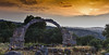
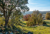
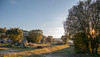
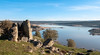
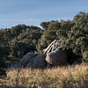
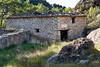
The above images may not be of the site on this page, but were taken nearby. They are loaded from Flickr so please click on them for image credits.
Click here to see more info for this site
Nearby sites
Click here to view sites on an interactive map of the areaKey: Red: member's photo, Blue: 3rd party photo, Yellow: other image, Green: no photo - please go there and take one, Grey: site destroyed
Download sites to:
KML (Google Earth)
GPX (GPS waypoints)
CSV (Garmin/Navman)
CSV (Excel)
To unlock full downloads you need to sign up as a Contributory Member. Otherwise downloads are limited to 50 sites.
Turn off the page maps and other distractions
Nearby sites listing. In the following links * = Image available
8.0km S 181° Vettonia Museum* Museum
10.2km SE 125° Prado de las Cruces dolmen* Burial Chamber or Dolmen
10.2km SE 126° Dolmen de Bernuy* Passage Grave
21.8km W 267° Castro de la Mesa de Miranda* Castro or Chafurdão
26.9km SW 215° Ulaca* Castro or Chafurdão
31.5km WSW 250° Necrópolis Medieval de La Coba Ancient Village or Settlement
36.3km SE 136° Necropolis Navaserrada Barrow Cemetery
50.6km NNE 33° Domingo García Rock Art
52.0km N 3° Museo de las Villas Romanas de Almenara-Puras Ancient Village or Settlement
52.2km SSE 155° Toros de Guisando* Sculptured Stone
55.2km SSE 159° Las Cogotas. Castro or Chafurdão
58.0km SSE 158° Piedra Escrita* Standing Stone (Menhir)
62.4km SW 221° Juego de los Bolos* Cairn
70.0km W 275° Éjeme: El Canturral Round Barrow(s)
70.7km W 278° Alba de Tormes: El Torrejón Burial Chamber or Dolmen
72.2km W 271° La Ermita Round Barrow(s)
78.4km WSW 258° El Teriñuelo Passage Grave
79.0km WSW 259° Dehesa de Aldeavieja Castro or Chafurdão
80.1km E 92° Yacimiento Arqueológico de Navalvillar Ancient Village or Settlement
81.8km W 260° Cabezuela de Salvatierra Round Barrow(s)
82.2km SW 223° El Raso de Candeleda Castro or Chafurdão
87.0km SE 133° Yacimiento Romano de Carranque Ancient Village or Settlement
89.6km ESE 112° Templo de Debod* Ancient Temple
91.9km ESE 111° Museo Arqueológico Nacional* Museum
93.5km W 281° Valmuza: Carrascalino Round Barrow(s)
View more nearby sites and additional images


 We would like to know more about this location. Please feel free to add a brief description and any relevant information in your own language.
 Wir möchten mehr über diese Stätte erfahren. Bitte zögern Sie nicht, eine kurze Beschreibung und relevante Informationen in Deutsch hinzuzufügen.
 Nous aimerions en savoir encore un peu sur les lieux. S'il vous plaît n'hesitez pas à ajouter une courte description et tous les renseignements pertinents dans votre propre langue.
 Quisieramos informarnos un poco más de las lugares. No dude en añadir una breve descripción y otros datos relevantes en su propio idioma.