


<< Our Photo Pages >> St Margaret's Well (Pembrokeshire) - Holy Well or Sacred Spring in Wales in Pembrokeshire
Submitted by coldrum on Tuesday, 12 January 2010 Page Views: 6023
Springs and Holy WellsSite Name: St Margaret's Well (Pembrokeshire) Alternative Name: Margaret's Well, TempletonCountry: Wales
NOTE: This site is 1.393 km away from the location you searched for.
County: Pembrokeshire Type: Holy Well or Sacred Spring
Map Ref: SN11101186
Latitude: 51.773451N Longitude: 4.739383W
Condition:
| 5 | Perfect |
| 4 | Almost Perfect |
| 3 | Reasonable but with some damage |
| 2 | Ruined but still recognisable as an ancient site |
| 1 | Pretty much destroyed, possibly visible as crop marks |
| 0 | No data. |
| -1 | Completely destroyed |
| 5 | Superb |
| 4 | Good |
| 3 | Ordinary |
| 2 | Not Good |
| 1 | Awful |
| 0 | No data. |
| 5 | Can be driven to, probably with disabled access |
| 4 | Short walk on a footpath |
| 3 | Requiring a bit more of a walk |
| 2 | A long walk |
| 1 | In the middle of nowhere, a nightmare to find |
| 0 | No data. |
| 5 | co-ordinates taken by GPS or official recorded co-ordinates |
| 4 | co-ordinates scaled from a detailed map |
| 3 | co-ordinates scaled from a bad map |
| 2 | co-ordinates of the nearest village |
| 1 | co-ordinates of the nearest town |
| 0 | no data |
Be the first person to rate this site - see the 'Contribute!' box in the right hand menu.
Internal Links:
External Links:
I have visited· I would like to visit
geoffstickland has visited here
 (PID:186376)")
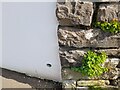
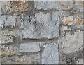
From Coflein: "Listed as one of 'The holy Wells of Wales', this is a stone well-chamber with a corbelled roof, set into a bank. Last reported dry (1975)."
You may be viewing yesterday's version of this page. To see the most up to date information please register for a free account.
 (PID:186377)")
Do not use the above information on other web sites or publications without permission of the contributor.
Nearby Images from Geograph Britain and Ireland:
©2022(licence)
©2011(licence)
©2015(licence)
©2022(licence)
©2015(licence)
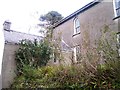
The above images may not be of the site on this page, they are loaded from Geograph.
Please Submit an Image of this site or go out and take one for us!
Click here to see more info for this site
Nearby sites
Key: Red: member's photo, Blue: 3rd party photo, Yellow: other image, Green: no photo - please go there and take one, Grey: site destroyed
Download sites to:
KML (Google Earth)
GPX (GPS waypoints)
CSV (Garmin/Navman)
CSV (Excel)
To unlock full downloads you need to sign up as a Contributory Member. Otherwise downloads are limited to 50 sites.
Turn off the page maps and other distractions
Nearby sites listing. In the following links * = Image available
392m SE 146° Templeton Cross* Early Christian Sculptured Stone (SN1131011528)
4.1km E 93° Belle Vue* Standing Stone (Menhir) (SN15211146)
4.2km ENE 57° Llan Chambered Tomb* Chambered Tomb (SN147140)
4.3km ESE 123° The Longstone (Pembrokeshire)* Standing Stone (Menhir) (SN146094)
4.3km ESE 114° Longstone Camp* Hillfort (SN14990996)
4.5km NNE 30° Ffynnon Dewi (Llanddewi Velfrey) Holy Well or Sacred Spring (SN13461565)
4.6km E 93° Newhouse Barrows* Barrow Cemetery (SN15711141)
4.7km WNW 294° Foel Eryr Hut Circle* Ancient Village or Settlement (SN069139)
5.0km W 272° Cott Lane* Modern Stone Circle etc (SN0610312254)
5.1km NNE 32° Caerau Gaer* Hillfort (SN14001609)
5.3km NE 36° Llanddewigaer* Hillfort (SN144160)
6.6km E 84° Crug Swllt* Round Barrow(s) (SN17711231)
7.1km SE 134° Amroth Submerged Forest Not Known (by us) (SN16070678)
7.1km SE 134° Amroth Submerged Forest Not Known (by us) (SN16070678)
7.6km NNE 27° Triangle of stones near Llanddewi Velfrey* Modern Stone Circle etc (SN1477418468)
8.3km E 97° Parc-y-Twmp* Round Barrow(s) (SN19341051)
9.2km SSW 208° Cuckoo Stones* Chambered Tomb (SN065039)
9.3km ESE 114° Top Castle, Eglwyscummin* Hillfort (SN19460772)
9.4km N 7° Llandissilio Cursus Cursus (SN12552120)
9.5km NE 42° St Canna's Stone (Llangan)* Natural Stone / Erratic / Other Natural Feature (SN17701874)
9.6km N 2° Llandissilio Cursus Cursus (SN11852146)
9.9km N 349° Brechfa South Ancient Village or Settlement (SN0962821643)
10.4km SW 216° Carew High Cross* Ancient Cross (SN0467503707)
10.4km NE 38° Henllan Amgoed Inscribed Stone* Standing Stone (Menhir) (SN1776719862)
10.4km ESE 103° Marros settlement* Ancient Village or Settlement (SN212091)
View more nearby sites and additional images


 We would like to know more about this location. Please feel free to add a brief description and any relevant information in your own language.
 Wir möchten mehr über diese Stätte erfahren. Bitte zögern Sie nicht, eine kurze Beschreibung und relevante Informationen in Deutsch hinzuzufügen.
 Nous aimerions en savoir encore un peu sur les lieux. S'il vous plaît n'hesitez pas à ajouter une courte description et tous les renseignements pertinents dans votre propre langue.
 Quisieramos informarnos un poco más de las lugares. No dude en añadir una breve descripción y otros datos relevantes en su propio idioma.