


<< Our Photo Pages >> Mull of Sinniness - Standing Stone (Menhir) in Scotland in Dumfries and Galloway
Submitted by cosmic on Saturday, 09 October 2004 Page Views: 4961
Neolithic and Bronze AgeSite Name: Mull of Sinniness Alternative Name: Auchenmalg; Longforth; Auchenmalg BridgeCountry: Scotland
NOTE: This site is 0.507 km away from the location you searched for.
County: Dumfries and Galloway Type: Standing Stone (Menhir)
Nearest Town: Stranraer Nearest Village: Auchenmalg
Map Ref: NX23095220
Latitude: 54.833291N Longitude: 4.755972W
Condition:
| 5 | Perfect |
| 4 | Almost Perfect |
| 3 | Reasonable but with some damage |
| 2 | Ruined but still recognisable as an ancient site |
| 1 | Pretty much destroyed, possibly visible as crop marks |
| 0 | No data. |
| -1 | Completely destroyed |
| 5 | Superb |
| 4 | Good |
| 3 | Ordinary |
| 2 | Not Good |
| 1 | Awful |
| 0 | No data. |
| 5 | Can be driven to, probably with disabled access |
| 4 | Short walk on a footpath |
| 3 | Requiring a bit more of a walk |
| 2 | A long walk |
| 1 | In the middle of nowhere, a nightmare to find |
| 0 | No data. |
| 5 | co-ordinates taken by GPS or official recorded co-ordinates |
| 4 | co-ordinates scaled from a detailed map |
| 3 | co-ordinates scaled from a bad map |
| 2 | co-ordinates of the nearest village |
| 1 | co-ordinates of the nearest town |
| 0 | no data |
Internal Links:
External Links:
")
For more information on this prehistoric standing stone see Canmore ID 62246 which tell us: "A tapered standing stone measuring 1.2m by 1.0m by 2.2m high."
You may be viewing yesterday's version of this page. To see the most up to date information please register for a free account.
")
")
")
")
Do not use the above information on other web sites or publications without permission of the contributor.
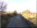
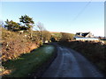
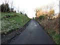
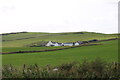
Nearby Images from Geograph Britain and Ireland:
©2012(licence)
©2012(licence)
©2012(licence)
©2021(licence)
©2012(licence)
The above images may not be of the site on this page, they are loaded from Geograph.
Please Submit an Image of this site or go out and take one for us!
Click here to see more info for this site
Nearby sites
Key: Red: member's photo, Blue: 3rd party photo, Yellow: other image, Green: no photo - please go there and take one, Grey: site destroyed
Download sites to:
KML (Google Earth)
GPX (GPS waypoints)
CSV (Garmin/Navman)
CSV (Excel)
To unlock full downloads you need to sign up as a Contributory Member. Otherwise downloads are limited to 50 sites.
Turn off the page maps and other distractions
Nearby sites listing. In the following links * = Image available
1.4km NNE 21° Culquhasen* Cairn (NX23655350)
1.5km ENE 68° Steeps Park Stone Circle (NX245527)
1.5km W 267° Laigh Sinniness* Promontory Fort / Cliff Castle (NX21575219)
1.5km ENE 65° Gillespie Stone Standing Stone (Menhir) (NX245528)
2.4km E 82° High Gillespie* Passage Grave (NX25525245)
2.5km WNW 296° Stairhaven Broch* Broch or Nuraghe (NX2090353351)
2.6km NE 49° Culroy Farm Cairn* Cairn (NX25165383)
2.7km NE 34° Machermore Cairns* Cairn (NX247544)
2.8km N 7° Whitefield Loch Crannog* Crannog (NX23555493)
2.8km NE 37° Culroy Cairn 1* Cairn (NX24905438)
3.0km NW 319° Chapel Well (St Fillan's) Holy Well or Sacred Spring (NX21195457)
3.1km NE 43° Culroy White Cairn* Cairn (NX25285435)
3.2km N 2° Barnsallie Fell* Cairn (NX23355535)
3.3km E 97° Craignarget Hill* Cairn (NX26365166)
3.6km ESE 107° Green House Bridge Cairn* Cairn (NX26485105)
3.9km ESE 106° Cairn Buy* Cairn (NX26835094)
4.3km NNE 32° Knock Hill Fort* Hillfort (NX25505577)
5.7km ESE 122° Chapel Finian Well* Holy Well or Sacred Spring (NX27834892)
5.9km NNW 335° Lady Well (Glenluce) Holy Well or Sacred Spring (NX20845768)
6.1km ENE 64° Castle Loch* Cairn (NX28695460)
6.1km NNW 346° Coffin Stone (Glenluce)* Natural Stone / Erratic / Other Natural Feature (NX2183158227)
6.3km NW 325° St John's Well (Glenluce) Holy Well or Sacred Spring (NX19705752)
6.5km ESE 117° Corwall S* Cairn (NX28774905)
6.6km ESE 111° Corwall E* Cairn (NX29204953)
6.7km ESE 105° High Moor Hut Circle* Misc. Earthwork (NX29485024)
View more nearby sites and additional images


 We would like to know more about this location. Please feel free to add a brief description and any relevant information in your own language.
 Wir möchten mehr über diese Stätte erfahren. Bitte zögern Sie nicht, eine kurze Beschreibung und relevante Informationen in Deutsch hinzuzufügen.
 Nous aimerions en savoir encore un peu sur les lieux. S'il vous plaît n'hesitez pas à ajouter une courte description et tous les renseignements pertinents dans votre propre langue.
 Quisieramos informarnos un poco más de las lugares. No dude en añadir una breve descripción y otros datos relevantes en su propio idioma.