

<< Text Pages >> Ardeer Sands - Ancient Village or Settlement in Scotland in North Ayrshire
Submitted by AstroGeologist on Monday, 20 May 2019 Page Views: 1325
Multi-periodSite Name: Ardeer Sands Alternative Name: Ardeer Neolithic Settlement; Stevenston SandsCountry: Scotland
NOTE: This site is 0.38 km away from the location you searched for.
County: North Ayrshire Type: Ancient Village or Settlement
Nearest Town: Stevenston Nearest Village: Dreghorn
Map Ref: NS2857740455
Latitude: 55.627363N Longitude: 4.724297W
Condition:
| 5 | Perfect |
| 4 | Almost Perfect |
| 3 | Reasonable but with some damage |
| 2 | Ruined but still recognisable as an ancient site |
| 1 | Pretty much destroyed, possibly visible as crop marks |
| 0 | No data. |
| -1 | Completely destroyed |
| 5 | Superb |
| 4 | Good |
| 3 | Ordinary |
| 2 | Not Good |
| 1 | Awful |
| 0 | No data. |
| 5 | Can be driven to, probably with disabled access |
| 4 | Short walk on a footpath |
| 3 | Requiring a bit more of a walk |
| 2 | A long walk |
| 1 | In the middle of nowhere, a nightmare to find |
| 0 | No data. |
| 5 | co-ordinates taken by GPS or official recorded co-ordinates |
| 4 | co-ordinates scaled from a detailed map |
| 3 | co-ordinates scaled from a bad map |
| 2 | co-ordinates of the nearest village |
| 1 | co-ordinates of the nearest town |
| 0 | no data |
Internal Links:
External Links:
Ancient Village or Settlement in North Ayrshire
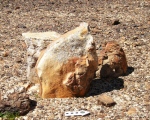
A Neolithic Settlement along the Ardeer Peninsula on the Ayrshire coast.
Until about 350 years ago Ardeer was an island, with the coastline being further inland than it is at present. Now surrounded by the River Garnock to the East, River Irvine to the South and Irvine Bay to the West, it once had a sea channel to the North. NEOLITHIC FINDS from the sand dunes of Ardeer include 54 Flint Arrowheads (48 of which were barbed) a Flint Spearhead, 24 Knives, 167 Scrapers, a Tardenosian type of Notched Tool, a Stone Hammer and a pierced Shale Disc. BRONZE AGE FINDS include a Socketed Gouge, part of a Bronze Age Bead, a Bronze Pin, a flat dark Blue Glass Bead, Shale Rings & Armlets. Most of these finds were by "John Smith" around the time of 1895 (An Iron Age Sword and Viking Silver were also found on the Peninsula)
During a wild storm just over a century ago Misk Knowes Cairn was revealed when high winds caused the drifting of sand to uncover an oval Cairn. Made from about eighty water-rolled boulders, it's size was recorded as being 4.5m x 3m, and 1m high in the centre.
When "Ludovic McLellan Mann" excavated the Cairn in 1906 he found the remains of at least sixteen bucket-shaped Cinerary Urns, with four of them having been sealed with plugs of half-baked or unbaked clay. As well as having Cremations inside them some of the Urns contained White Quartz Pebbles, with one in particular having six small White Quartz Pebbles and a Reddish Quartz Pebble the size of a hen's egg embedded in the soft clay cover which sealed it. One Urn contained traces of thin Gold Leaf, two Segmented Beads, and one star-shaped Faience Bead. Also found was a Cremation covered by soft clay, but not accompanied by an Urn.
The site of the Cairn was unfortunately destroyed sometime around the mid 1930's when the area was built over and industrialised.
At 22km long Irvine Bay is famous for its long sweeping sandy beaches, and views across to the Island of Arran 25km to the West. The Ardeer Sands Settlement & the Shewalton Moor Settlement are now separated by a narrow stretch of shallow water were the River Irvine enters the sea, but at one time may have been connected, as both the River Irvine and the River Garnock have both changed course at some point over the last 500~1,000 years.
For more information : Canmore ID 41066
You may be viewing yesterday's version of this page. To see the most up to date information please register for a free account.
Do not use the above information on other web sites or publications without permission of the contributor.
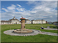
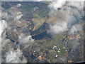
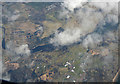
Nearby Images from Geograph Britain and Ireland:
©2009(licence)
©2019(licence)
©2019(licence)
©2014(licence)
©2018(licence)
The above images may not be of the site on this page, they are loaded from Geograph.
Please Submit an Image of this site or go out and take one for us!
Click here to see more info for this site
Nearby sites
Key: Red: member's photo, Blue: 3rd party photo, Yellow: other image, Green: no photo - please go there and take one, Grey: site destroyed
Download sites to:
KML (Google Earth)
GPX (GPS waypoints)
CSV (Garmin/Navman)
CSV (Excel)
To unlock full downloads you need to sign up as a Contributory Member. Otherwise downloads are limited to 50 sites.
Turn off the page maps and other distractions
Nearby sites listing. In the following links * = Image available
1.8km NNW 335° Dubbs Cist Cist (NS27884208)
1.8km NNE 21° Todhill Crannog Crannog (NS2930042101)
2.1km NW 313° Stevenston Souterrain Souterrain (Fogou, Earth House) (NS27114193)
2.8km NE 46° Dirrans burial* Cist (NS30684230)
3.8km ESE 115° Grannie Stane* Natural Stone / Erratic / Other Natural Feature (NS3196038711)
4.0km NNW 343° Ashgrove Loch Crannog* Crannog (NS27594431)
4.1km ENE 62° Eglinton Park Ancient Village or Settlement (NS3229642217)
4.5km NNW 328° Diddup Hillfort Hillfort (NS2636344331)
4.9km SE 133° Shewalton Moor Ancient Village or Settlement (NS320370)
5.5km ENE 77° Sourlie Hill Modern Stone Circle etc (NS3398041490)
5.7km NW 323° Knockrivoch Mount Barrow Cemetery (NS25344510)
5.7km WNW 285° Ardrossan Shell Mound* Artificial Mound (NS23134218)
6.1km E 85° Lawthorn Mount Barrow Cemetery (NS34654078)
6.9km ESE 106° Dreghorn Neolithic Village Ancient Village or Settlement (NS35183830)
7.4km NNW 329° Blackshaw Moor Stone Circle (NS250470)
7.7km NNE 22° Cleaves Cove* Cave or Rock Shelter (NS31774744)
8.1km ESE 114° Drybridge Neolithic Village Ancient Village or Settlement (NS3582336852)
8.1km ESE 114° Dundonald Cursus Cursus (NS35893690)
8.3km ESE 116° Drybridge* Standing Stone (Menhir) (NS35923644)
9.1km N 2° Courthill Cairn* Round Barrow(s) (NS29244958)
9.6km NW 323° Blackshaw Rock Art* Rock Art (NS23104834)
9.7km SE 132° Kemp Law* Stone Fort or Dun (NS35583364)
9.8km SE 125° Dun Donald Hillfort (NS36363451)
10.6km NW 307° Seamill Fort* Promontory Fort / Cliff Castle (NS20314715)
10.6km SE 134° Wardlaw Hill Fort Hillfort (NS35923276)
View more nearby sites and additional images


 We would like to know more about this location. Please feel free to add a brief description and any relevant information in your own language.
 Wir möchten mehr über diese Stätte erfahren. Bitte zögern Sie nicht, eine kurze Beschreibung und relevante Informationen in Deutsch hinzuzufügen.
 Nous aimerions en savoir encore un peu sur les lieux. S'il vous plaît n'hesitez pas à ajouter une courte description et tous les renseignements pertinents dans votre propre langue.
 Quisieramos informarnos un poco más de las lugares. No dude en añadir una breve descripción y otros datos relevantes en su propio idioma.