


<< Our Photo Pages >> St John's Well (Tenby) - Holy Well or Sacred Spring in Wales in Pembrokeshire
Submitted by HOLYWELl on Sunday, 31 August 2008 Page Views: 6083
Springs and Holy WellsSite Name: St John's Well (Tenby)Country: Wales
NOTE: This site is 0.241 km away from the location you searched for.
County: Pembrokeshire Type: Holy Well or Sacred Spring
Nearest Town: Tenby
Map Ref: SN130008
Latitude: 51.674759N Longitude: 4.705936W
Condition:
| 5 | Perfect |
| 4 | Almost Perfect |
| 3 | Reasonable but with some damage |
| 2 | Ruined but still recognisable as an ancient site |
| 1 | Pretty much destroyed, possibly visible as crop marks |
| 0 | No data. |
| -1 | Completely destroyed |
| 5 | Superb |
| 4 | Good |
| 3 | Ordinary |
| 2 | Not Good |
| 1 | Awful |
| 0 | No data. |
| 5 | Can be driven to, probably with disabled access |
| 4 | Short walk on a footpath |
| 3 | Requiring a bit more of a walk |
| 2 | A long walk |
| 1 | In the middle of nowhere, a nightmare to find |
| 0 | No data. |
| 5 | co-ordinates taken by GPS or official recorded co-ordinates |
| 4 | co-ordinates scaled from a detailed map |
| 3 | co-ordinates scaled from a bad map |
| 2 | co-ordinates of the nearest village |
| 1 | co-ordinates of the nearest town |
| 0 | no data |
Internal Links:
External Links:
 (PID:41935)")
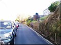
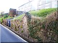
Once the main source of water for the town, the well is now blocked up although the spring still arises beneath it and flows down the lane. It is just on the road side with a plaque over the well arch which records the facts above. It is found down St. John's Hill Lane.
You may be viewing yesterday's version of this page. To see the most up to date information please register for a free account.
 (PID:41936)")
Do not use the above information on other web sites or publications without permission of the contributor.
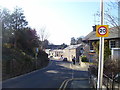
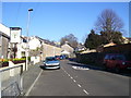
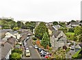
Nearby Images from Geograph Britain and Ireland:
©2016(licence)
©2016(licence)
©2017(licence)
©2016(licence)
©2016(licence)
The above images may not be of the site on this page, they are loaded from Geograph.
Please Submit an Image of this site or go out and take one for us!
Click here to see more info for this site
Nearby sites
Key: Red: member's photo, Blue: 3rd party photo, Yellow: other image, Green: no photo - please go there and take one, Grey: site destroyed
Download sites to:
KML (Google Earth)
GPX (GPS waypoints)
CSV (Garmin/Navman)
CSV (Excel)
To unlock full downloads you need to sign up as a Contributory Member. Otherwise downloads are limited to 50 sites.
Turn off the page maps and other distractions
Nearby sites listing. In the following links * = Image available
669m ESE 114° Tenby Museum Museum (SN136005)
1.9km WSW 253° Hoyle's Mouth Cave* Cave or Rock Shelter (SN11190032)
2.0km WSW 243° Longberry Bank Cave* Cave or Rock Shelter (SS11179996)
2.0km SW 215° Penally Celtic Cross Ancient Cross (SS1177799180)
2.1km SW 217° St Deiniols Well* Holy Well or Sacred Spring (SS117992)
2.1km W 276° Gumfreston Holy Wells* Holy Well or Sacred Spring (SN1093001084)
2.9km SSW 210° Giltar cliff barrow* Round Barrow(s) (SS1145298352)
3.5km S 191° St Margaret's Island* Ancient Village or Settlement (SS12209736)
3.6km S 177° Eel Point* Cave or Rock Shelter (SS13049723)
4.0km SSE 158° Potter's Cave Cave or Rock Shelter (SS14369707)
4.1km SSE 156° Nanna's Cave* Cave or Rock Shelter (SS14589697)
4.3km SW 234° Lydstep Submerged Forest and Mesolithic Footprints Not Known (by us) (SS0944998404)
4.3km SSE 155° Skull Cave Cave or Rock Shelter (SS14679680)
4.6km S 175° West Beacon Barrow Round Barrow(s) (SS13239623)
4.6km SSE 154° Daylight Rock Mesolithic Site Cave or Rock Shelter (SS149966)
4.6km SSE 164° Caldey Ogham Stone* Early Christian Sculptured Stone (SS14089628)
5.7km W 261° Norchard Beacon* Barrow Cemetery (SN07310008)
6.7km NNE 25° Amroth Submerged Forest Not Known (by us) (SN16070678)
6.7km NNE 25° Amroth Submerged Forest Not Known (by us) (SN16070678)
7.2km WNW 293° Cuckoo Stones* Chambered Tomb (SN065039)
7.9km WSW 241° King's Quoit, Manorbier* Burial Chamber or Dolmen (SS05939728)
8.7km N 8° The Longstone (Pembrokeshire)* Standing Stone (Menhir) (SN146094)
8.8km WNW 287° Carew High Cross* Ancient Cross (SN0467503707)
9.4km N 10° Longstone Camp* Hillfort (SN14990996)
9.5km NE 41° Top Castle, Eglwyscummin* Hillfort (SN19460772)
View more nearby sites and additional images


 We would like to know more about this location. Please feel free to add a brief description and any relevant information in your own language.
 Wir möchten mehr über diese Stätte erfahren. Bitte zögern Sie nicht, eine kurze Beschreibung und relevante Informationen in Deutsch hinzuzufügen.
 Nous aimerions en savoir encore un peu sur les lieux. S'il vous plaît n'hesitez pas à ajouter une courte description et tous les renseignements pertinents dans votre propre langue.
 Quisieramos informarnos un poco más de las lugares. No dude en añadir una breve descripción y otros datos relevantes en su propio idioma.