
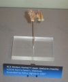

<< Our Photo Pages >> Menhir de Croaz Ambich - Standing Stone (Menhir) in France in Bretagne:Finistère (29)
Submitted by Regina on Tuesday, 01 October 2019 Page Views: 1896
Neolithic and Bronze AgeSite Name: Menhir de Croaz AmbichCountry: France
NOTE: This site is 0.126 km away from the location you searched for.
Département: Bretagne:Finistère (29) Type: Standing Stone (Menhir)
Nearest Town: Brest Nearest Village: Lampaul-Ploudalmézeau
Latitude: 48.561640N Longitude: 4.652396W
Condition:
| 5 | Perfect |
| 4 | Almost Perfect |
| 3 | Reasonable but with some damage |
| 2 | Ruined but still recognisable as an ancient site |
| 1 | Pretty much destroyed, possibly visible as crop marks |
| 0 | No data. |
| -1 | Completely destroyed |
| 5 | Superb |
| 4 | Good |
| 3 | Ordinary |
| 2 | Not Good |
| 1 | Awful |
| 0 | No data. |
| 5 | Can be driven to, probably with disabled access |
| 4 | Short walk on a footpath |
| 3 | Requiring a bit more of a walk |
| 2 | A long walk |
| 1 | In the middle of nowhere, a nightmare to find |
| 0 | No data. |
| 5 | co-ordinates taken by GPS or official recorded co-ordinates |
| 4 | co-ordinates scaled from a detailed map |
| 3 | co-ordinates scaled from a bad map |
| 2 | co-ordinates of the nearest village |
| 1 | co-ordinates of the nearest town |
| 0 | no data |
Internal Links:
External Links:
")
More Information and Pictures:
t4t35.fr
Page originally by Holger Rix
Note: It's right in the middle of the junction! See the Street View lower down our page
You may be viewing yesterday's version of this page. To see the most up to date information please register for a free account.
")
Do not use the above information on other web sites or publications without permission of the contributor.
Nearby Images from Flickr
The above images may not be of the site on this page, but were taken nearby. They are loaded from Flickr so please click on them for image credits.
Click here to see more info for this site
Nearby sites
Click here to view sites on an interactive map of the areaKey: Red: member's photo, Blue: 3rd party photo, Yellow: other image, Green: no photo - please go there and take one, Grey: site destroyed
Download sites to:
KML (Google Earth)
GPX (GPS waypoints)
CSV (Garmin/Navman)
CSV (Excel)
To unlock full downloads you need to sign up as a Contributory Member. Otherwise downloads are limited to 50 sites.
Turn off the page maps and other distractions
Nearby sites listing. In the following links * = Image available
864m N 10° Allée Couverte Le Ribl* Passage Grave
915m ENE 65° Menhir de Poullédan* Standing Stone (Menhir)
1.4km WSW 255° Menhir de Prat-Leach* Standing Stone (Menhir)
2.6km E 97° Menhir de Kerouant* Standing Stone (Menhir)
3.3km WNW 297° Île Carn cairn* Chambered Cairn
3.3km WNW 296° Ile Carn menhir* Standing Stone (Menhir)
3.3km WSW 246° Alignement de Kerhoanoc* Stone Row / Alignment
3.7km WSW 256° Menhir de la Pointe de Guilligui B* Standing Stone (Menhir)
3.7km WSW 256° Menhir du Guilligui* Standing Stone (Menhir)
3.8km WSW 258° Pointe de Guilligui allée couverte* Passage Grave
4.4km NNE 17° Menhir de Guenioc Standing Stone (Menhir)
4.5km NNE 16° Ile Guénioc* Chambered Tomb
4.5km NE 40° Ilot Roc'h-Avel* Chambered Cairn
4.7km W 267° Menhir de Beg-ar-Galeti* Standing Stone (Menhir)
4.9km NNE 26° Île Tariec menhir* Standing Stone (Menhir)
4.9km NNE 26° Île Tariec cairn* Cairn
4.9km ESE 103° Lannoulouarn Alignement de Menhirs* Stone Row / Alignment
5.2km NNE 31° Tumulus de l'Île Beg Hamon Chambered Cairn
5.7km SW 219° Menhir De Kerougana* Standing Stone (Menhir)
5.8km SSE 162° Menhir de Kervignen* Standing Stone (Menhir)
6.0km NE 41° Dolmen de Vourch* Burial Chamber or Dolmen
6.0km WSW 256° Menhir de Foshuel* Standing Stone (Menhir)
6.2km WSW 256° Menhirs du Lavoir de Saint-Samson Standing Stone (Menhir)
6.2km SSW 200° Tumulus du Bourg à Rubrat Huella Cairn
6.3km WSW 258° St Samson's Well (Landunvez)* Holy Well or Sacred Spring
View more nearby sites and additional images


 We would like to know more about this location. Please feel free to add a brief description and any relevant information in your own language.
 Wir möchten mehr über diese Stätte erfahren. Bitte zögern Sie nicht, eine kurze Beschreibung und relevante Informationen in Deutsch hinzuzufügen.
 Nous aimerions en savoir encore un peu sur les lieux. S'il vous plaît n'hesitez pas à ajouter une courte description et tous les renseignements pertinents dans votre propre langue.
 Quisieramos informarnos un poco más de las lugares. No dude en añadir una breve descripción y otros datos relevantes en su propio idioma.