


<< Text Pages >> Langwell Farm - Cairn in Scotland in Sutherland
Submitted by coldrum on Friday, 02 October 2009 Page Views: 4059
Neolithic and Bronze AgeSite Name: Langwell FarmCountry: Scotland
NOTE: This site is 4.597 km away from the location you searched for.
County: Sutherland Type: Cairn
Map Ref: NC416011
Latitude: 57.970881N Longitude: 4.679639W
Condition:
| 5 | Perfect |
| 4 | Almost Perfect |
| 3 | Reasonable but with some damage |
| 2 | Ruined but still recognisable as an ancient site |
| 1 | Pretty much destroyed, possibly visible as crop marks |
| 0 | No data. |
| -1 | Completely destroyed |
| 5 | Superb |
| 4 | Good |
| 3 | Ordinary |
| 2 | Not Good |
| 1 | Awful |
| 0 | No data. |
| 5 | Can be driven to, probably with disabled access |
| 4 | Short walk on a footpath |
| 3 | Requiring a bit more of a walk |
| 2 | A long walk |
| 1 | In the middle of nowhere, a nightmare to find |
| 0 | No data. |
| 5 | co-ordinates taken by GPS or official recorded co-ordinates |
| 4 | co-ordinates scaled from a detailed map |
| 3 | co-ordinates scaled from a bad map |
| 2 | co-ordinates of the nearest village |
| 1 | co-ordinates of the nearest town |
| 0 | no data |
Be the first person to rate this site - see the 'Contribute!' box in the right hand menu.
Internal Links:
External Links:
Cairn in Sutherland
Bronze Age stone cist with burial discovered on Langwell Farm.
BBC News
You may be viewing yesterday's version of this page. To see the most up to date information please register for a free account.
Do not use the above information on other web sites or publications without permission of the contributor.
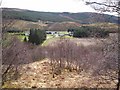
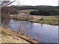
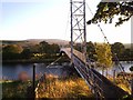
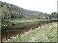
Nearby Images from Geograph Britain and Ireland:
©2006(licence)
©2016(licence)
©2006(licence)
©2005(licence)
©2010(licence)
The above images may not be of the site on this page, they are loaded from Geograph.
Please Submit an Image of this site or go out and take one for us!
Click here to see more info for this site
Nearby sites
Key: Red: member's photo, Blue: 3rd party photo, Yellow: other image, Green: no photo - please go there and take one, Grey: site destroyed
Download sites to:
KML (Google Earth)
GPX (GPS waypoints)
CSV (Garmin/Navman)
CSV (Excel)
To unlock full downloads you need to sign up as a Contributory Member. Otherwise downloads are limited to 50 sites.
Turn off the page maps and other distractions
Nearby sites listing. In the following links * = Image available
446m WSW 241° Torr Chorcain Vitrified Fort (NC412009)
7.6km ESE 102° Carn Mor 2 Broch or Nuraghe (NH49039926)
8.6km E 79° Durcha Broch or Nuraghe (NC50170239)
9.1km ESE 104° Carn Mor 3 Broch or Nuraghe (NH50399853)
10.1km N 355° Dail Langwell Broch or Nuraghe (NC41161121)
10.5km SSE 155° Croick Broch or Nuraghe (NH45649143)
13.0km E 96° Linsidemore* Stone Circle (NH54509918)
13.1km WNW 299° Cnoc Chaornaidh South-east* Chambered Cairn (NC30320793)
13.4km WNW 300° Cnoc Chaornaidh Central* Cairn (NC30170818)
13.7km WNW 300° Cnoc Chaornaidh North West* Chambered Cairn (NC299084)
14.2km E 81° Druim Baile Fuir West Ancient Village or Settlement (NC55780289)
14.5km E 81° Achany Stone Circle* Stone Circle (NC560029)
14.5km E 81° Druim Baile Fuir North Cairn (NC56030292)
14.7km E 80° Gruids Wood Cairn (NC56200307)
15.5km E 84° Achany Chambered Cairn* Chambered Cairn (NC57100200)
15.5km ENE 56° Sallachadh Broch* Broch or Nuraghe (NC549092)
15.9km SE 140° St John the Baptist's Well (Fodderty)* Holy Well or Sacred Spring (NH514885)
16.5km ESE 103° Invershin Farm* Standing Stone (Menhir) (NH5760796742)
16.5km ENE 68° Ferry Wood* Broch or Nuraghe (NC57190679)
16.6km ENE 73° The Ord* Ancient Village or Settlement (NC577052)
16.8km SE 126° Gruinards Broch or Nuraghe (NH549908)
16.8km E 89° Auchinduich* Stone Circle (NC58450084)
16.9km ENE 75° River Shin NW* Stone Circle (NC58150493)
17.0km ENE 75° Shin River* Stone Circle (NC582049)
17.0km ENE 75° River Shin SE Stone Circle (NC58220492)
View more nearby sites and additional images


 We would like to know more about this location. Please feel free to add a brief description and any relevant information in your own language.
 Wir möchten mehr über diese Stätte erfahren. Bitte zögern Sie nicht, eine kurze Beschreibung und relevante Informationen in Deutsch hinzuzufügen.
 Nous aimerions en savoir encore un peu sur les lieux. S'il vous plaît n'hesitez pas à ajouter une courte description et tous les renseignements pertinents dans votre propre langue.
 Quisieramos informarnos un poco más de las lugares. No dude en añadir una breve descripción y otros datos relevantes en su propio idioma.