 with our Megalithic Portal iPhone app")


<< Text Pages >> Loch Winnoch Crannog - Crannog in Scotland in Renfrewshire
Submitted by AstroGeologist on Wednesday, 22 May 2019 Page Views: 1144
Iron Age and Later PrehistorySite Name: Loch Winnoch Crannog Alternative Name: Lochwinnoch Crannog, Castle Semple CrannogCountry: Scotland
NOTE: This site is 0.825 km away from the location you searched for.
County: Renfrewshire Type: Crannog
Nearest Town: Johnstone Nearest Village: Lochwinnoch
Map Ref: NS3600358999
Latitude: 55.796371N Longitude: 4.617603W
Condition:
| 5 | Perfect |
| 4 | Almost Perfect |
| 3 | Reasonable but with some damage |
| 2 | Ruined but still recognisable as an ancient site |
| 1 | Pretty much destroyed, possibly visible as crop marks |
| 0 | No data. |
| -1 | Completely destroyed |
| 5 | Superb |
| 4 | Good |
| 3 | Ordinary |
| 2 | Not Good |
| 1 | Awful |
| 0 | No data. |
| 5 | Can be driven to, probably with disabled access |
| 4 | Short walk on a footpath |
| 3 | Requiring a bit more of a walk |
| 2 | A long walk |
| 1 | In the middle of nowhere, a nightmare to find |
| 0 | No data. |
| 5 | co-ordinates taken by GPS or official recorded co-ordinates |
| 4 | co-ordinates scaled from a detailed map |
| 3 | co-ordinates scaled from a bad map |
| 2 | co-ordinates of the nearest village |
| 1 | co-ordinates of the nearest town |
| 0 | no data |
Internal Links:
External Links:
I have visited· I would like to visit
AstroGeologist visited on 24th Aug 2019 - their rating: Cond: -1 Amb: 3 Access: 5 Loch Winnoch Crannog :
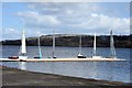
No visible remains of the Crannog to be seen above the water level
There was once a Crannog in Loch Winnoch (Now called Castle Semple Loch)
In 1791 several canoes, dug-out of single trees were found 1.5m below the surface of the loch.
One of them was on display in the garden of local man "Allan Pinkerton" of Mossend.
By 1845 "R. Smith" of the NSA noted that many more canoes had been found since 1791.
In 1868 "J. Stuart" first proposed that the vast number of Logboats discovered in Loch Winnoch probably meant that there was once a Crannog there too.
Picking up on that in 1876 "R. Love" suggests that at least some of the 'canoes' noted by NSA were probably the wooden portion of a Crannog, situated on the islet near the centre of the loch.
The surface of the islet was freestone and it could not have been above the water prior to the partial drainage of the loch, which took place in the late 17th century.
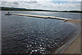
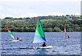
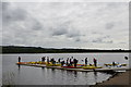
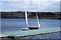
Castle Semple Loch is a recreational spot these days, used for sailing, swimming and fishing. The islet no longer remains, but perhaps there is wooden piles beneath the sediment on the bed of the loch. It has never received a proper, modern investigation.
For more information : Canmore ID 42149
You may be viewing yesterday's version of this page. To see the most up to date information please register for a free account.
Do not use the above information on other web sites or publications without permission of the contributor.
Nearby Images from Geograph Britain and Ireland:
©2008(licence)
©2007(licence)
©2013(licence)
©2015(licence)
©2015(licence)
The above images may not be of the site on this page, they are loaded from Geograph.
Please Submit an Image of this site or go out and take one for us!
Click here to see more info for this site
Nearby sites
Key: Red: member's photo, Blue: 3rd party photo, Yellow: other image, Green: no photo - please go there and take one, Grey: site destroyed
Download sites to:
KML (Google Earth)
GPX (GPS waypoints)
CSV (Garmin/Navman)
CSV (Excel)
To unlock full downloads you need to sign up as a Contributory Member. Otherwise downloads are limited to 50 sites.
Turn off the page maps and other distractions
Nearby sites listing. In the following links * = Image available
2.6km NNE 29° Clochodrick Stone* Natural Stone / Erratic / Other Natural Feature (NS37366127)
2.9km W 278° Dun Connel Hillfort (NS3311459497)
3.0km NNW 341° Knockmade Tumulus Barrow Cemetery (NS35126184)
3.8km NNE 17° Dun Bower Hillfort (NS3721962579)
4.2km WSW 248° Ladyland Barrow Barrow Cemetery (NS32015759)
4.4km SSE 153° Four Stones (North Ayrshire) Stone Circle (NS379550)
4.5km WNW 303° Glenward Cairn Cairn (NS32356159)
4.6km SE 144° Cuff Hill* Chambered Cairn (NS386552)
5.2km E 90° Walls Hill Fort Hillfort (NS4117058800)
5.3km SW 234° Langlands Tumulus Cairn (NS31625602)
5.4km NNE 19° Lawmarnock Cup Marks Rock Art (NS3794264004)
6.3km NNW 330° Ladymuir Cairn Cairn (NS3299964600)
6.5km SSW 211° Kilbirnie Crannog Crannog (NS32385356)
6.8km NE 44° Barr Hill Fort Hillfort (NS40946365)
7.2km NNW 346° Dun Gotter Hillfort (NS3458666033)
7.3km NNE 25° Broom Cist Cist (NS39356552)
7.7km ENE 70° Craigston Wood Menhir* Standing Stone (Menhir) (NS4332961360)
8.0km NNE 16° Law Hill Dun Hillfort (NS38506659)
8.0km ENE 68° High Craigenfeoch Rock Art* Rock Art (NS43616168)
8.4km NNE 27° Houston Tumulus Barrow Cemetery (NS40066640)
8.5km NNE 29° Back O' Hill Farm Cup Marked Stone Rock Art (NS40456623)
8.5km NNE 26° Houston South Mound Cairn (NS4010066487)
8.7km NW 325° Smeath Hill Cairn Cairn (NS3131566308)
9.4km E 80° Gleniffer Braes Menhirs* Standing Stones (NS45356026)
9.5km SW 228° Carwinning Hill Hillfort (NS28715286)
View more nearby sites and additional images


 We would like to know more about this location. Please feel free to add a brief description and any relevant information in your own language.
 Wir möchten mehr über diese Stätte erfahren. Bitte zögern Sie nicht, eine kurze Beschreibung und relevante Informationen in Deutsch hinzuzufügen.
 Nous aimerions en savoir encore un peu sur les lieux. S'il vous plaît n'hesitez pas à ajouter une courte description et tous les renseignements pertinents dans votre propre langue.
 Quisieramos informarnos un poco más de las lugares. No dude en añadir una breve descripción y otros datos relevantes en su propio idioma.