 with our Megalithic Portal iPhone app")


<< Text Pages >> Cairn de l'Île Venan - Cairn in France in Bretagne:Finistère (29)
Submitted by theCaptain on Monday, 21 April 2014 Page Views: 1407
Neolithic and Bronze AgeSite Name: Cairn de l'Île VenanCountry: France
NOTE: This site is 1.494 km away from the location you searched for.
Département: Bretagne:Finistère (29) Type: Cairn
Nearest Village: Plouguerneau
Latitude: 48.628100N Longitude: 4.5555W
Condition:
| 5 | Perfect |
| 4 | Almost Perfect |
| 3 | Reasonable but with some damage |
| 2 | Ruined but still recognisable as an ancient site |
| 1 | Pretty much destroyed, possibly visible as crop marks |
| 0 | No data. |
| -1 | Completely destroyed |
| 5 | Superb |
| 4 | Good |
| 3 | Ordinary |
| 2 | Not Good |
| 1 | Awful |
| 0 | No data. |
| 5 | Can be driven to, probably with disabled access |
| 4 | Short walk on a footpath |
| 3 | Requiring a bit more of a walk |
| 2 | A long walk |
| 1 | In the middle of nowhere, a nightmare to find |
| 0 | No data. |
| 5 | co-ordinates taken by GPS or official recorded co-ordinates |
| 4 | co-ordinates scaled from a detailed map |
| 3 | co-ordinates scaled from a bad map |
| 2 | co-ordinates of the nearest village |
| 1 | co-ordinates of the nearest town |
| 0 | no data |
Internal Links:
External Links:
Remains of a round cairn, 20m diameter, on the Île Venan. Possibly also a fallen menhir nearby
You may be viewing yesterday's version of this page. To see the most up to date information please register for a free account.
Do not use the above information on other web sites or publications without permission of the contributor.
Nearby Images from Flickr
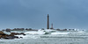
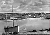
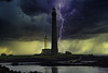
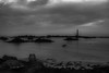
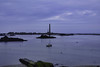
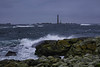
The above images may not be of the site on this page, but were taken nearby. They are loaded from Flickr so please click on them for image credits.
Click here to see more info for this site
Nearby sites
Click here to view sites on an interactive map of the areaKey: Red: member's photo, Blue: 3rd party photo, Yellow: other image, Green: no photo - please go there and take one, Grey: site destroyed
Download sites to:
KML (Google Earth)
GPX (GPS waypoints)
CSV (Garmin/Navman)
CSV (Excel)
To unlock full downloads you need to sign up as a Contributory Member. Otherwise downloads are limited to 50 sites.
Turn off the page maps and other distractions
Nearby sites listing. In the following links * = Image available
969m SW 230° Allée couverte de la Plage de Kervenni Passage Grave
1.1km S 177° Allée couverte de Lilia* Passage Grave
1.5km NE 52° Affleurement à Cupules de Roch Pelguent Rock Art
1.6km SSW 212° Men Ozac'h menhir Standing Stone (Menhir)
1.9km E 94° Menhir de Penn ar Strejou* Standing Stone (Menhir)
2.9km ENE 77° Tumuli de Saint-Michel* Chambered Cairn
3.5km E 85° Tumulus de Pen Enez* Chambered Cairn
4.3km SE 124° Stèle de Plouguerneau* Standing Stone (Menhir)
4.3km SW 228° Dolmen de Vourch* Burial Chamber or Dolmen
4.6km SE 137° Stèle de Keriel* Standing Stone (Menhir)
4.7km SSE 147° Stèle de Beg-ar-C'hastell* Standing Stone (Menhir)
5.1km ESE 101° Goarivan Menhir* Standing Stone (Menhir)
5.3km WSW 237° Tumulus de l'Île Beg Hamon Chambered Cairn
5.8km SW 227° Ilot Roc'h-Avel* Chambered Cairn
5.8km WSW 239° Île Tariec menhir* Standing Stone (Menhir)
5.8km WSW 239° Île Tariec cairn* Cairn
6.6km WSW 242° Menhir de Guenioc Standing Stone (Menhir)
6.7km WSW 243° Ile Guénioc* Chambered Tomb
7.4km E 83° Allée couverte de Enez Du Passage Grave
8.0km ESE 121° St Grouanec well* Holy Well or Sacred Spring
8.4km ESE 118° Grouanec stèle* Standing Stone (Menhir)
8.8km ESE 123° Menhir du Grouannec Standing Stone (Menhir)
8.9km SSW 195° Lannoulouarn Alignement de Menhirs* Stone Row / Alignment
9.0km SSW 210° Menhir de Kerouant* Standing Stone (Menhir)
9.4km SW 222° Menhir de Poullédan* Standing Stone (Menhir)
View more nearby sites and additional images


 We would like to know more about this location. Please feel free to add a brief description and any relevant information in your own language.
 Wir möchten mehr über diese Stätte erfahren. Bitte zögern Sie nicht, eine kurze Beschreibung und relevante Informationen in Deutsch hinzuzufügen.
 Nous aimerions en savoir encore un peu sur les lieux. S'il vous plaît n'hesitez pas à ajouter une courte description et tous les renseignements pertinents dans votre propre langue.
 Quisieramos informarnos un poco más de las lugares. No dude en añadir una breve descripción y otros datos relevantes en su propio idioma.