

<< Text Pages >> Harpercroft Hillfort - Hillfort in Scotland in South Ayrshire
Submitted by AstroGeologist on Sunday, 19 May 2019 Page Views: 901
Iron Age and Later PrehistorySite Name: Harpercroft Hillfort Alternative Name: Harpercroft Oppidum, Harpercroft DunCountry: Scotland
NOTE: This site is 2.665 km away from the location you searched for.
County: South Ayrshire Type: Hillfort
Nearest Town: Troon Nearest Village: Dundonald
Map Ref: NS36003252
Latitude: 55.558699N Longitude: 4.601816W
Condition:
| 5 | Perfect |
| 4 | Almost Perfect |
| 3 | Reasonable but with some damage |
| 2 | Ruined but still recognisable as an ancient site |
| 1 | Pretty much destroyed, possibly visible as crop marks |
| 0 | No data. |
| -1 | Completely destroyed |
| 5 | Superb |
| 4 | Good |
| 3 | Ordinary |
| 2 | Not Good |
| 1 | Awful |
| 0 | No data. |
| 5 | Can be driven to, probably with disabled access |
| 4 | Short walk on a footpath |
| 3 | Requiring a bit more of a walk |
| 2 | A long walk |
| 1 | In the middle of nowhere, a nightmare to find |
| 0 | No data. |
| 5 | co-ordinates taken by GPS or official recorded co-ordinates |
| 4 | co-ordinates scaled from a detailed map |
| 3 | co-ordinates scaled from a bad map |
| 2 | co-ordinates of the nearest village |
| 1 | co-ordinates of the nearest town |
| 0 | no data |
Internal Links:
External Links:
Hillfort in South Ayrshire
Harpercroft HillFort occupies the 2nd highest summit of the Dundonald range in Ayrshire.
At 6.5ha, the Hillfort may have been a minor Oppidum, occupying the entire summit plateau it measures about 320m E-W x 260m.
It is located 144m above sea level on a level, subsidiary peak of Wardlaw Hill.
In 1893 "D. Christison" documented an Inner Ring Wall with an approx diameter of 100m, with an Outer Defensive Wall encircling this at a distance of 100m. The ruinous stone wall was 5m~6m thick.
Defensively the Outer Wall utilizes the steep natural scarps around the N and W, but around the South a Stony Rampart with an outer scarp up to 1.5m high survived. The circuits of both ramparts are now heavily denuded and contains several large gaps.
An OS report in 1954 noted the the Earthwork Ramparts were similar in character to ones found 250m to the North on Wardlaw Hillfort. There is every reason to suppose that the two were contemporary. Possibly starting of on the smaller Hillfort, and as the tribe grew in size the need for a larger settlement may have seen some branch off to the peak of the next hill.
Finds by "E. Halpin" in 1985 included some Pottery, fragments of at least three Shale Bracelets and several pieces of unworked Shale.
For more information : Canmore ID 41986
You may be viewing yesterday's version of this page. To see the most up to date information please register for a free account.
Do not use the above information on other web sites or publications without permission of the contributor.
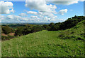
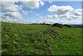
Nearby Images from Geograph Britain and Ireland:
©2020(licence)
©2020(licence)
©2008(licence)
©2020(licence)
©2020(licence)
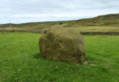
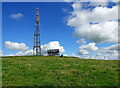
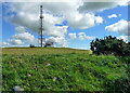
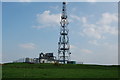
The above images may not be of the site on this page, they are loaded from Geograph.
Please Submit an Image of this site or go out and take one for us!
Click here to see more info for this site
Nearby sites
Key: Red: member's photo, Blue: 3rd party photo, Yellow: other image, Green: no photo - please go there and take one, Grey: site destroyed
Download sites to:
KML (Google Earth)
GPX (GPS waypoints)
CSV (Garmin/Navman)
CSV (Excel)
To unlock full downloads you need to sign up as a Contributory Member. Otherwise downloads are limited to 50 sites.
Turn off the page maps and other distractions
Nearby sites listing. In the following links * = Image available
253m NNW 339° Wardlaw Hill Fort Hillfort (NS35923276)
1.2km NNW 337° Kemp Law* Stone Fort or Dun (NS35583364)
2.0km N 8° Dun Donald Hillfort (NS36363451)
3.9km N 357° Drybridge* Standing Stone (Menhir) (NS35923644)
4.3km N 356° Drybridge Neolithic Village Ancient Village or Settlement (NS3582336852)
4.4km N 356° Dundonald Cursus Cursus (NS35893690)
4.7km S 181° The Muckle Stane (Monkton)* Natural Stone / Erratic / Other Natural Feature (NS3578027790)
5.8km N 350° Dreghorn Neolithic Village Ancient Village or Settlement (NS35183830)
6.0km NW 316° Shewalton Moor Ancient Village or Settlement (NS320370)
6.2km E 86° Craigie Hill Fort Hillfort (NS42243276)
6.7km E 90° Witches Stane (Craigie) Natural Stone / Erratic / Other Natural Feature (NS42683231)
6.8km E 86° Craigie Broch Broch or Nuraghe (NS42793272)
6.8km E 88° Craigie Dun Hillfort (NS42803254)
7.4km NW 325° Grannie Stane* Natural Stone / Erratic / Other Natural Feature (NS3196038711)
7.8km S 188° Bruce's Well (Prestwick)* Holy Well or Sacred Spring (NS3467624801)
8.4km NNW 349° Lawthorn Mount Barrow Cemetery (NS34654078)
8.9km SE 126° Tarbolton Cist* Cist (NS4327)
9.2km NNW 345° Sourlie Hill Modern Stone Circle etc (NS3398041490)
10.0km E 101° Loch Lee Crannog* Crannog (NS45753027)
10.4km NNW 337° Eglinton Park Ancient Village or Settlement (NS3229642217)
10.7km SE 124° Coilsfield (Tarbolton) Rock Art (NS44692624)
10.7km ESE 124° Tarbolton Tumulus Cairn (NS4469926247)
10.8km NW 315° Ardeer Sands Ancient Village or Settlement (NS2857740455)
11.1km NNW 329° Dirrans burial* Cist (NS30684230)
11.7km NW 323° Todhill Crannog Crannog (NS2930042101)
View more nearby sites and additional images


 We would like to know more about this location. Please feel free to add a brief description and any relevant information in your own language.
 Wir möchten mehr über diese Stätte erfahren. Bitte zögern Sie nicht, eine kurze Beschreibung und relevante Informationen in Deutsch hinzuzufügen.
 Nous aimerions en savoir encore un peu sur les lieux. S'il vous plaît n'hesitez pas à ajouter une courte description et tous les renseignements pertinents dans votre propre langue.
 Quisieramos informarnos un poco más de las lugares. No dude en añadir una breve descripción y otros datos relevantes en su propio idioma.