<< Our Photo Pages >> Mynydd Bach - Round Cairn in Wales in Anglesey
Submitted by guile on Friday, 07 May 2010 Page Views: 5585
Neolithic and Bronze AgeSite Name: Mynydd BachCountry: Wales
NOTE: This site is 2.492 km away from the location you searched for.
County: Anglesey Type: Round Cairn
Nearest Village: Rhosneigr
Map Ref: SH32847086
Latitude: 53.208446N Longitude: 4.504501W
Condition:
| 5 | Perfect |
| 4 | Almost Perfect |
| 3 | Reasonable but with some damage |
| 2 | Ruined but still recognisable as an ancient site |
| 1 | Pretty much destroyed, possibly visible as crop marks |
| 0 | No data. |
| -1 | Completely destroyed |
| 5 | Superb |
| 4 | Good |
| 3 | Ordinary |
| 2 | Not Good |
| 1 | Awful |
| 0 | No data. |
| 5 | Can be driven to, probably with disabled access |
| 4 | Short walk on a footpath |
| 3 | Requiring a bit more of a walk |
| 2 | A long walk |
| 1 | In the middle of nowhere, a nightmare to find |
| 0 | No data. |
| 5 | co-ordinates taken by GPS or official recorded co-ordinates |
| 4 | co-ordinates scaled from a detailed map |
| 3 | co-ordinates scaled from a bad map |
| 2 | co-ordinates of the nearest village |
| 1 | co-ordinates of the nearest town |
| 0 | no data |
Internal Links:
External Links:
I have visited· I would like to visit
elad13 visited on 15th May 2022 - their rating: Cond: 2 Amb: 4 Access: 3
TheCaptain guile have visited here
Sources: RCAHM Anglesey Inventory (1937), 98
Powell & Daniel 'Barclodiad y Gawres' (1956), 71-2
Lynch 'Prehistoric Anglesey' (1970), 103
Source:
COFLEIN
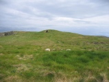
Anglesey seems prone to exaggeration when it comes to identifying geographical features, for example the remains of this circular cairn is found on top of Mynydd Bach, which means Little Mountain in English. It is to be found a short walk from Mynydd Mawr, which means Big Mountain. Mynydd Mawr is far more famous than this quiet and under stated cairn, as it has Barclodiad y Gawres on its summit.
Both of these features are of course little more than hills.
Overshadowed by its famous neighbour and despite being thickly overgrown with grass obscuring most details, I found the open sky ambience of this site with its 360º views most enjoyable and a complete contrast to Barclodiad y Gawres.
This very peaceful site also has one of my favourite rocks comprising its number, with minute yet perfectly formed quartz crystal prismatic extrusions in its matrix.
You may be viewing yesterday's version of this page. To see the most up to date information please register for a free account.


Do not use the above information on other web sites or publications without permission of the contributor.
Click here to see more info for this site
Nearby sites
Key: Red: member's photo, Blue: 3rd party photo, Yellow: other image, Green: no photo - please go there and take one, Grey: site destroyed
Download sites to:
KML (Google Earth)
GPX (GPS waypoints)
CSV (Garmin/Navman)
CSV (Excel)
To unlock full downloads you need to sign up as a Contributory Member. Otherwise downloads are limited to 50 sites.
Turn off the page maps and other distractions
Nearby sites listing. In the following links * = Image available
134m SSE 151° Barclodiad-y-Gawres (Anglesey)* Passage Grave (SH32907074)
484m ESE 120° Porth Trecastell* Hillfort (SH33257060)
643m ESE 107° Trecastell Farm (Llanfaelog) Sculptured Stone (SH33457065)
3.4km NNE 26° Ty Newydd (Llanfaelog)* Chambered Tomb (SH34437387)
3.8km SE 139° Trwyn Du* Cairn (SH352679)
4.6km NE 35° Bodfeddan Inscribed Stone* Standing Stone (Menhir) (SH356745)
5.7km ESE 104° St Cadwaladr (Llangadwaladr)* Early Christian Sculptured Stone (SH38376927)
6.1km NNW 336° Llyn Cerrig Bach* Natural Stone / Erratic / Other Natural Feature (SH30607650)
6.9km ENE 74° Din Dryfol* Chambered Tomb (SH3956572490)
7.0km NE 42° A55 Erratic* Natural Stone / Erratic / Other Natural Feature (SH3774475886)
7.1km NW 305° Borthwen Beach* Chambered Tomb (SH2714975151)
7.1km WNW 303° Borth Wen Stone Row / Alignment (SH27007500)
8.0km NW 318° Bodior Standing Stone* Standing Stone (Menhir) (SH277770)
8.1km E 99° Malltraeth* Standing Stone (Menhir) (SH4085569306)
8.3km WNW 302° St Gwenfaens Well* Holy Well or Sacred Spring (SH2594975436)
8.7km NW 310° Cromlech in Rhoscolyn* Burial Chamber or Dolmen (SH2634376610)
8.7km NW 306° Bwa Gwyn* Natural Stone / Erratic / Other Natural Feature (SH259762)
9.5km ENE 63° Graiglas* Round Barrow(s) (SH415749)
9.6km NW 325° Ynys Leurad* Ancient Village or Settlement (SH2764978895)
9.7km ENE 62° Druid Farm* Standing Stones (SH416751)
9.8km E 81° Hen Blas* Burial Chamber or Dolmen (SH42577197)
9.8km ENE 71° St Ceinwen Holy Well* Holy Well or Sacred Spring (SH423737)
9.8km SE 140° Merddyn Cil* Holy Well or Sacred Spring (SH3894563110)
9.9km SE 142° Ffynnon Dafaden* Holy Well or Sacred Spring (SH3867562885)
9.9km SE 142° Ffynnon Dwynwen* Holy Well or Sacred Spring (SH387628)
View more nearby sites and additional images


 We would like to know more about this location. Please feel free to add a brief description and any relevant information in your own language.
 Wir möchten mehr über diese Stätte erfahren. Bitte zögern Sie nicht, eine kurze Beschreibung und relevante Informationen in Deutsch hinzuzufügen.
 Nous aimerions en savoir encore un peu sur les lieux. S'il vous plaît n'hesitez pas à ajouter une courte description et tous les renseignements pertinents dans votre propre langue.
 Quisieramos informarnos un poco más de las lugares. No dude en añadir una breve descripción y otros datos relevantes en su propio idioma.